
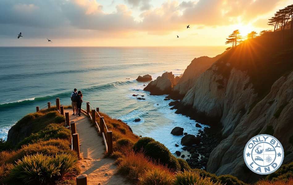
California’s Lost Coast Trail stretches dramatically for 53 miles along the coastline. Waterfalls tumble directly into the Pacific Ocean on this breathtaking coastal hike. America’s shoreline trails are a great way to get more than exercise – they showcase nature’s most spectacular displays, from sea lion colonies to pristine sandy beaches.
The US coastline welcomes hikers of all skill levels. Families can enjoy Acadia National Park’s 4-mile Ocean Path Trail, while adventurous hikers tackle the challenging 11-mile Kalalau Trail along Hawaii’s Nāpali Coast with its 800-foot drops. False Cape State Park’s trails tell fascinating stories of 5,000 shipwrecks since the 1500s. The Tahkenitch Dunes Trail lets visitors encounter unique wildlife, including giant coastal salamanders.
America’s shoreline beauty shines through these 11 coastal hikes. Each trail reveals its own unique view of the meeting point between land and sea. Unforgettable ocean views reward every step, from Hawaii’s rugged cliffs to Maine’s granite coastlines.
Lost Coast Trail, California
The Lost Coast Trail spans 25 miles through the King Range National Conservation Area along California’s most untouched shoreline. This remote trail takes you through black sand beaches and grassy plateaus that give hikers a unique wilderness experience.
Lost Coast Trail Highlights
The path weaves between Mattole Beach and Black Sands Beach and shows off California’s rugged coastline where waterfalls drop straight into the Pacific Ocean. You’ll likely spot harbor seals, Stellar sea lions, and northern elephant seals on your journey. The trail features the historic Punta Gorda lighthouse among pristine black sand beaches and steep coastal bluffs.
Lost Coast Trail Difficulty and Best Season
The trail keeps elevation gain under 1,000 feet, but the terrain can be tricky. Soft sand and loose rocks slow down your pace compared to regular trails. The best time to hike runs from May through October with daily permits allowing 60 people, while the off-season limit stays at 30. Summer brings drier weather, but winter sees 100-200 inches of rainfall yearly.
Lost Coast Trail Planning Tips and Permits
You can get permits through Recreation.gov on a three-month rolling window system. Each permit allows up to three people. Hikers need to check tide tables since three trail sections become impossible to pass during high tides:
- Punta Gorda (passable under 6 feet)
- Sea Lion Gulch to Randall Creek (passable under 2.5 feet)
- Miller Flat to Gitchell Creek (passable under 3 feet)
You must carry hard-sided bear canisters to store food. The coastal weather changes quickly, so pack gear for fog and wind. Most people take 2-4 days to finish the trail, and you’ll find plenty of creek-side camping spots between Mattole Beach and Telegraph Creek.
Kalalau Trail, Hawaii
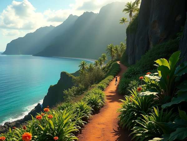
The Kalalau Trail stretches 11 miles along Hawaii’s Nāpali Coast through some of the Pacific’s most dramatic landscapes. This famous coastal hike weaves through five valleys and ends at Kalalau Beach.
Kalalau Trail Scenic Viewpoints
Hikers first encounter the breathtaking Kalalau Lookout at 4,000 feet above sea level. The stunning Kalalau Valley spans two miles wide below this viewpoint. The trail leads past green cliffs and reveals hidden waterfalls, with Hoʻoleʻa Falls visible at Kalalau Beach. Moreover, the valley views are best between 8 AM and 11 AM when skies are clear.
Kalalau Trail Difficulty Level
The Sierra Club gives this coastal hike a challenging 9 out of 10 difficulty rating. Hikers climb about 5,000 feet throughout the trail’s length. The path takes 8-10 hours to complete, depending on weather and fitness level. You’ll face several stream crossings and narrow ridges with steep drops, especially at the notorious Crawler’s Ledge section.
Kalalau Trail Access and Permits
The trail requires proper planning and documentation. You’ll need permits to hike beyond the first two miles. The permit system has these rules:
- USD 35 per person daily for non-residents
- Maximum stay of 5 consecutive nights
- Daily limit of 60 people on the trail
- Permits available 90 days in advance
Hikers must book separate overnight parking at Hāʻena State Park after getting camping permits. The trail might close during bad weather, especially when streams are high.
Try the Mermaid Caves and Olomana Trail.
Ocean Path Trail, Acadia National Park
The Ocean Path stretches 2.2 miles one-way along Maine’s rugged coastline from Sand Beach to Otter Point. This beautiful coastal trail winds between the crashing surf and the Ocean Drive section of Park Loop Road. Hikers can enjoy unmatched views of the Atlantic Ocean throughout their walk.
Ocean Path Trail Attractions
Maine’s bold coast shows off several iconic landmarks along this trail. Thunder Hole sits 0.7 miles from Sand Beach. This shallow sea cave creates thunderous crashes when conditions are right – about two hours before high tide with strong winds. The trail then guides you to Monument Cove, known for its sea stack – a vertical granite formation that erosion has carved away from the cliff. The trail ends at Otter Cliff, which towers 110 feet above the ocean.
Ocean Path Trail Difficulty and Accessibility
This trail works well for hikers of all skill levels. The stretch from Sand Beach to Thunder Hole features concrete and packed gravel surfaces. Past Thunder Hole, the path gets a bit uneven with two granite staircases about 1.4 miles in. A complete round trip covers 4.4 miles and usually takes 2-4 hours.
Ocean Path Trail Facilities
The trail’s amenities make hiking here convenient and comfortable. You’ll find:
- Parking spots at Sand Beach’s upper lot and Old Soaker Parking Lot
- Restrooms and a gift shop that sells snacks near Thunder Hole
- Year-round access since this part of Park Loop Road stays plowed through winter
It’s worth mentioning that from mid-June through mid-October, you’ll need a vehicle reservation to start at Sand Beach. Many hikers start their trip at Otter Point instead and head north toward Sand Beach.
Cape Perpetua Trail, Oregon

Cape Perpetua rises dramatically as an oceanic shield volcano in the Siuslaw National Forest. This 2,700-acre expanse offers some of Oregon’s most captivating coastal hikes.
Cape Perpetua Coastal Features
Ancient volcanic basalt meets the Pacific Ocean to create remarkable geological formations in this area. The Cape Perpetua Overlook stands 800 feet above sea level. This makes it the highest viewpoint available by car on the Oregon Coast. Visitors can see up to 70 miles of coastline and 37 miles out to sea on clear days. The landscape features Thor’s Well, a mysterious collapsed sea cave. The dramatic Devil’s Churn adds to the scenery as waves crash through narrow volcanic fissures.
Cape Perpetua Trail Difficulty
A network of trails covers 26 miles through coastal mature and old-growth rainforest. The Giant Spruce Trail offers an easy 2-mile round trip to a magnificent 500-year-old Sitka spruce. This ancient giant measures 185 feet in height and 40 feet in diameter. The Saint Perpetua Trail presents a moderate 2.8-mile out-and-back hike from the visitor center to the overlook. Wheelchair users can enjoy the Whispering Spruce Trail, a 0.3-mile loop with panoramic ocean views.
Cape Perpetua Visitor Information
The Cape Perpetua Visitor Center acts as the main trailhead hub. Facilities include:
- Restrooms and potable water at the visitor center
- A small museum with marine exhibits
- Viewing scopes on the observation deck
Visitors can access the area with a USD 5.00 day-use fee or valid recreation pass. The scenic area stays open from dawn to dusk throughout the year. Visitors should check trail conditions before their trip. Dogs must stay on leashes no longer than 6 feet in the scenic area.
Visit Crater Lake.
Dungeness Spit Trail, Washington
The Dungeness Spit, America’s longest natural sand spit, extends nearly seven miles into the Strait of Juan de Fuca from Washington‘s Olympic Peninsula. Each year, it grows about 13 feet.
Dungeness Spit Wildlife Viewing
The Dungeness National Wildlife Refuge’s rich ecosystem supports more than 240 bird species, 29 mammal species and 26 fish species. The National Audubon Society recognizes this area as an “Important Bird Area”. Wildlife you’ll spot here includes:
- Bald eagles and black oystercatchers
- Harbor seals and rough-skinned newts
- Purple martins (visible between April and September)
- Harlequin ducks and plovers
Dungeness Spit Trail Conditions
A paved half-mile path through forest leads to an overlook above the spit. The complete round trip covers 10.3 miles and takes about 3 hours. You’ll walk on fine sand mixed with large cobbles and driftwood formations. High tides can substantially limit trail access, so checking tide tables is essential. The trail’s exposure to weather makes wind condition checks a vital part of planning your hike.
Dungeness Spit Facilities
The trailhead features detailed amenities. Groups up to four people pay a USD 3.00 entrance fee. The Dungeness Recreation Area provides several facilities:
- ADA-accessible restrooms with coin-operated showers
- Day-use picnic tables with fire pits
- Water faucets throughout the park
- Informational panels along the main trail
The park welcomes visitors from sunrise until 30 minutes before sunset. The New Dungeness Lighthouse, which you can reach only by hiking, offers daily guided tours from 9 AM to 5 PM.
More hiking trails in Oklahoma.
North Coast Trail, Olympic National Park

The North Coast Trail in Olympic National Park stretches 20 miles along Washington’s rugged shoreline from Ozette Trailhead to Rialto Beach. This coastal path combines pristine beaches with dense forest sections to create a unique Pacific Northwest hiking experience.
North Coast Trail Highlights
Dramatic geological formations dominate the landscape with towering sea stacks and natural rock arches. Note that hikers can spot gray whales and seals frequently appearing offshore. The route features many tidal pools that burst with colorful starfish and anemones, particularly during low tide periods.
North Coast Trail Difficulty
Hikers encounter a mix of flat beach sections and steep overland trails. Some segments need rope-assisted climbs over rocky bluffs. Most people take 2-3 days to complete the trail, covering 3-8 miles each day. The trail’s biggest challenge comes from sections that become impassable during high tides, which makes careful timing essential.
North Coast Trail Planning Tips
You’ll need backcountry permits and reservations for overnight stays. The best time to hike is from April through October, when temperatures range from 63°F during day to 48°F at night. The trail’s tidal restrictions include:
- 5-foot tide limit at 2.4 miles north of Rialto Beach
- 4-foot restriction at Cape Johnson, 4.3 miles from trailhead
- 6-foot limit at 7.9 miles south of Ozette Station
Groups must stay at 12 people or fewer. The trail’s main camping spots are at Ellen Creek, Chilean Memorial and Cedar Creek. Like in other coastal hikes, visitors should bring water filtration systems since water sources near camping areas need treatment before drinking.
False Cape Trail, Virginia
False Cape State Park sits between Back Bay and the Atlantic Ocean as one of the last untouched areas along the Atlantic coast. This 4,321-acre coastal sanctuary spans a mile-wide barrier spit.
False Cape Beach Access
The park stays pristine through its restricted access rules. Visitors must enter through Back Bay National Wildlife Refuge by hiking, biking or boating. Back Bay connects to False Cape State Park through East and West Dike trails, but only one trail stays open at a time. The beach access works best within two hours of low tide because hard-packed sand makes walking easier.
False Cape Trail Difficulty
Sand Ridge Trail, a service road, runs 6.7 miles out-and-back. Sandy surfaces make many sections moderately challenging. Weather affects trail difficulty by a lot – heavy rains can flood some areas. The trail network has over 15 miles of paths that wind through dunes, woodlands, farm fields and salt marshes.
False Cape Amenities
The park offers simple facilities that preserve its wilderness feel. Key amenities include:
- Three drinking water locations in the Barbour Hill area
- Several pit toilets throughout the park
- A visitor center operating daily from 9 AM to 4 PM
- Twelve primitive campsites for tent-only camping
The park’s steadfast dedication to wildlife shapes how visitors can use the space. Over 300 species of nesting and migratory songbirds call this area home. Visitors should carry insect repellent and watch out for venomous eastern cottonmouth snakes. While open fires are not allowed, visitors can use camp stoves to cook.
Try a spiritual retreat in Virginia.
Coastal Trail, Quoddy Head State Park
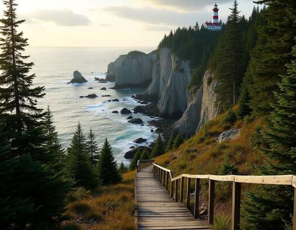
Quoddy Head State Park’s Coastal Trail winds through 541 acres of dramatic shoreline at Maine’s easternmost point. This trail is a chance to explore the Atlantic coast’s rugged beauty.
Quoddy Head Trail Features
The coastal path stretches 4 miles round-trip and showcases stunning ocean views and unique geological formations. Hikers will pass several remarkable spots along the way:
- Gulliver’s Hole – a narrow chasm created by volcanic gabbro rock erosion
- High Ledge – towering 150 feet above the ocean
- Green Point – a large ledge outcropping with beach access
- Quoddy Channel – views of Grand Manan Island’s red cliffs
Quoddy Head Trail Difficulty
The trail climbs about 300 feet in elevation and we rated it as moderate. The western section has packed gravel paths at least 5 feet wide that work well for motorized wheelchairs. The eastern portion has steeper terrain with narrow paths closer to the cliffs. Most visitors finish the round trip in about 2 hours.
Quoddy Head Facilities
The park’s amenities make visits more comfortable. Wheelchair-accessible privies that meet ADA standards are available near the lighthouse. The weather plays a big role in the hiking experience – fog often forms as warm mainland air meets cold ocean masses. Visitors can find picnic tables near West Quoddy Head Light that serve as great whale watching spots during summer. Good footwear is a must since trails tend to get wet and muddy.
Tahkenitch Dunes Trail, Oregon
The Tahkenitch Dunes Trail winds through Oregon’s varied landscape as a 6-mile loop that features vegetated dunescapes and dense coastal forests. This coastal hike blends shore pine and Sitka spruce forests with wide sand dunes that create an ever-changing terrain.
Tahkenitch Dunes Attractions
The trail shows off an amazing mix of coastal ecosystems. Hikers will find thickets of evergreen huckleberry, wax myrtle and silk tassel growing under tall Sitka spruce. The path winds among Tahkenitch Creek, which flows through high dunes and runs parallel to the beach for two miles. The trail’s heart reveals something special – seasonal pools dot the landscape between dune hummocks where Scots broom has taken root.
Tahkenitch Trail Difficulty
This moderately challenging route takes about 2 hours and 26 minutes to complete. Current trail conditions need extra attention, especially when you have beach access points where bad erosion has made some tricky passages. The terrain changes by a lot:
- Gravel paths through forest sections
- Sandy inclines supporting shore pines
- Boardwalks crossing driftwood-filled creeks
- Mossy slopes along old dunes
Tahkenitch Trail Access
Visitors must pay a USD 5.00 daily vehicle fee or show a valid recreation pass. The trailhead sits 8 miles north of Reedsport on Highway 101’s west side and has several amenities like flush toilets and drinking water. Hikers should remember the snowy plover restrictions from March 15 to September 15, when dogs can’t go on the trail or beach. The area stays quiet throughout the year, making it perfect for anyone wanting some peace on Oregon’s coast.
Provincetown Dunes Trail, Massachusetts

The Provincetown Dunes Trail stands out as one of Massachusetts’ most striking coastal areas. This 1.9-mile out-and-back trail near Provincetown shows off Cape Cod’s northern tip’s raw beauty.
Provincetown Dunes Highlights
The trail meanders through the Peaked Hill Bars Historic District and covers 1,900 acres of sand dunes, small bogs, and peaceful coastline. These dunes are home to nineteen historic shacks where famous artists like Jackson Pollock, Tennessee Williams and Jack Kerouac once found inspiration. The path takes you to clean, empty beaches where you might spot seals swimming offshore. Wild cranberry bogs add color to the area, especially during late summer and fall.
Provincetown Trail Difficulty
You’ll face some moderate challenges on this route, mostly because of deep loose sand and steep dune formations. Most people complete the round trip in about 42 minutes. The terrain needs careful footing since some dunes are quite tall. We recommend hiking early morning or evening because the sand gets hot by a lot during midday. You won’t find any shade on the trail, so weather is a vital factor.
Provincetown Trail Information
You’ll find the trailhead on Route 6 northbound, right across from Snail Road. To have a good hike, bring these items:
- Water (one quart per person during summer)
- Beach towels or blankets to protect from sand
- Bug spray for beach flies
- Good shoes that work well in hot sand
The trail stays available all year, but March through October gives you the best conditions. You can park along the road near the trailhead without permits or fees. A Cumberland Farms store sits 2.5 miles north where you can get supplies and use restrooms. Art’s Dune Tours provides guided trips by vehicle if you want to explore this unique landscape differently.
Mountains-to-Sea Trail, North Carolina
The Mountains-to-Sea Trail stretches 1,175 miles from Clingmans Dome to Jockey’s Ridge State Park. This remarkable footpath, North Carolina’s longest marked trail, takes about 2,112,000 footsteps to finish.
Mountains-to-Sea Coastal Section
The trail’s coastal stretch brings North Carolina’s maritime heritage to life with its barrier islands, marshes and riverine wetlands. The eastern part features the Onslow Bight, a shallow bend between Cape Lookout and Cape Fear. Hikers can explore pristine beaches and discover historic spots like World War II observation towers and the Karen Beasley Turtle Hospital.
Mountains-to-Sea Trail Difficulty
This amazing trail spreads across 18 segments. Right now, 720 miles of the path consists of natural surface or greenway trails, while the rest follows bicycle routes and back roads. You’ll experience everything from mountain peaks at 6,684 feet to sea-level beaches. The western portion packs the most challenging sections, especially through Linville Gorge.
Mountains-to-Sea Trail Planning
You just need solid preparation to complete this trail. Here’s what you should think about:
- Getting permits and papers for overnight stays
- Having water filtration systems for backcountry parts
- Packing gear that matches weather conditions
- Setting up transportation between segments
Most hikers take 3-4 months to complete the trail. Each year, only 20-30 adventurers walk the entire path. Many towns along the way have limited spots for hikers to rest. The trail lets cyclists ride the road sections, which gives people different ways to complete their journey.
Comparison Table
| Trail Name | Location | Trail Length | Difficulty Level | Notable Features | Required Permits/Fees | Best Season |
|---|---|---|---|---|---|---|
| Lost Coast Trail | California | 25 miles | Moderate (under 1,000 ft elevation gain) | Waterfalls, black sand beaches, Punta Gorda lighthouse, marine wildlife | Permit needed for groups up to 3 people | May-October |
| Kalalau Trail | Hawaii | 11 miles | 9/10 difficulty (Sierra Club rating) | 5 valleys, Kalalau Beach, Ho’ole’a Falls, 4,000 ft lookout | $35 daily for non-residents with required permit | Year-round |
| Ocean Path Trail | Maine | 2.2 miles one-way | Easy to moderate | Thunder Hole, Monument Cove, Otter Cliff | Vehicle booking needed (mid-June to mid-October) | Year-round |
| Cape Perpetua Trail | Oregon | 26 miles network | Easy to moderate | Thor’s Well, Devil’s Churn, 500-year-old Sitka spruce | $5 daily use fee | Year-round |
| Dungeness Spit Trail | Washington | 10.3 miles round-trip | Moderate | America’s longest natural sand spit, wildlife refuge, lighthouse | $3 per group (up to 4) | Year-round |
| North Coast Trail | Washington | 20 miles | Moderate to difficult | Sea stacks, tidal pools, marine life | Backcountry permit needed | April-October |
| False Cape Trail | Virginia | 6.7 miles out-and-back | Moderate | Natural coastline, wildlife, dunes | – | Year-round |
| Coastal Trail (Quoddy Head) | Maine | 4 miles round-trip | Moderate (300 ft elevation gain) | Gulliver’s Hole, High Ledge, lighthouse | – | Summer |
| Tahkenitch Dunes Trail | Oregon | 6 miles loop | Moderate | Dunes, coastal forests, seasonal pools | $5 daily vehicle fee | Year-round |
| Provincetown Dunes Trail | Massachusetts | 1.9 miles out-and-back | Moderate | Historic dune shacks, cranberry bogs, pristine beaches | No fee mentioned | March-October |
| Mountains-to-Sea Trail | North Carolina | 1,175 miles total | Varies by section | Barrier islands, maritime forests, historic landmarks | Permits needed for overnight stays | Year-round |
Enjoy Your Coastal Hikes in the US
Coastal trails across America showcase remarkable variety. The rugged 53-mile Lost Coast Trail stands in contrast to the family-friendly 4-mile Ocean Path in Acadia. Each path tells its own story through dramatic cliffs along Hawaii’s Kalalau Trail, pristine dunes at Provincetown and ancient forests at Cape Perpetua.
Hikers need proper preparation to tackle these coastal paths. The hiking experience depends on weather patterns, tide tables and seasonal restrictions. These trails welcome everyone – from beginners who prefer gentle beach walks to seasoned trekkers ready for challenging terrain with steep elevation gains.
Rich maritime heritage comes alive through historic lighthouses, dune shacks and wildlife refuges along these coastal paths. Nature enthusiasts can spot harbor seals at Dungeness Spit and watch nesting seabirds along the North Coast Trail. These paths are home to diverse ecosystems filled with marine life.
These 11 coastal trails have become America’s natural treasures. Their protection ensures future generations can experience breathtaking ocean views, dramatic geological formations and thriving coastal ecosystems that make each trail special.
FAQs
Q1. What is the longest coastal hike mentioned in the article?
The longest coastal hike mentioned is the Mountains-to-Sea Trail in North Carolina, spanning an impressive 1,175 miles from Clingmans Dome to Jockey’s Ridge State Park.
Q2. Which trail is considered the most challenging among those listed?
The Kalalau Trail in Hawaii is considered the most challenging, with a difficulty rating of 9 out of 10 according to the Sierra Club. It features steep elevation changes and narrow ridges with dropoffs.
Q3. Are there any family-friendly coastal hikes mentioned?
Yes, the Ocean Path Trail in Acadia National Park, Maine, is described as family-friendly. It’s a 2.2-mile one-way trail with easy to moderate difficulty, featuring attractions like Thunder Hole and Otter Cliff.
Q4. Do all these coastal hikes require permits?
Not all trails require permits, but several do. For example, the Lost Coast Trail in California and the Kalalau Trail in Hawaii both require permits for hiking. It’s best to check the specific requirements for each trail before planning your hike.
Q5. What’s a unique feature of the Provincetown Dunes Trail?
A unique feature of the Provincetown Dunes Trail in Massachusetts is the presence of historic dune shacks. These shacks have sheltered renowned artists like Jackson Pollock and Tennessee Williams, adding a cultural element to the natural beauty of the trail.


Leave A Comment