
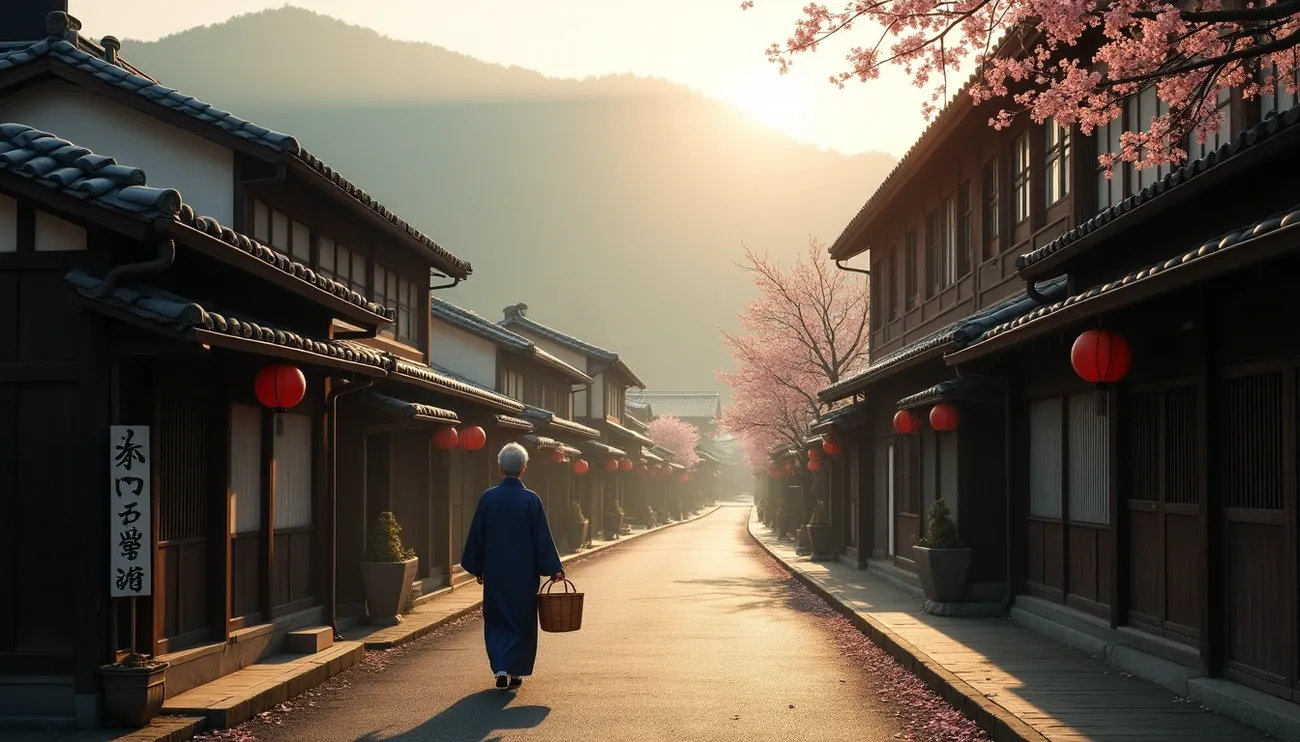
Japan’s landmarks stretch way beyond the Instagram hotspots you’ll see in most travel guides. Shibuya Crossing pulses with more than 1,000 people at each light change. The magnificent Himeji Castle, a UNESCO World Heritage Site, stands proud among a world of hidden spots just waiting to be explored.
You might know about Kyoto’s Kinkaku-ji with its 20 kilograms of gold leaf or Tokyo Skytree that soars 634 meters high. But Japan holds many secret spots that locals love to keep quiet about. These places range from deserted islands to ancient pilgrim paths that feel worlds away from the tourist crowds at Itsukushima Shrine’s 50-foot floating torii gate or Nara Park’s 1,400 friendly deer.
This piece will show you 27 secret locations that highlight Japan’s true character. These spots let you soak in the country’s heritage, stunning views and cultural richness without pushing through tour groups. You’ll find peaceful historic towns and volcanic island adventures that show you a side of Japan most visitors never get to see.
Tottori Sand Dunes

Image Source: www.tottori-tour.jp
Japan’s massive Tottori Sand Dunes stand as an unexpected natural wonder in a land famous for cherry blossoms and ancient temples. These golden expanses stretch 16 kilometers along the Sea of Japan coast and tower up to 50 meters high, making them the country’s largest sand dunes.
Why Tottori Sand Dunes is Special
These remarkable dunes tell a 100,000-year story. Sediment from the Chūgoku Mountains flowed down the Sendai River into the Sea of Japan, where winds and currents sculpted this unique landscape. The dunes now proudly belong to the San’in Kaigan UNESCO Global Geopark.
Nature’s artistry shines through the ever-shifting landscapes. Bowl-shaped depressions called “suribachi” reach heights of 40 meters. Wind creates mesmerizing ripple patterns known as “fūmon,” while seasonal “oasis” pools emerge as groundwater seeps through the sand. Each season brings a new face to the dunes – pristine snow blankets them in winter, and purple scallion flowers carpet the sand in autumn.
Local Tips for Tottori Sand Dunes
The best time to visit is early morning when you can see untouched wind patterns. Photographers will find the most striking ripple views in the eastern area. The central hill, Umanose, rewards climbers with sweeping views of the sea and mountains.
The dunes offer more than just walks:
- Camel rides give you a taste of desert life (1,300 yen per person)
- Paragliding provides breathtaking aerial perspectives
- Evening visits between July and October showcase magical squid-fishing lights (isaribi) on the sea
Good footwear matters here. You might want to grab some 250 yen shoe covers to keep the sand out of your shoes.
How to Get to Tottori Sand Dunes
Tokyo travelers can catch a 1-hour 20-minute flight from Haneda to Tottori Airport, followed by a quick bus ride. Osaka visitors can take the “Super Hakuto” Limited Express train to Tottori Station in about 2 hours 40 minutes.
From Tottori Station, you have several options:
- Regular city busses head to Tottori Sakyu (20 minutes, 380 yen)
- Kirin Jishi Loop Bus runs on weekends/holidays (25 minutes, 300 yen per ride)
- Taxis take about 20 minutes and cost around 3,000 yen
Tsumago-juku Post Town

Image Source: ANA
Walking through Tsumago-juku’s entrance transports you back to Japan’s Edo period. This meticulously preserved post town stands frozen in time. The historical landmark in Nagano Prefecture served as the forty-second of sixty-nine post towns along the Nakasendo route that connected Edo (present-day Tokyo) with Kyoto.
Why Tsumago-juku is Special
This remarkable town earned its place as Japan’s first post town that actively preserved its historical atmosphere. The local residents started an unprecedented preservation movement in 1968. They collectively agreed to a charter declaring that no place in Tsumago should be “sold, hired out or destroyed”. The town received official recognition as a Nationally Designated Architectural Preservation Site by 1976.
The town’s exceptional character comes from its steadfast dedication to authenticity. Signs of modernity remain hidden from view—you won’t see power lines or telephone poles. Cars cannot enter the main street during daylight hours. Buildings preserve their original Edo-period wooden construction. This creates an immersive experience that sets it apart from other Japanese landmarks.
Local Tips for Tsumago-juku
To experience the town at its best:
- The town becomes magical early morning or overnight after day-trippers leave—lantern-lit streets create an enchanting atmosphere
- The Waki-honjin Okuya offers a glimpse into history—this original secondary inn from the 19th century served travelers of lower status than the main honjin
- Traditional refreshments await at local tea shops, especially “kakigori” (shaved ice) during summer months
How to Get to Tsumago-juku
The journey from Tokyo starts with the Tokaido Shinkansen to Nagoya (about 1.5-2 hours). You then connect to the JR Chuo Line toward Nagiso Station. From Nagiso Station, you can:
- Catch a local bus (7 minutes, 300 yen)
- Take a taxi (about 2,000 yen)
- Enjoy a scenic hour-long marked trail to town
Many visitors prefer the preserved 9-kilometer hiking trail between Tsumago and neighboring Magome post town. This beautiful walk takes about three hours.
Ouchi-juku Village

Image Source: Fukushima Travel
Ouchi-juku sits quietly in Fukushima Prefecture’s southwestern mountains. This remarkable village takes visitors back to feudal Japan with its preserved traditional streetscape. The village played a crucial role as a post station on the Aizu-Nishi Kaido trade route that connected Aizu with Nikko during the Edo period (1603-1867).
Why Ouchi-juku is Special
The village received recognition as an Important Preservation District for Groups of Traditional Buildings in 1981. This Japanese landmark stands out because of its authentic preservation. The village keeps its Edo-period charm by burying telephone and electricity wires underground. A 400-meter unpaved street runs through the village, lined with thick thatched-roof buildings that have stood strong for over 300 years.
The village’s rich history comes alive through local stories. Tales speak of Prince Mochihito who found refuge here during the Heian Period (794-1185) after a battle defeat. A shrine now honors his memory.
Local Tips for Ouchi-juku
Your visit should include:
- The unique negi soba experience – buckwheat noodles you eat with a leek instead of chopsticks
- Local treats like tochimochi (horse chestnut rice cakes) and shingoro (perilla miso dumplings)
- The Snow Festival lights up the thatched roofs with candles every second weekend of February
- The Ouchi-juku Townscape Exhibition Hall showcases Edo-period tools and authentic interiors
The best views await at the temple. Climb the steep stairs at the main street’s end to see stunning mountain vistas across the village.
How to Get to Ouchi-juku
Your trip from Tokyo starts on the Tohoku Shinkansen to Koriyama Station. Switch to the JR Ban-etsu-West Line to Aizu-Wakamatsu Station, then take the Aizu Railway to Yunokami Onsen Station. The trip takes about 3.5 hours.
From Yunokami Onsen Station, you can:
- Ride the Saru-yu-go sightseeing bus (20 minutes, 1,100 yen for a 2-day pass)
- Take a taxi (15 minutes, around 2,000 yen)
Smart travelers can use the “Nikko-Ouchijuku Free Pass.” This 4,860 yen pass gives you two days of unlimited travel between Tobu-Nikko and Yunokami stations, plus bus service to Ouchi-juku.
Tottori Castle Ruins

Image Source: FUN! JAPAN
The atmospheric Tottori Castle Ruins sit proudly on Mount Kyusho with a spectacular view of Tottori City. These ruins are evidence of Japan’s turbulent feudal history. Built in 1532 during Japan’s warring states era, this historical landmark became the powerful seat of the Ikeda Clan who ruled the Tottori fiefdom throughout the Edo Period.
Why Tottori Castle Ruins is Special
The Japan Castle Foundation recognized Tottori Castle as one of Japan’s Top 100 Castles in 2006. The site has been a National Historic Site since 1957. The Meiji Period’s modernization policies destroyed much of the structure. However, the stone walls and a single wooden gate still stand. The gate, reinforced with iron and defensive spikes, gives us a glimpse of its mighty past.
The sort of thing I love about these ruins is their dramatic history. The castle’s defenders managed to keep fighting through a legendary siege in 1581 until starvation forced them to surrender. The fortress earned an interesting nickname – “little brother” of Himeji Castle. This came from family ties, as Ikeda Mitsumasa, grandson of Himeji Castle’s lord, later controlled it. The same craftsmen worked on both castles.
Local Tips for Tottori Castle Ruins
You’ll get the most from your visit if you:
- Time your visit during cherry blossom season (late March to mid-April). About 400 Yoshino and Sato cherry trees bloom beautifully along the stone walls
- Head to the observation point at the flattened peak. You’ll find amazing 360-degree views of Tottori City
- Check out Jinpukaku, a French Renaissance-style mansion at the base built in the early 1900s (note: closed to renovate until 2028-2029)
Kyusho Park now includes the castle grounds and houses the Tottori Prefectural Museum. The museum lets you take a closer look at local history.
How to Get to Tottori Castle Ruins
Getting to the ruins is easy:
- The green line of the 100 Yen Kururi Bus runs from Tottori Station to bus stop number 12. The ride takes 10 minutes
- Busses run every 20 minutes throughout the day
- A walk from the station takes about 30 minutes if you prefer
Visitors from distant cities can reach Tottori through the Chugoku Expressway to Tottori IC. The drive from Sayo takes about an hour.
Kawagoe’s Toki no Kane

Image Source: Time Out
The iconic Toki no Kane bell tower stands proudly in Kawagoe City, just 30 minutes from central Tokyo. This remarkable wooden structure rises four stories high and serves as the centerpiece of Kawagoe’s historic district. Local residents call this area “Little Edo” because it preserves the authentic architecture from the Edo period.
Why Toki no Kane is Special
“Toki no Kane” means “Bell of Time” in Japanese, which reflects its role of announcing time to townspeople since 1624. The current tower dates back to 1893, built after the Great Kawagoe Fire destroyed its predecessors. Today, the bell rings four times daily at 6 AM, 12 PM, 3 PM and 6 PM, maintaining the same rich tone that has resonated through this merchant town for generations.
This landmark holds unique significance as one of the “100 Soundscapes of Japan,” recognized by the Ministry of Environment as part of Japan’s cultural heritage. The bell’s deep, melodious tone reaches about two kilometers throughout the city and creates a connection to Japan’s past that makes it distinct among Japanese landmarks.
Local Tips for Toki no Kane
The best ways to experience the tower:
- Plan your visit during one of the four daily bell ringings
- Discover the Kurazukuri (traditional warehouse-style) buildings on Ichibangai Street
- Experience the Kawagoe Festival during the third weekend in October with its traditional parades and music
- Try the area’s specialty sweet potato treats at nearby shops, a tradition since the Edo period
The classic postcard shot awaits photographers at the intersection near the tower. Golden hour provides perfect lighting that bathes the wooden structure in warm tones.
How to Get to Toki no Kane
Tokyo offers convenient access routes:
- The Tobu Tojo Line runs from Ikebukuro Station straight to Kawagoe Station (30 minutes, 480 yen)
- The JR Saikyo/Kawagoe Line connects from Shinjuku Station (55 minutes, 770 yen)
From Kawagoe or Hon-Kawagoe stations, you can:
- Walk to the bell tower in about 20 minutes
- Take a quick 5-minute bus ride to Ichibangai bus stop
Gunkanjima (Battleship Island)

Image Source: Discover Nagasaki
Gunkanjima rises majestically from the sea 19 kilometers southwest of Nagasaki. The abandoned coal mining facility earned its nickname “Battleship Island” because its silhouette resembles a military vessel. This concrete ghost town, officially named Hashima Island, stands as one of Japan’s most haunting historical landmarks since its abandonment in 1974.
Why Gunkanjima is Special
The island achieved UNESCO World Heritage status in 2015 as part of “Sites of Japan’s Meiji Industrial Revolution.” This remarkable place thrived as an undersea coal mining community from 1890 to 1974. The island’s population peaked at 5,267 residents in 1960, making it the most densely populated place in world history. Mitsubishi Corporation’s development of the island led to Japan’s first reinforced concrete apartment building in 1916.
The island’s haunting beauty caught Hollywood’s attention. It served as inspiration for the villain’s lair in the James Bond film “Skyfall” (2012) and appeared in the live-action “Attack on Titan” (2015). The weathered concrete structures create a compelling landscape that showcases Japan’s rapid industrialization.
Local Tips for Gunkanjima
Weather conditions limit successful landings to about 100 days each year. Tours stop operating under these conditions:
- Wind speeds exceed 5 meters per second
- Ocean waves exceed 0.5 meters
- Visibility drops below 500 meters
Here’s what you need to know before visiting:
- Wear flat-soled shoes (no high heels or sandals permitted)
- Bring a raincoat instead of an umbrella (which is prohibited)
- Take motion sickness medication 30 minutes before departure
- The island has no toilets or vending machines
How to Get to Gunkanjima
Tour companies operate from Nagasaki Port, with prices between 3,900 and 5,810 yen per person. Yamasa Shipping, Gunkanjima Cruise and Gunkanjima Concierge run morning and afternoon departures. Each tour lasts 2.5-3 hours, including 45-60 minutes on the island.
You must make reservations and sign a safety contract. The departure points are just 2-10 minutes from JR Nagasaki Station. You can walk or take a tram to Ohato or Ourakaikandori stops.
Shiriyazaki Lighthouse

Image Source: Amazing AOMORI
The chalk-white Shiriyazaki Lighthouse stands proudly at Honshu’s northeastern tip. This solitary sentinel guides ships through dangerous waters where the Tsugaru Strait meets the Pacific Ocean. Japan’s geographical extremity features this historical landmark in Aomori Prefecture’s Higashidori village, which watches over wild grasslands and rugged coastlines.
Why Shiriyazaki Lighthouse is Special
British engineer Richard Henry Brunton built this remarkable lighthouse in 1901. It became Japan’s first electric lighthouse and still shines as one of the country’s brightest at 530,000 candela. The lighthouse started operating in 1876 as the Tōhoku region’s first western-style lighthouse. Its history includes several breakthroughs – Japan’s first fog bell appeared here in 1877 and the country’s first fog horn replaced it in 1879.
This iconic structure earned its place among Japan’s top 50 lighthouses and became a Registered Tangible Cultural Property in 2017. The lighthouse survived WWII despite American warships bombing it. The attack cracked its Fresnel lens and killed its attendant, but full restoration happened by 1951.
Local Tips for Shiriyazaki Lighthouse
The lighthouse welcomes visitors as one of just 16 lighthouses available to the public in Japan. Here are some helpful tips:
- Visit between late April and early November (9:00-16:00, entrance fee 300 yen)
- Show up at least 15 minutes before closing time
- Be ready for the 128-step spiral staircase climb
Clear days let you see Hokkaido across the sea. The area has many attractions, including the scenic Shiriyazaki Doro—one of Japan’s Top 100 Roads. Watch for unique Kandachime horses that graze freely in the grasslands.
How to Get to Shiriyazaki Lighthouse
Getting to this remote Japanese landmark takes a few transfers. Start at JR Hachinohe Station and take Aoi-mori Railway (45 minutes, ¥1,340) to Noheji Station. Then catch the JR Ominato Line (55 minutes, ¥1,140) to Shimokita Station. You can walk 35 minutes from there or grab a 10-minute taxi.
Another option starts at Mutsu Bus Terminal. Take the Shimokita Kotsu Bus Shiriya Line (40 minutes, ¥1,310) and get off at Shiriyazaki-kuchi Stop.
Kiyotsu Gorge Tunnel
 The Kiyotsu Gorge Tunnel became a stunning art installation in 2018. Visitors can now experience one of Japan’s three great canyons through this 750-meter passageway in Tokamachi City, Niigata Prefecture. Nature and contemporary art blend here to create something truly special.
Why Kiyotsu Gorge Tunnel is Special
This Japanese natural landmark earned its place as a National Place of Scenic Beauty and Natural Monument. Ancient magma cooling created remarkable columnar jointed rock formations that shear along right angles in the gorge.
MAD Architects’ 2018 renovation for the Echigo-Tsumari Art Triennale makes this place unique. The “Tunnel of Light” installation uses nature’s five elements (wood, earth, metal, fire, water) to create distinct artistic spaces at viewing platforms throughout. The “panorama station” stands out as the most photographed spot, where a shallow pool mirrors the emerald-green Kiyotsu River that flows through the gorge.
Local Tips for Kiyotsu Gorge Tunnel
Visitor numbers jumped 60% to about 320,000 in 2023. Here are some helpful tips:
- Weekday visits help you avoid crowds since peak seasons and weekends need advance booking
- The “Light Cave” at the tunnel’s end creates perfect photo opportunities with its water-covered floor
- Each installation offers something special – from mirrored toilet facilities at the second platform to droplet-shaped mirrors at the third
- Every season brings a new view – autumn colors, snowy landscapes, or spring greenery
The tunnel stays at a pleasant 20°C whatever the weather outside.
How to get to Kiyotsu Gorge Tunnel
Your journey from Tokyo starts with the Joetsu Shinkansen to Echigo-Yuzawa Station. Next, catch an express bus to Morimiyanohara. The Kiyotsukyo Iriguchi stop is followed by a 30-minute walk.
Drivers can take the Kan-Etsu Expressway to Shiozawa-Ishiuchi Interchange and follow Route 353 for about 25 minutes. A free parking lot fits 155 vehicles.
Adults pay 1,000 yen while elementary and junior high school students pay 400 yen. The tunnel welcomes visitors from 8:30am to 5:00pm (last entry 4:30pm). Winter hours run from 9:00am to 4:00pm during December to February.
Aogashima Island

Image Source: Tokyo
Japan’s most isolated inhabited territory sits 358 kilometers south of Tokyo. Aogashima Island rises from the Pacific Ocean like a scene from another world. This remote volcanic island in the Izu archipelago engages visitors with its remarkable double caldera formation—a volcano within a volcano that stands mysteriously in the vast sea.
Why Aogashima Island is Special
The island’s distinctive double volcanic structure makes it a rare geological wonder. Mount Maruyama’s central cone sits inside a larger crater. A massive eruption in 1785 shaped the island we see today. Half the population died and survivors escaped to nearby Hachijojima. The island remained empty for 50 years until 1835.
Steep cliffs shoot straight up from the ocean to create breathtaking panoramic views from spots like Oyama Observation Park. The island’s dramatic landscape is home to roughly 170 people, though a local resident suggests the actual number might be closer to 50.
Local Tips for Aogashima Island
First-time visitors should:
- Take the One Circle Maruyama Hiking Route that offers stunning ridge views in about 30 minutes
- Visit the unique Aogashima Fureai Sauna that runs on natural geothermal energy
- Cook eggs and sweet potatoes using the geothermal vents near the sauna
- Try Aochu, the island’s signature vodka-like spirit made from sweet potatoes
The night sky here is a stargazer’s dream. The island provides unmatched views of the Milky Way, Canopus (the second-brightest star) and occasional meteor showers.
How to Get to Aogashima Island
The journey to this remote spot needs careful planning. Travelers must reach Hachijojima (70km north) by flight or boat from Tokyo first. Two options exist from there:
- Helicopter: A 20-minute flight costs 11,530 yen for adults. The service runs 80% of the time but takes only nine passengers daily
- Ferry: A 2.5-hour trip costs 2,700 yen one-way. Rough seas mean the service runs just 50-60% of the time
Weather often disrupts both travel options, so advance planning is essential.
Sado Island’s Gold Mine

Image Source: Enjoy Niigata
Sado Island, located off Japan’s western coast, holds an incredible piece of history—a network of gold and silver mines that once produced a third of the world’s gold. These vast tunnels, known as Sado Kinzan (Gold Mine), represent Japan’s rich industrial heritage. The mines operated without interruption from 1601 until 1989.
Why Sado Gold Mine is Special
UNESCO recognized this remarkable site’s universal value by granting it World Heritage status in 2023 as part of the “Sado Island Gold Mines” site. The complex features two main facilities. Aikawa showcases the groundbreaking Soday-style drainage system, while Nishimikawa houses Japan’s first Western-influenced vertical shaft.
The mine’s technological achievements make it truly unique. Miners used advanced hand-digging techniques to create perfectly straight tunnels without modern equipment. Visitors can marvel at the Doyu-no-warito, a hand-cut trench that stretches 600 meters long, plunges 74 meters deep and spans 2.5 meters wide.
Local Tips for Sado Gold Mine
These tips will enhance your visit:
- Both Aikawa (Soday-mabu) and Nishimikawa (Otate-mabu) sites deserve attention since they showcase different mining methods
- Early morning visits help you avoid tour groups that arrive after 10:00 AM
- A light jacket comes in handy even during summer since tunnel temperatures stay around 12-14°C
The detailed museum next to the mine entrances features mining tools, gold dust samples and lifelike robot mannequins that demonstrate traditional techniques.
How to Get to Sado Gold Mine
Your journey from Tokyo starts with a Joetsu Shinkansen ride to Niigata (2 hours). Next, take either a Sado Kisen ferry (2.5 hours) or jetfoil (1 hour) to Ryotsu Port. Once there, you can:
- Catch the Sado Gold Mine direct bus from Ryotsu Port (35 minutes)
- Take a local bus to Aikawa and walk 20 minutes
- Rent a car to explore the island freely
Adult admission costs 1,000 yen while children pay 500 yen. English guided tours need advance booking.
Okunoshima (Rabbit Island)

Image Source: ABC News – The Walt Disney Company
A quick 15-minute ferry ride from mainland Japan takes you to Okunoshima, a small island off Hiroshima Prefecture’s coast. This Japanese landmark has changed from a secret military base to one of the world’s cutest spots. About 1,000 wild rabbits now call this 4.3-kilometer island their home.
Why Okunoshima is Special
Okunoshima’s story is both fascinating and disturbing. The island served as a hidden chemical weapons factory from 1929 until WWII ended. The Japanese government went so far as to erase it from maps to keep it secret. The island stood empty after the war until it became a national park resort.
Nobody knows exactly where the rabbits came from. Some say they’re descendants of lab animals released after WWII. Others believe eight rabbits that schoolchildren brought in 1971 started it all. The rabbit population keeps growing since cats and dogs aren’t allowed on the island and the bunnies have no natural enemies.
Local Tips for Okunoshima
The best way to enjoy your visit:
- Purchase rabbit food before arrival as none is sold on the island; buy at Tadanoumi Port (200 yen per bag)
- Visit early afternoon when rabbits are most active
- Avoid holding or chasing the rabbits as this can stress them
- Bring fresh veggies but avoid lettuce and cabbage which damage their digestive systems
The island offers more than just rabbits. You’ll find beaches perfect for swimming, hiking trails around the edge and natural hot springs at Kyukamura Hotel—the only place to stay on the island.
How to Get to Okunoshima
Tokyo travelers can take the Tokaido-Sanyo bullet train to Mihara Station and switch to the JR Kure Line bound for Tadanoumi Station. The trip takes about 6 hours.
Osaka visitors have a shorter trip. The Tokaido-Sanyo bullet train reaches Mihara Station in under 2 hours, followed by the same connection to Tadanoumi.
Hiroshima provides the easiest route. You can catch a direct express bus to Tadanoumi (1.5 hours) or use the JR Pass on the Kodama Shinkansen to Mihara. The ferry terminal sits just 3 minutes from Tadanoumi Station, with boats leaving every 30-45 minutes.
Kiso Valley

Image Source: A Different Side of Japan
The Kiso Valley stretches 60 kilometers through southwestern Nagano Prefecture. This stunning V-shaped corridor lies between the towering Central Alps and Mount Ontake. Visitors can experience a beautifully preserved piece of feudal Japan here.
Why Kiso Valley is Special
The valley’s rich history dates back to the Edo Period (1603-1868) when it served as part of the Nakasendo route—a 500-kilometer path connecting Edo (Tokyo) and Kyoto. Unlike the coastal Tokaido route, this mountain path featured 69 post towns where weary travelers could rest during their long trips.
The valley stands out because of its remarkably preserved post towns. We explored Tsumago, Magome, and Narai, where you can walk the same stone paths that samurai and merchants used centuries ago. The region also features Japan’s best hinoki cypress forests. These “Five Trees of Kiso” were so valuable during the Edo period that cutting them meant death.
Local Tips for Kiso Valley
To experience the best of Kiso Valley:
- Walk the original Nakasendo trail between Magome and Tsumago (about 3 hours)
- The atmosphere is best early morning or during an overnight stay in a traditional ryokan
- Try local Kiso specialties, especially the high-quality soba noodles made from local buckwheat
- Join traditional woodworking workshops that use the famous hinoki cypress
You can visit the valley throughout the year, but heavy snow makes hiking difficult in winter.
How to Get to Kiso Valley
The trip from Tokyo starts with the JR Tokaido Shinkansen to Nagoya (100-110 minutes). Then catch the JR Shinano limited express train that runs through the valley.
Travelers from Osaka should take the Tokaido-Sanyo Shinkansen to Nagoya (under 2 hours) and connect to the Shinano train.
The main stations to know are:
- Nakatsugawa Station (for Magome)
- Nagiso Station (for Tsumago)
- Narai Station (right in Narai town)
The trip from Tokyo takes about 3-4 hours and costs around 13,000 yen one way.
Shodoshima’s Olive Park

Image Source: www.olive-pk.jp
The sparkling waters of the Seto Inland Sea surround Shodoshima, Japan’s “Olive Island,” where Mediterranean landscapes blend seamlessly with traditional Japanese scenery. The 115-year old Olive Park stands as the island’s crown jewel. This picturesque park emerged in 1908 after Japan’s first successful olive cultivation and became one of Japan’s most distinctive natural landmarks.
Why Shodoshima Olive Park is Special
The park showcases Japan’s oldest olive trees, which took root over a century ago during a government project to find Mediterranean-like climates suitable for olive growing. About 2,000 olive trees now grace the hillsides that overlook the Seto Inland Sea, creating breathtaking panoramic views.
A stunning Greek-inspired architecture adds to the park’s charm, complete with a replica of the Grecian windmill from Mykonos island. The Olive Memorial Hall showcases historical exhibits that tell the story of the island’s groundbreaking role in Japanese olive cultivation. Beautiful Mediterranean-style gardens surround the hall, making visitors feel worlds away from typical Japanese landscapes.
Local Tips for Shodoshima Olive Park
The best time to explore is early morning between 8:30-10:00am, before tour busses arrive. The park’s restaurant serves unique olive-infused specialties – you might want to try their olive ice cream or olive curry. The gift shop offers premium olive oil products that make authentic souvenirs. Mid-October brings the annual Olive Festival, the perfect time to see fruit-bearing trees.
The park’s terraced layout might challenge some visitors, especially those with mobility concerns. A convenient shuttle service runs between major viewing points to help guests explore comfortably.
How to Get to Shodoshima Olive Park
Your journey starts with a train ride from Osaka to Himeji or Okayama. From there, catch a ferry to Tonosho or Kusakabe Port on Shodoshima. Ferries run throughout the day and the experience takes 60-120 minutes depending on your chosen route.
The island offers several ways to reach the park. You can rent a car for maximum flexibility, hop on a direct bus or join an island tour that features the park as a key stop. The park welcomes visitors daily from 8:30am to 5:00pm, and adult admission costs 800 yen.
Cape Soya

Image Source: 悠悠北海道
Cape Soya marks Japan’s northern edge at Hokkaido’s tip and serves as the country’s most northern point you can visit. The windswept cape creates a natural border between two worlds. On clear days, you can see Russia’s Sakhalin Island just 43 kilometers across the narrow strait.
Why Cape Soya is Special
This unique spot has earned its place among Japan’s most important landmarks through its location and deep symbolic meaning. A distinctive triangular pyramid monument stands 5.44 meters tall at the site. The monument represents the North Star and sits exactly at 45°31’14” north latitude. On top of that, the cape has several memorials. The Tower of Prayer stands as a solemn tribute to Korean Airlines Flight 007, which was shot down in 1983. The tower reaches exactly 19.83 meters – a height that marks the year of the tragedy.
The cape is home to Japan’s northernmost lighthouse, built in 1885. This makes it the third oldest lighthouse in Hokkaido. The bright red and white structure rises 17 meters and sits 40 meters above sea level. Its light beam reaches up to 32 kilometers away.
Local Tips for Cape Soya
To make the most of your visit:
- Plan your trip during spring or summer when the weather is milder and busses run more often
- Get your “Certificate of Arrival to the Northernmost Point in Japan” from the Wakkanai Sightseeing Association
- Use the special stamp at Soya Misaki Post Office
- Head to the Peace Memorial Park across from the monument for better views of the area
The weather can be rough here. Strong winds blow often, and you might even see drift ice during winter.
How to Get to Cape Soya
You can catch the Tenpoku Soya-Misaki Sen Line from Platform 1 at Wakkanai Station Bus Terminal. Look for busses heading to Hamatombetsu or Onishibetsu. The trip takes about 50 minutes – make sure to get off at Soya Misaki bus stop. A one-way ticket costs ¥1,420 (¥710 for children and those with disabilities). You can save money with a round-trip memorial ticket for ¥2,560.
Busses run very rarely here, so check the schedule before you go. If you prefer driving, take National Route 238. You’ll find free parking at Cape Soya Parking Lot.
Kanmangafuchi Abyss

Image Source: Condé Nast Traveler
Hidden in the woods of Nikko, Kanmangafuchi Abyss stands as one of Japan’s most hauntingly beautiful historical landmarks with its rows of stone Jizo statues. The small gorge emerged about 7,000 years ago when Mount Nantai’s massive eruption sent lava flows that merged with the Daiya River’s waters.
Why Kanmangafuchi Abyss is Special
The abyss showcases roughly 70 stone Jizo statues that line up against a 320-foot wall overlooking the river. Jizo holds a special place in Japanese culture as one of its most beloved deities. This Bodhisattva protects travelers and lost souls while watching over children.
The spiritual site’s distinctive character comes from its statues’ mysterious reputation. Local people call them “Bake Jizo” (Ghost Jizo) because of their ghostly nature and tendency to play disappearing tricks. The mystical allure grows stronger with a local legend that says no one can count the same number of statues twice.
Sanskrit characters carved into the cliff appear near the upper stream. These writings are attributed to Kobo Daishi, who founded Shingon Buddhism, which adds to the site’s spiritual importance.
Local Tips for Kanmangafuchi Abyss
The best ways to enjoy your visit:
- Early morning visits let you enjoy the peaceful atmosphere before crowds arrive
- Each statue wears distinctive red cloth bibs and crocheted caps
- The weather feels most pleasant during spring and autumn, with Japanese maple trees creating spectacular fall colors
The site’s beauty comes in part from its quiet location. Unlike Nikko’s major attractions, this spot remains peaceful and lets visitors explore the riverbank trail without crowds.
How to Get to Kanmangafuchi Abyss
Visitors from JR or Tobu Nikko Station can choose several routes:
- A Tobu bus ride to Chuzenji Onsen or Yumoto Onsen stops at Tamozawa (10 minutes, 350 yen)
- A 30-minute walk from Toshogu Shrine
- A peaceful 20-30 minute walk from Shinkyo Bridge
The trail starts after a 10-15 minute stroll through quiet residential streets from the bus stop. These backstreets add charm to your experience.
Laugh at these Japan puns.
Utsukushigahara Highlands

Image Source: Tripadvisor
Utsukushigahara Highlands stands proudly at 2,000 meters between Matsumoto and Ueda cities. This natural wonder ranks among Japan’s largest elevated plateaus in Nagano Prefecture. The name “beautiful fields” perfectly matches this landmark where alpine meadows stretch endlessly under open skies.
Why Utsukushigahara is Special
The highlands showcase breathtaking 360-degree panoramic views. Visitors can see the entire Japanese Alps range, Mount Asama, Yatsugatake mountains, and Mount Fuji when skies are clear. Summer brings a spectacular display as more than 200 types of wildflowers paint the expansive meadows.
Nature’s beauty meets art at this special place. The Utsukushigahara Open-Air Museum creates a stunning “museum without walls” where modern sculptures stand against mountain backgrounds. The museum’s popularity shows in its numbers – about 320,000 people visited in 2023.
The graceful Utsukushi Tower adds to the highland’s charm. Its resonant bell helped lost hikers find their way through thick fog. You might spot cows grazing relaxed through the highland pastures, adding to the peaceful atmosphere.
Local Tips for Utsukushigahara
The best ways to experience the highlands:
- Head to Ogato, the 2,034-meter peak, to catch the most stunning panoramic views
- Take a 20-minute hike from Ogato to Ogahana (“nose of the king”) where you can spot about 30% of Japan’s 100 top mountains
Photographers should arrive early before the crowds. The exposed plateau has little shade, so sunscreen is essential. Each season brings its charm – alpine flowers bloom July through August, autumn colors paint the landscape September to November, and frost creates sparkling scenes December through March.
How to Get to Utsukushigahara
Your options from Matsumoto Station include:
- A 70-minute drive works best year-round
- The seasonal Utsukushigahara bus runs early to mid-August (105 minutes from Matsumoto Bus Terminal)
Weekend busses ran from June to September in 2017, with daily service in July and August. Hiking enthusiasts can reach the highlands from Sanjiro Bus Stop – the climb takes about 90 minutes.
Tateyama Kurobe Alpine Route

Image Source: www.alpen-route.com
The Tateyama Kurobe Alpine Route cuts through the Northern Japan Alps, showcasing an engineering marvel that makes a rugged mountain range into an available natural spectacle. This 37.2-kilometer sightseeing path earned its “Roof of Japan” nickname by crossing high-altitude terrain through clever transportation systems.
Why Tateyama Kurobe is Special
The route is a chance to experience eight different modes of transportation—including cable cars, ropeways and electric trolley busses—to complete your trip. Japan’s engineering achievements shine here with the country’s only cable car without supporting pylons and its only underground cable car.
Each season paints a different picture along the route. Spring visitors can walk among the famous snow corridor where walls reach up to 20 meters high. The mountains burst with lush greenery and wildflowers during summer and display vibrant foliage in autumn.
Record-breaking attractions dot the route: Japan’s tallest dam (Kurobe Dam at 186 meters), highest altitude train station (Murodo at 2450 meters) and highest natural hot spring.
Local Tips for Tateyama Kurobe
Mountain weather can change faster here, so layered clothing works best whatever the season. Higher elevations see temperatures swing from below freezing in spring to 50-70°F (10-20°C) in summer.
Photographers will find amazing shots at these spots:
- Daikanbo observation deck with mountain panoramas
- Kurobe Dam (best during water discharges between late June and mid-October)
- The single-span Tateyama Ropeway with bird’s eye views
Smart planning helps you avoid heavy crowds during Golden Week, summer holidays and autumn leaf season.
How to Get to Tateyama Kurobe
The Hokuriku Shinkansen connects Tokyo to Nagano in about 1 hour 45 minutes for 8000 yen. Most travelers pick one direction, starting from either:
Toyama side: Toyama Station connects to Toyama-Dentetsu Station where trains run to Tateyama (about 1 hour, 1420 yen).
Nagano side: Busses or trains link Nagano to Ogizawa Station. Direct busses make the trip in 105 minutes for 4300 yen.
A one-way trip costs 12,360 yen. Your tickets stay valid for up to five days, letting you stop along the route.
Kumano Kodo Pilgrimage Trail

Image Source: CNN
The ancient pilgrimage paths of Kumano Kodo snake through the mountainous Kii Peninsula in southern Honshu. These sacred trails have remained almost untouched for over 1,000 years. Both emperors and common folk walked these paths searching for enlightenment.
Why Kumano Kodo is Special
UNESCO recognized Kumano Kodo as a World Heritage site in 2004. This recognition places it among Japan’s most prominent historical landmarks. The site stands as one of only two UNESCO World Heritage pilgrimage routes worldwide, with Spain’s Camino de Santiago being the other. Religious harmony makes this landmark extraordinary – the trails naturally connect the three grand shrines of Kumano Sanzan where Shintoism and Buddhism blend together.
Six main routes make up this pilgrimage network. The Nakahechi route, once popular with Kyoto’s imperial families, remains the most available today. The mountainous Kohechi route takes hikers across three passes higher than 1,000 meters. Pacific Ocean views along the coastal Ohechi route sparked creativity in Edo-period artists.
Local Tips for Kumano Kodo
Your hiking ability should guide your trail choice since difficulty levels vary substantially. Mountain weather changes faster than expected, so check forecasts before you start. Book your accommodations early because smaller settlements have limited lodging options.
Seasoned hikers suggest you should:
- Break in your hiking shoes before you arrive and wear non-cotton layers
- Use luggage shuttle services to make your hike easier
- Local guides help you understand the culture better
The best hiking happens in spring and fall. Summer brings challenging heat and humidity.
How to Get to Kumano Kodo
Tanabe City serves as your main gateway to these pilgrimage trails. Trains connect major cities to Tanabe (western routes) or Kii-Katsuura/Shingu (eastern access points). The Kisei Mainline (Kinokuni line) links these entry points with Osaka, Kyoto, and Nagoya.
Tanabe Tourism Office helps with bookings and gives detailed trail information. Modern access has made this historical landmark easier to reach while keeping its spiritual essence intact – a sacred path through Japan’s cultural heritage.
Comparison Table
| Landmark Name | Location | Type | Main Feature/Attraction | UNESCO Status | Best Time to Visit | Access Method |
|---|---|---|---|---|---|---|
| Tottori Sand Dunes | Tottori Prefecture | Natural | 16km coastal sand dunes with 50m heights | Part of San’in Kaigan UNESCO Global Geopark | Early morning | 20-min bus from Tottori Station |
| Tsumago-juku | Nagano Prefecture | Historical | Preserved Edo-period post town | Nationally Designated Architectural Preservation Site | Early morning or overnight | Train to Nagiso Station + bus/taxi |
| Ouchi-juku | Fukushima Prefecture | Historical | Traditional thatched-roof village | Important Preservation District (1981) | February for Snow Festival | Train to Yunokami Onsen + bus |
| Tottori Castle Ruins | Tottori Prefecture | Historical | Stone walls and single wooden gate | National Historic Site (1957) | Cherry blossom season (March-April) | 100 Yen Kururi Bus from Tottori Station |
| Gunkanjima | Nagasaki Prefecture | Historical | Abandoned coal mining island | UNESCO World Heritage (2015) | Weather-dependent (100 days/year) | Tour boats from Nagasaki Port |
| Shodoshima Olive Park | Seto Inland Sea | Natural/Cultural | 2,000 olive trees and Greek architecture | – | Early morning (8:30-10:00am) | Ferry from Himeji/Okayama |
| Cape Soya | Hokkaido | Natural | Japan’s northernmost point | – | Spring/Summer | Bus from Wakkanai Station |
| Kanmangafuchi Abyss | Nikko | Historical/Spiritual | 70 stone Jizo statues | – | Early morning | Bus/walking from Nikko Station |
| Utsukushigahara Highlands | Nagano Prefecture | Natural | 2,000m high plateau with alpine meadows | – | July-August for wildflowers | 70-min drive from Matsumoto Station |
| Tateyama Kurobe Alpine Route | Northern Japan Alps | Natural | 37.2km mountain sightseeing route | – | Spring for snow corridor | Multiple transport modes from Toyama/Nagano |
| Kumano Kodo | Kii Peninsula | Historical/Spiritual | Ancient pilgrimage trails | UNESCO World Heritage (2004) | Spring and Fall | Train to Tanabe City |
Appreciate Landmarks in Japan
Japan definitely has much more to offer than cherry blossoms, Tokyo skyscrapers and Kyoto temples. These popular destinations deserve their fame, yet a country filled with extraordinary hidden treasures awaits those who venture further. Each landmark on this list tells its own story—from Tottori Sand Dunes’ unexpected desert landscapes to Gunkanjima’s haunting abandoned buildings.
Secret spots showcase Japan’s remarkable diversity. Ancient pilgrimage routes carry centuries of spiritual history. Perfectly preserved post towns stand frozen in time. Natural wonders appear almost otherworldly. Learning about these lesser-known destinations helps visitors learn about Japanese culture, history and natural beauty without the overwhelming crowds at famous sites.
Japan’s excellent transportation system makes most hidden landmarks available. Remote locations like Aogashima Island or seasonal attractions like Tateyama Kurobe Alpine Route’s snow corridor need advance planning. Many spots reveal their magic at specific times—early mornings before tour groups arrive or during seasons when natural elements create perfect conditions.
True magic happens when travelers step away from guidebook suggestions. Your Japanese adventure deserves time at these remarkable places where authentic experiences await. Mountain trails, ghost towns and Japan’s geographical extremes reveal this country’s extraordinary depth and character. Curious travelers who look beyond the obvious find rewards here.
FAQs
Q1. What is the best time to visit the Tottori Sand Dunes?
The best time to visit the Tottori Sand Dunes is early morning. This allows you to see the undisturbed wind patterns before other tourists arrive and enjoy the most pristine views of the dunes.
Q2. How can I experience the Kumano Kodo pilgrimage trail?
To experience the Kumano Kodo, select a trail that matches your hiking ability, as routes vary in difficulty. It’s recommended to visit in spring or fall for optimal hiking conditions. Make sure to book accommodations in advance and consider using a local guide for cultural insights.
Q3. What makes Gunkanjima (Battleship Island) unique?
Gunkanjima is a UNESCO World Heritage site that was once a thriving coal mining community. Its distinctive silhouette resembling a battleship, abandoned concrete structures and the highest recorded population density in history make it a haunting and unique landmark.
Q4. How do I get to Okunoshima (Rabbit Island)?
To reach Okunoshima, take a train to Tadanoumi Station, then a short ferry ride to the island. It’s important to purchase rabbit food before arrival as none is sold on the island. The best time to visit is early afternoon when the rabbits are most active.
Q5. What is special about the Tateyama Kurobe Alpine Route?
The Tateyama Kurobe Alpine Route is known as the “Roof of Japan” and offers a unique travel experience using eight different modes of transportation. It features Japan’s tallest dam, highest altitude train station and in spring, visitors can walk alongside snow corridors with walls up to 20 meters high.




Leave A Comment