
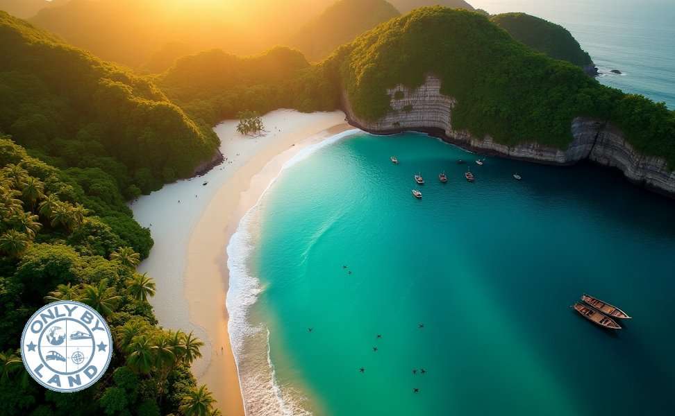
Picture a paradise with an island to match each day of the year. The San Blas archipelago stretches across the Caribbean with 365 pristine isles that showcase nature at its finest.
The best beaches in Central America hide countless wonders waiting to be explored. Belize features untamed jungles that meet crystal-clear waters. Nicaragua’s volcanic shores create natural phenomena where sand seems to burst from the earth. Some beaches maintain perfect 82°F water temperatures year-round. Others transform at night when bioluminescent algae light up the waves with an otherworldly glow.
These stunning coastal spots deliver more than beautiful sand and surf. Isla de Ometepe’s 73 archeological sites contain over 1,700 ancient petroglyphs. Utila’s rich waters teem with more than 500 fish species and migrating whale sharks. Local residents have carefully protected 15 hidden beaches that rank among Central America’s most beautiful coastal treasures.
Playa Biesanz, Costa Rica
Playa Biesanz, a peaceful beach along Costa Rica’s Pacific coastline, stands out from the busy central American beaches. This hidden cove gives visitors a genuine beach experience without the overwhelming crowds you’d find at other popular spots in the region.
Playa Biesanz Location and Access
The secluded beach sits between Quepos town and Manuel Antonio National Park. Beach-goers can park their cars near Parador Resort or Shana By The Beach . Local car watchers charge about 2000 colones (approximately $4) to watch vehicles. A 10-minute walk through a forest trail takes you to this hidden paradise. Some spots on the path can be steep and challenging, so wearing proper shoes makes sense. The short trip through the jungle canopy sets the perfect mood for the peaceful beach waiting below.
Playa Biesanz Wildlife and Natural Beauty
The beach features pristine white sand and turquoise waters in a protected cove that stays calm year-round. The natural shelter makes swimming safe for families and anyone looking for gentle waters.
The path to Playa Biesanz lets you spot amazing wildlife. You’ll often see three-toed sloths, howler monkeys, and rare Central American squirrel monkeys in the trees above. These natural encounters happen right on the trail, showing off Costa Rica’s rich wildlife before you reach the beach.
Playa Biesanz Nearby Attractions
The beach offers several conveniences to make your stay better. You can rent kayaks, snorkeling gear, beach chairs, and umbrellas for $20-40 daily, depending on when you visit. Small stands sell drinks, cocktails and local treats like “Churchills” – sweet shaved ice treats.
The area around Playa Biesanz has plenty to explore. Manuel Antonio National Park sits just minutes away, so you can watch wildlife and relax on the beach in one day. Falafel Bar’s excellent Mediterranean food is just a five-minute drive away. Quepos’s Marina Pez Vela lets visitors book sailing tours along the beautiful Pacific coast.
Playa El Tunco, El Salvador
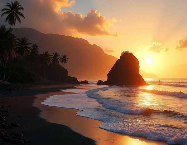
Playa El Tunco stands as El Salvador’s most visited beach destination and ranks among central America’s most celebrated beaches. A pig-shaped rock formation visible at high tide gave this beach its unique name. This small two-street town has evolved from an unknown spot to become a world-renowned surf haven that features distinctive volcanic elements and community-based initiatives.
Playa El Tunco Volcanic Sand and Surf
The beach’s dramatic volcanic black sand creates a stunning contrast with the Pacific’s blue waters. Flat areas perfect for beach walks emerge at low tide, while the rocky coastline reveals itself at high tide. El Tunco provides access to two premier surf spots: La Bocana and Sunzal. Sunzal works great for beginners, though the waves attract intermediate to advanced surfers. The dry season (November-April) brings smaller waves that suit learning surfers, while the rainy season (May-October) produces powerful swells that test even seasoned professionals.
Playa El Tunco Local Legends and Culture
The beach’s name comes from a rock formation that looks like a pig with upturned legs, which becomes an island at high tide. The town comes alive each weekend as nearly half of San Salvador’s residents head to this coastal retreat. Street vendors multiply, music changes from pop to salsa and the atmosphere transforms from tourist-focused to authentic Salvadoran. Local food revolves around pupusas – tortillas filled with cheese, beans, chicharrones and vegetables – which cost between 50 cents and $1 each. Visitors can walk to the signature rock formation at low tide, where local fishermen cast their lines each morning.
Playa El Tunco Sustainability Efforts
El Tunco’s community takes environmental protection seriously. El Salvador Surf Travel Association and La Libertad Surf Association lead conservation projects and beach cleanups. A significant cleanup event in 2023 brought together over 60 volunteers, including Tourism and Environment ministry staff. The community pools resources to support daily street cleanings at 6 AM, maintain the police station and fund security guards and surveillance cameras. Several accommodations embrace eco-friendly practices through energy-efficient designs with natural airflow, proper waste management systems and hiring policies that support local workers and women’s advancement.
Isla de Ometepe, Nicaragua
Lake Nicaragua’s waters are home to Isla de Ometepe, the world’s largest volcanic island in a freshwater lake. The island covers approximately 270km² and amazes visitors with its twin volcanoes, Concepción and Maderas. You won’t find beaches like these anywhere else in Central America.
Isla de Ometepe Volcanic Beach Features
The island’s coastline tells a fascinating story of contrasts with its distinctive black sand beaches created by volcanic activity. The westernmost point, Punta Jesús María, features a remarkable volcanic sandbar that stretches almost a kilometer into Lake Nicaragua during dry season. Visitors feel like they’re walking on water here. The spot offers a unique view of three volcanoes at once: Maderas, Concepción and Mombacho. The island has some surprises too – among these volcanic black sand beaches, you’ll find “normal” sandy beaches that look like they belong in the Caribbean, especially between the two volcanoes.
Isla de Ometepe Cultural and Archeological Significance
The island’s rich mixture of cultures goes back about 3,500 years. Its name comes from Nahuatl – “ome” means two and “tepetl” means mountain. The area around Maderas volcano holds petroglyphs and stone sculptures that are roughly 1,700 years old. These ancient carvings, along with ceramic relics and religious statues, show how important the island was as a pre-Columbian spiritual center. The towns of Altagracia and Moyogalpa keep traditions alive with festivals that honor patron saints. These celebrations feature traditional dances like the Baile del Zompopo and Balie de las Inditas.
Isla de Ometepe Unique Wildlife
The island’s varied landscape creates different ecosystems from wetlands to tropical rainforests and cloud forests. Wildlife thrives here, and you can spot howler and capuchin monkeys in the remaining forest areas. It’s common to see monkeys with their babies playing in trees right by the beach. The shallow waters around the island are full of birds, including beautiful white egret-type birds. UNESCO recognized Ometepe’s natural importance by naming it a biosphere reserve in 2010, which helps protect its unique environment.
Playa Cocles, Costa Rica
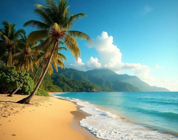
Playa Cocles stretches two kilometers along Costa Rica’s Caribbean coast and stands out as one of the region’s best surfing spots with hidden ecological treasures. This beach sits just 2 miles south of Puerto Viejo in Limón province and offers a perfect mix of adventure and relaxation among central America’s beaches.
Playa Cocles Surf and Reef Life
The beach’s tan sand and crystal clear waters create distinctive surfing conditions with beach breaks over sandbars. Waves rise quickly and deliver steep, fast entries that lead to slower rides extending between 300-500 meters. Surfers love the consistent left and right waves that break throughout the day, making this spot a regional favorite.
Warm water temperatures stay around 28-29°C year-round, with the best surf happening early morning at mid to high tide. All the same, strong rip currents and undertow can challenge even skilled swimmers. The beach proudly displays its blue flag status that shows its cleanliness and safety, while lifeguards watch over visitors during busy hours.
Playa Cocles Cacao Farms and Local Economy
The area’s rich cacao industry supports the local economy beyond the beach. Caribeans Chocolate and Coffee sits in the lush landscapes near Puerto Viejo and shows the region’s dedication to eco-friendly agriculture. This business started as a passion project to bring back the local cacao industry after disease wiped out crops in the 1970s.
The region faces economic hurdles today. A neighboring pineapple plantation bought the 110-hectare FINMAC cacao farm in 2017, which led to a 20% drop in Costa Rica’s total cacao production and most of its organic cacao. Small operations struggle as labor costs make up 75-80% of total production expenses.
Playa Cocles Bioluminescence and Rare Minerals
The beach lights up magically at night when bioluminescent organisms glow along the shoreline. This natural light show happens as tiny water organisms release light through chemical reactions, creating an ethereal blue glow in the waves. Visitors can see this spectacular display best during new moon phases under dark skies.
Costa Rica’s cacao holds deep cultural meaning for first-time visitors to understand. A local saying captures this perfectly: “Pataste for the people, Cacao for the Gods”—showing this crop’s sacred place in local culture and traditions.
More on hidden South American beaches.
Utila, Honduras
Utila, the smallest of the Bay Islands off Honduras’s coast, has earned a remarkable reputation among central America beaches for its unique marine experiences. This island paradise spans just 18km in length and 6km in width, giving visitors access to the world’s second largest barrier reef system.
Utila Diving and Marine Biodiversity
The island features over 60 distinct dive sites with untouched coral formations. The northern coast, where the island meets the Cayman Trough, houses most of these sites. Rich coral reef ecosystems create spectacular wall dives that support diverse marine life. “Duppy Waters,” located at the edge of Turtle Harbor Marine Reserve, displays remarkable biodiversity with crystal-clear visibility from the depths to the surface. The Black Coral Wall stands out because of its rare coral formations. The “Halliburton” wreck, deliberately sunk in 1998, now acts as an artificial reef that draws many species.
Utila Reef System and Whale Shark Migration
The island’s reputation as the “Whale Shark Capitol of the Caribbean” comes from year-round sightings of these gentle giants. Researchers recorded 479 whale shark encounters around the island between 1999 and 2011. Their studies identified 95 individual Rhincodon typus measuring 2 to 11 meters. Males make up 65% of these visitors. The research team calculated that each whale shark stayed for about 11.76 days on average. Visitors have the best chances to spot these creatures during March-May and August-September.
Utila Local Culture and Slow Island Life
The island’s charm extends beyond its marine wonders with a relaxed lifestyle that draws travelers seeking genuine experiences rather than luxury. This tight-knit community of 3,500 residents truly embodies the saying “everyone knows everyone”. The locals’ helpful nature shows when they check if neighbors need supplies before heading to town. Main Street serves as the island’s hub, connecting Sandy Bay to The Point. Here you’ll find everything from banks and grocery stalls to unique spots like Rene’s tattoo parlor, where visitors often get permanent reminders of their island stay. Utila remains true to its roots as an affordable, unpretentious paradise where “shorts, a t-shirt and bare feet are the recommended attire”.
Playa Venao, Panama
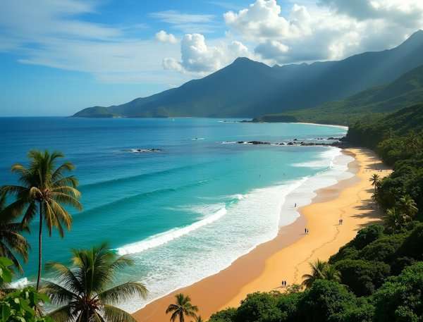
Playa Venao curves like a perfect horseshoe along Panama’s Pacific coastline. This hidden gem among Central American beaches captivates visitors with its world-class surf, vibrant marine ecosystems and strong focus on conservation.
Playa Venao Surf Conditions and Black Sand
The wide bay stretches over a mile with soft black volcanic sand that creates a stunning contrast against turquoise waters. Surfers can catch waves consistently throughout the year, though the dry season from December to April brings the most reliable southwest swells. The beach’s unique layout lets surfers of all levels ride simultaneously. Expert surfers head out to catch overhead swells that form clean left and right lines offshore, while beginners can practice on gentler waves near the bay’s edges. The current surf forecast shows 7-9 ft waves with clean conditions, proving why this spot earned its reputation for quality breaks. Big swells in June and July bring the western edge’s point break to life.
Playa Venao Marine Life and Coral Reefs
The underwater world of Playa Venao matches its surface beauty. Warm tropical waters mean you can swim comfortably without a wetsuit most of the year. Vibrant coral reefs fill the bay with colorful fish, sea turtles and countless marine species. Nature lovers can take a short boat ride to Isla Iguana, a protected wildlife sanctuary known for its exceptional marine diversity. Local shops rent snorkeling gear to anyone wanting to explore these underwater wonders firsthand.
Playa Venao Conservation and Turtle Nesting
The beach’s identity centers around protecting its natural treasures. Endangered Olive Ridley sea turtles choose this special place as their nesting ground. “Tortugas Playa Venao” volunteers watch over the shoreline, move vulnerable nests to safer spots, and track how many hatchlings make it to sea. These environmental champions have set up beach vehicle curfews during nesting season and pushed for turtle-friendly lighting to help hatchlings find their way. The local community and beach visitors work together by filling in sand holes after their activities to help baby turtles reach the ocean safely.
Cayos Cochinos, Honduras
Cayos Cochinos, a pristine archipelago among central America beaches, has been a biological reserve since 1993. This natural wonder covers 460 square kilometers off Honduras‘ Caribbean coast. Crystal-clear waters and healthy coral reefs surround two forested islands and 13 smaller cays in this hidden gem.
Cayos Cochinos Indigenous Garifuna Culture
The archipelago’s rich culture comes from its Garifuna inhabitants, who descended from West and Central African survivors and mixed with Arawak and Carib peoples. Today, about 250 Garifuna people live in two small fishing villages: East End on Cayo Mayor and Chachahuate Cay. Their society values family ties and matriarchal leadership. These communities preserve traditional fishing methods passed down through generations.
Central America celebrates Garifuna ceremonies that showcase vibrant handmade costumes. Musicians play drums, conch shells, and turtle shells during these events. UNESCO recognized this heritage’s significance in 2001 by declaring Garifuna culture a “Masterpiece of the Oral and Intangible Heritage of Humanity”.
Cayos Cochinos Marine Reserve and Eco-tourism
The Mesoamerican Barrier Reef, earth’s second-largest coral reef system, makes Cayos Cochinos home to thriving marine ecosystems. The Honduran Coral Reef Foundation oversees this Marine Protected Area and bans commercial fishing.
Conservation efforts center around a research station on Cayo Menor, which opened in 1995. Scientists work here to balance eco-friendly development with biological preservation. Visitors learn about the islands’ history and culture through an educational film upon arrival. A $25 entrance fee supports ongoing conservation work.
Cayos Cochinos Accommodations and Access
Boats provide the only way to reach the archipelago. Travelers can depart from La Ceiba on mainland Honduras or nearby islands like Roatan and Utila. The trip takes 40 minutes to 1.5 hours based on ocean conditions.
Visitors can choose between simple Garifuna village stays and more comfortable options. Budget travelers experience authentic island life in Chachahuate for about 250-300 HNL ($10-11) nightly. Local restaurants serve fresh fish meals at similar prices. These modest accommodations might lack amenities but reward guests with stunning ocean views and genuine cultural experiences.
Corn Islands, Nicaragua
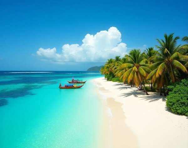
Nicaragua’s Corn Islands remind visitors of the unspoiled Caribbean from decades past, with some of the most beautiful beaches in central America. This duo of islands—Big Corn and Little Corn—sits roughly 70 kilometers off Nicaragua’s eastern coast. They preserve the relaxed charm that larger Caribbean destinations lost to commercialization.
Corn Islands Caribbean Charm and Affordability
These islands showcase a distinctive Afro-Caribbean culture where Creole English flows with Spanish. Getting there takes determination—a flight from Managua to Big Corn Island on small 12-seater Cessna planes, followed by a sometimes choppy 40-minute boat ride to Little Corn. Little Corn’s complete ban on motorized vehicles creates a peaceful environment where life moves at island pace. Travelers can find accommodations that match any budget, from simple $15-per-night beach bungalows to luxurious $250 lodgings with private plunge pools. The islands’ affordability makes them a refreshing alternative to expensive Caribbean destinations.
Corn Islands Local Food and Lifestyle
The island’s story comes alive through its food. Lobster fishing serves as the economic foundation, letting visitors enjoy fresh catches at surprisingly low prices. Local specialties include:
- Rondon – a rich coconut milk stew with seafood, yams and taro root pronounced “run-down”
- Coconut bread – warm, fragrant bread from home bakeries like Miss Esther’s
- Lobster dishes – prepared countless ways, often costing under $10
These culinary treasures complement the island’s relaxed pace of life. Without major resorts or cruise ships, the authentic atmosphere thrives and hammock-lounging becomes a legitimate daily activity.
Corn Islands Snorkeling and Beach Life
Little Corn Island’s northern waters feature over 12 kilometers of vibrant reef just meters from shore. Marine life flourishes in these protected waters, with rays, groupers, sharks, eels, and colorful damselfish. Snorkelers love Dolphin Shallows—perfect for beginners and night exploration—and several reef patches along the north end. Big Corn Island offers a unique attraction: a shallow shipwreck where a 50-year-old steamship rests in waters no deeper than 15 feet. Underwater adventures remain affordable with equipment rentals and guided tours ranging from $20-40.
San Blas Islands, Panama
The San Blas Islands stand as an autonomous archipelago governed by the indigenous Guna people. These islands rank among central America’s most pristine beaches. A stunning collection of over 365 islands stretches along Panama’s northeastern Caribbean coast. The fiercely independent Guna community inhabits just 49 of these islands, leaving the rest untouched by mass tourism.
San Blas Islands Guna Culture and Traditions
The Guna people hold a semi-autonomous status within Panama. Their traditional leadership council, the Guna General Congress, oversees political and social affairs. The community runs on agriculture, fishing, and clothing manufacturing, backed by their deep-rooted history of mercantilism. Their economic self-determination has helped them stay more independent than other indigenous groups.
Guna culture’s most distinctive feature lies in their colorful textile art—molas. Women create these vibrant panels through appliqué and reverse appliqué techniques for their daily national dress blouses. “Mola” translates to “clothing” in the Guna language. These beautiful textiles now serve as a major economic driver, with vendors throughout Panama selling them to locals and tourists alike.
San Blas Islands Natural Beauty and Isolation
Natural beauty remains exceptionally preserved thanks to the archipelago’s isolation. Paradise-like settings emerge from crystal-clear waters and pristine white sand beaches, untouched by commercial development. The San Blas region features healthy coral reefs that support rich marine ecosystems.
The archipelago’s 378 islands remain largely uninhabited, which helps protect their pristine beaches and biodiversity. This limited development sets these islands apart from more commercialized destinations. The Guna people actively guard their lands against mass tourism to keep them “healthy, pristine and beautiful”.
San Blas Islands Eco-friendly Travel Tips
Visitors should respect Guna customs and ask permission before taking photos of locals—it’s their tradition. Buying local handicrafts like molas directly helps the community’s economy.
Eco-conscious travelers should bring biodegradable sunscreen to protect the coral reefs and marine life. Most islands lack Wi-Fi or cell phone signals, offering a perfect chance for digital detox.
The islands’ lodging reflects their commitment to sustainability. Simple eco-friendly lodges built from local natural materials dot the islands and surrounding jungle. These basic accommodations connect guests with both nature and Guna culture authentically.
Playa Maderas, Nicaragua
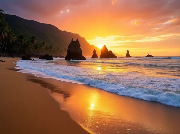
Playa Maderas sits just 25 minutes from San Juan Del Sur and stands out as a unique paradox among central American beaches. The perfect mix of reliable surf, mysterious sand formations, and archeological discoveries makes this Nicaraguan gem worth exploring beyond the usual tourist spots.
Playa Maderas Surf and Sand Volcano
This beach serves as one of Nicaragua’s surfing cultural hubs and hosts competitions throughout the year. Recent forecasts show impressive 4-7 ft waves with clean conditions, backed by long period swells of 17 seconds. The beach transforms throughout the day—high tide brings gentle sunset surfing on A-frame waves, while low tide creates steeper challenges that experienced surfers love. The real surprise lies beneath these waves—sand volcanoes. These cone-shaped formations emerge when liquefied sand bursts through a central vent to create miniature volcano-like structures from inches to several feet wide.
Playa Maderas Archeological Significance
The beach fascinates surfers, and the surrounding area holds remarkable archeological treasures. The Gregorio Aguilar Barea Museum features an exceptional collection of pre-Columbian stone sculptures with more than 120 basalt statues carved between AD 800 and 1500. Visitors often marvel at “La Chinita,” known as “The Mona Lisa of Chontales”. The museum’s collection of stelae stands as Nicaragua’s most significant, with some monuments reaching up to 4 meters tall.
Playa Maderas Accommodation Options
The lodging options fit a variety of priorities. Maderas Village offers wooden lodgings with shared dinners and daily yoga classes for those seeking jungle immersion. Hush Maderas delivers adults-only luxury complete with an infinity pool overlooking the jungle, in-room massages, and weekly live music nights. Selina Maderas and Buena Vista Surf Club round out the top choices, earning high marks for their service and spectacular settings.
Playa Blanca, Guatemala
Playa Blanca, Guatemala’s only white-sand beach, stands among central America’s most beautiful coastal treasures. This secluded shoreline offers visitors pristine natural beauty away from the usual tourist crowds.
Playa Blanca Remote Access and Seclusion
Local sources say you’ll need determination to reach this hidden paradise, as boats from Rio Dulce or Puerto Barrios provide the only access. The 40-minute boat ride costs vary based on passenger count. This travel challenge helps maintain the beach’s isolation and untouched character. Note that you won’t find hotels or restaurants at the beach, which makes it perfect for day trips and keeps the scenery pristine.
The beach spans about half a mile within Amatique Bay, an area known for its river networks and mangroves. This isolation sets it apart from other more developed beaches in the region.
Playa Blanca White Sand and Calm Waters
The shoreline’s unique pale color comes from its calcium carbonate composition—broken coral and marine shell structures. Swimming conditions are perfect in these crystal-clear waters that offer excellent visibility. The tides can show impressive changes of about three meters between high and low points.
The marine habitat around the beach supports incredible biodiversity, with coral formations that house over 500 fish species. This rich ecosystem plays a vital role in the region’s marine network and supports local fishing activities.
Playa Blanca Local Community and Conservation
While commercial development stays minimal, local communities have adopted green practices for tourism. Unlike mass tourism spots, visitors here directly support conservation efforts through their presence and spending.
The nearby marine ecosystem holds great ecological value and the area’s culinary traditions show a deep connection to sustainable sea resources. Local cooking methods pass through generations, using fresh fish often combined with native crops like coconut and regional spices.
Conservation projects now bring together government agencies and local stakeholders to protect this untouched environment while allowing controlled public access. The challenge to maintain this balance continues as more flights route through nearby airports.
More beaches in Guatemala.
Placencia Peninsula, Belize
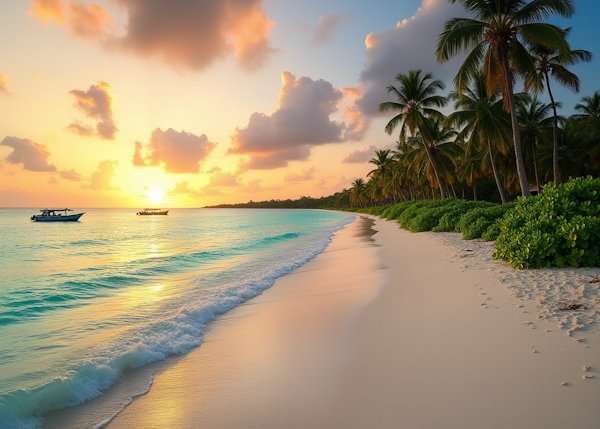
The Placencia Peninsula stretches 16 miles into the Caribbean Sea. This beautiful strip of land captures Belize’s perfect balance of natural beauty and cultural richness among central America beaches. A unique geography shapes the thin peninsula, with a lagoon on its west side and stunning azure waters to the east.
Placencia Peninsula Hidden Coves and Beaches
The peninsula’s southern tip houses Placencia Village and hides many secluded beaches and coves along its length. Locals nicknamed the spectacular crescent beach at Placencia Village “Barefoot Perfect,” and it stays peaceful even in busy seasons.
Maya Beach welcomes travelers with quiet shores and some of the best sunrises you’ll ever see. On top of that, Sandy Hill Caye in the South Water Caye Marine Reserve offers perfect solitude and crystal-clear waters perfect for exploring.
Placencia Peninsula Snorkeling and Reef Access
Placencia’s location next to the world’s second-longest barrier reef makes it perfect for underwater adventures. Clear waters extend up to 100 feet deep and reveal colorful coral gardens below the surface.
Popular snorkeling destinations include:
- Silk Caye (nicknamed “Turtle Alley”) with its untouched reefs and graceful sea turtles
- Laughing Bird Caye National Park, known for beautiful coral formations and rich marine life
- The quiet spots around Lark, Bugle, Scipio, and Colson cayes
Whale shark watching tours run at Gladden Spit from March to June, letting visitors swim near these gentle giants.
Placencia Peninsula Local Culture and Food
An array of cultural influences shapes Placencia, blending Garifuna, Mestizo, Mayan, Creole, European, East Indian and Asian traditions. This rich mix has turned the peninsula into a food lover’s paradise.
Visitors should try traditional dishes like Fry Jacks, Hudut (a Garifuna fish soup) and authentic rice and beans. Placencia’s sidewalks—including the Guinness World Record holder for “narrowest main street in the world”—are lined with everything from small food stands to fancy restaurants. Local tamales arrive fresh from southern villages each morning, while seafood comes straight from the day’s catch. The small takeaway stands often serve the most authentic food at half the price of regular restaurants.
Playa Cocalito, Costa Rica
Playa Cocalito lies tucked away along Costa Rica’s Nicoya Peninsula. This remarkable central American beach features something extraordinary – a waterfall that flows right into the ocean.
Playa Cocalito Waterfall Beach Experience
“El Chorro” makes this beach exceptional. It’s one of just seven waterfalls worldwide that pour into the sea. The water tumbles from a cliff into lava rock pools and ocean waters, which creates a spectacular sight with rainbow reflections. A pristine white sand beach cove with bright blue waters surrounds the waterfall’s north end. El Chorro gives visitors a perfect blend of beach relaxation and nature’s wonders. The beach stays empty most times, which makes it feel like your own private paradise. Fresh cascading water meets the blue ocean to create a photographer’s dream scene. Visitors become part of what looks like a perfect poster.
Playa Cocalito Jungle Trail and Wildlife
This hidden gem needs some work to reach since cars can’t get there. Visitors can take a two-hour hike through jungles, beaches, and rivers. Many choose the popular one-hour horseback ride from Montezuma instead. The path winds through sandy beaches, rock formations, and tropical rainforest stretches. Wildlife appears often along the way. Travelers see capuchin monkeys, anteaters, and tropical birds in their natural home. Rio Bonito appears just before the beach. This river creates a lagoon-style pool that emerges from the jungle and offers a cool swim.
Playa Cocalito Best Time to Visit
The right timing is vital to visit this beach sanctuary. Early morning works best when the sun stays low and few people are around. Low tide makes beach walking easier along the route, so check tide times before going. High tide brings strong currents with dangerous driftwood. Each season offers something different. The dry season runs from December to April, while the wet season goes from May to November. The waterfall’s flow might decrease in dry months. Rainy season can make river crossings and rock climbing more challenging.
Playa Las Lajas, Panama
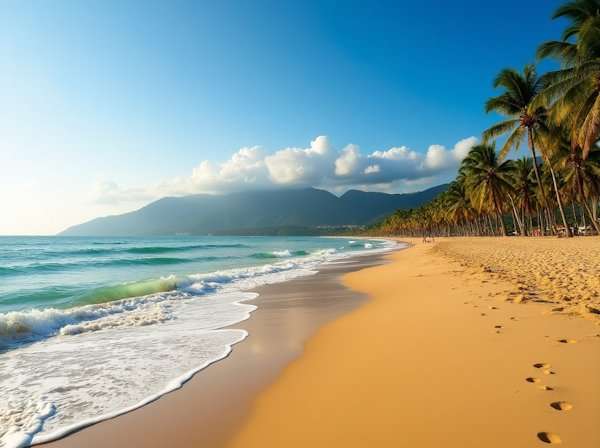
The extraordinary Playa Las Lajas stretches along Panama’s Pacific coastline with its 13-kilometer golden sand beach. This hidden paradise gives visitors an authentic beach experience without the crowds that plague other beaches in Central America.
Playa Las Lajas Long Beach and Tranquility
Playa Las Lajas ranks among Panama’s longest mainland beaches, stretching an impressive 15 kilometers. The vast shoreline creates a remarkable scene where you’ll spot more pelicans than people, especially during weekdays or rainy season when the beach becomes empty. The wide sandy shoreline lets you take long sunrise and sunset walks that locals call “celebrations”. The beach’s peaceful atmosphere comes in part from its unique layout—you can walk for kilometers either way along the sandy Pacific shore. This creates a sense of endless space you won’t find at other Central American beaches.
Playa Las Lajas Local Seafood and Culture
Local restaurants serve up delicious traditional Panamanian cuisine. El Rincon del Chef dishes out fresh seafood, while Restaurante Las Lajas specializes in local favorites. The regional specialties like sancocho (hearty chicken soup) and patacones (fried plantains) are must-try dishes. Las Lajas Beach Resort and Johnny Fiestas serve tasty meals at prices that won’t break the bank. The area’s welcoming atmosphere makes it special—most visitors feel at home after just three days thanks to the friendly locals.
Playa Las Lajas Accessibility and Tips
The beach sits about 75 kilometers east of David in Chiriquí province. Travelers can take a one-hour flight from Panama City to David and drive roughly 75 miles to reach the beach. Busses run from David to San Felix every 30 minutes for about $5. A taxi from San Felix to the beach costs around $10. The Pacific’s big tide changes need attention—checking tide charts will give a better beach experience. Beach enthusiasts should head out early because sunrise creates amazing photo opportunities along this coastline.
Playa Negra, Costa Rica
Playa Negra stands out as a hidden treasure on Costa Rica’s Pacific coast in Guanacaste province. The beach captivates visitors with its distinctive volcanic black sand and world-class surf breaks. This lesser-known gem among Central American beaches gives visitors an authentic experience away from crowded tourist spots.
Playa Negra Black Sand and Surf
The beach’s striking black volcanic shoreline makes it instantly recognizable. Visitors can explore fascinating rock formations and small tide pools scattered across the beach during low tide. The location’s legendary surf break gained fame after appearing in Robert August’s iconic film “Endless Summer II”. The spot draws professional surfers worldwide with its consistent year-round waves and hollow right-hand barrels. The high tide provides better surfing conditions, while low tide reveals a vast rock bottom that can be dangerous for beginners. Newcomers to surfing should head to nearby beaches like Tamarindo, Avellanas or Grande when Playa Negra’s waves become too challenging.
Playa Negra Local Vibe and Fewer Crowds
The area thrives on its strong local surfing culture that visitors need to respect. The local community’s protective attitude toward their waves means they don’t tolerate behaviors like dropping in or snaking—actions that could create tension. The beach offers more than just surfing. Visitors can enjoy beach walks, practice yoga, relax in hammocks and watch spectacular sunsets. Playa Negra attracts travelers who want a remote, rustic Costa Rican beach experience without tourist shops or massive crowds. The region’s laid-back pace reflects the authentic “pura vida” lifestyle that characterizes Costa Rica’s coastal communities.
Playa Negra Eco-lodges and Sustainability
Local eco-lodges show remarkable dedication to environmental protection. These accommodations embrace green practices through solar panels, water conservation and waste reduction. Drift Away Lodge exemplifies this approach by using local supplies, natural materials and biodegradable cleaning products while maintaining a strict plastic-free policy. These establishments boost community development and economic stability by hiring local staff. Guests can minimize their environmental footprint by using free bike rentals, eating at local restaurants and buying from area artisans. Costa Rica leads global responsible travel practices by focusing on both environmental conservation and community welfare.
Comparison Table
| Beach Name | Country | Notable Features | Main Activities | Access | Best Time to Visit |
|---|---|---|---|---|---|
| Playa Biesanz | Costa Rica | Hidden cove with white sand | Swimming, snorkeling, kayaking | 10-min forest trail walk | – |
| Playa El Tunco | El Salvador | Black volcanic sand with pig-shaped rock | Surfing, beach walks | Two-street town | Dry season (Nov-Apr) suits beginners |
| Isla de Ometepe | Nicaragua | Twin volcanoes with black sand beaches | Ancient site visits, wildlife viewing | Boat access | – |
| Playa Cocles | Costa Rica | Crystal waters with tan sand | Surfing, cacao farm visits | 2 miles from Puerto Viejo | Early morning during mid-high tide |
| Utila | Honduras | World’s second largest barrier reef | Diving, whale shark watching | Boat access | Mar-May & Aug-Sep brings whale sharks |
| Playa Venao | Panama | Curved horseshoe bay with black sand | Surfing, turtle watching | – | Dec-Apr offers dry weather |
| Cayos Cochinos | Honduras | Marine sanctuary | Snorkeling, Garifuna culture | 40-min to 1.5-hr boat ride | – |
| Corn Islands | Nicaragua | Rich Caribbean culture | Snorkeling, diving, local cuisine | Flight + boat ride | – |
| San Blas Islands | Panama | 365 pristine island waters | Cultural visits, snorkeling | Boat access only | – |
| Playa Maderas | Nicaragua | Reliable surf spots, sand volcanoes | Surfing, ancient site visits | 25-min from San Juan Del Sur | – |
| Playa Blanca | Guatemala | Guatemala’s only white-sand beach | Swimming, marine life viewing | 40-min boat ride | – |
| Placencia Peninsula | Belize | Stretches 16 miles | Snorkeling, whale shark watching | – | Mar-Jun brings whale sharks |
| Playa Cocalito | Costa Rica | Ocean-meeting waterfall | Hiking, horseback riding | 2-hr hike or 1-hr horseback | Early morning, low tide |
| Playa Las Lajas | Panama | 13-km stretch of golden sand | Beach walks, local food | 75km from David | Early morning |
| Playa Negra | Costa Rica | Dark volcanic sand | Surfing, yoga | – | Low tide suits exploring, high tide for surfing |
Enjoy Central America Beaches
Beautiful hidden beaches dot Central America’s coastline, ranging from volcanic black sand shores to pristine white coral beaches. Each spot carries its unique story – Playa Cocalito amazes visitors with its ocean-meeting waterfall, while Utila draws them with its whale shark encounters. The San Blas Islands preserve their rich indigenous culture proudly.
These secluded coastal treasures prove that genuine beach experiences still exist naturally. The Guna people’s careful protection of San Blas and Cayos Cochinos’ marine conservation efforts show how local communities protect their natural heritage through eco-friendly tourism.
Adventurous travelers who head over to these hidden gems find they need extra effort to reach them. Natural gatekeepers like remote locations, boat-only access, and challenging trails help maintain their pristine state. Limited accessibility creates perfect moments to connect with local communities and share meaningful cultural exchanges.
These 15 beaches mean much more than just beautiful coastlines – they represent thriving ecosystems, ancient traditions and sustainable tourism models. Their future depends on responsible travelers who honor local customs, back community projects and cherish authentic experiences over convenience.
FAQs
Q1. Which Central American country offers the most beautiful beaches?
While beauty is subjective, Costa Rica is often praised for its stunning beaches. Manuel Antonio beach and Hermosa beach in Costa Rica are frequently cited as some of the most beautiful in Central America, offering a perfect blend of lush jungle scenery and pristine coastlines.
Q2. How can I find secluded beaches in Central America?
To discover secluded beaches in Central America, consider visiting less touristy areas and be prepared for some adventure. Places like Playa Biesanz in Costa Rica or Playa Blanca in Guatemala require extra effort to reach, often involving short hikes or boat rides, which helps keep them less crowded.
Q3. What unique beach experiences can I find in Central America?
Central America offers several unique beach experiences. For instance, you can witness bioluminescence at Playa Cocles in Costa Rica, see a waterfall cascading directly into the ocean at Playa Cocalito, or explore ancient petroglyphs near the beaches of Isla de Ometepe in Nicaragua.
Q4. Are there good snorkeling and diving opportunities in Central American beaches?
Yes, Central America offers excellent snorkeling and diving opportunities. The Mesoamerican Barrier Reef System, the second-largest in the world, runs along the coasts of several countries. Utila in Honduras and the Placencia Peninsula in Belize are particularly renowned for their marine life and coral reefs.
Q5. How can I responsibly visit these hidden beaches in Central America?
To responsibly visit hidden beaches in Central America, respect local customs and environments. Use eco-friendly sunscreen, avoid single-use plastics, support local businesses and follow Leave No Trace principles. In places like the San Blas Islands, be mindful of indigenous cultures and always ask permission before taking photographs of locals.










Leave A Comment