
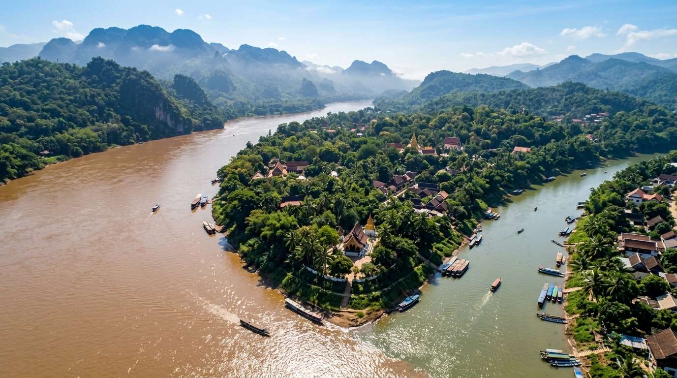
Could the royal capital of Lan Xang turn Mekong floods and quiet almsgiving footsteps into a net-zero haven by 2050? The town is the test case for that vision. I used to read city plans only after visiting, and I wish I had read this one before.
The old center sits on a peninsula where the Mekong and the Nam Khan meet. This report walks through the planning scenario for that land and keeps one line clear throughout: what is planned, and what is still only a vision. As an explorer, I want to know what a place may look like before I choose how to move through it.
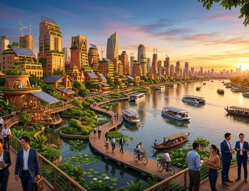
The first big picture of that 2050 vision comes next.
Key Takeaways
- The 2050 picture is a planning scenario and a vision, not a description of the town today.
- The old town is a living World Heritage Zone, and residents still need modern services.
- Visitors grew from about 62,000 in 1997 to about 860,000 in 2019.
- Green power does most of the work in the emissions plan, at 2,391 of 2,907 ktCO2.
- Flood risk is real: the peninsula was hit hard in 2008.
- Money and local capacity are the biggest obstacles.
- For a trip now, walk the core and plan 2 to 3 days.
Luang Prabang future 2050: a carbon-neutral heritage sanctuary
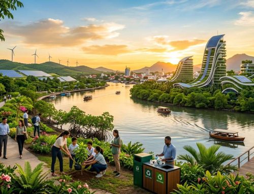
The vision is a city that stays a living sacred town while running on clean power and staying dry in floods. By 2050 the royal capital would serve as a model of resilience for a river peninsula. Its goals are a carbon-neutral city, flood-ready riverfronts, protected temples and clean power from everyday footsteps.
The vision rests on four pillars:
- Protected timber and stucco buildings
- Flood-ready riverfronts
- Clean microgrid power
- A carbon-neutral city
I read this as a goal to steer by, not a promise. Planners call the method backcasting: starting from a goal set for 2050 and working backward to find the actions needed to reach it, rather than predicting what will probably happen.
The 2050 picture is a target to steer by. It shows which actions the city would need to take, not what will surely happen.
A short summary of the city’s future leaves out the trade-offs. Growth brings visitors and jobs, climate goals demand cuts, and heritage rules limit what can be built. Later sections cover each tension, and the government and local teams have to weigh them one by one. A strategy that ignores one side loses its potential.
To judge the vision, I first need to explain why the peninsula is so special.
Why the peninsula holds UNESCO World Heritage status
The old town has been a UNESCO World Heritage Zone since 1995. The status honors a living heritage district, where residents work and live among temples, cafes and guesthouses. Lao-French shophouses and Buddhist temples give Luang Prabang its look.
The historic core sits on the peninsula, bounded by the Mekong to the north and the Nam Khan to the east. Residents and visitors share the same roads and sidewalks. A 1999 safeguarding and preservation plan is one of the main protection tools.
The rules shape daily life. Development and road changes inside the World Heritage Zone are highly restricted. That means the streets cannot simply be widened, and the number of people the center can hold has a natural cap.
Management here works as a framework, with regulations at every level of the city. The exception matters: the status protects a living town, not a museum. People who live here still need clinics, shops, power and ways to get to work.
That balance explains why so many plans start with a simple question: who actually visits, and how fast did the numbers grow?
How tourism grew and what it asks of the city
In 2019 about 860,000 visitors came to Luang Prabang, up from roughly 62,000 in 1997. That is nearly 13 times more, or 12.7% a year over those years. Tourism now drives most planning on the peninsula.
The city handles nearly 20% of all tourist arrivals to Laos. From 2016 to 2019, arrivals grew about 10.2% a year, against about 4.2% for the country, with growth mostly from China. Most visitors still come from Europe, the Americas and the rest of Asia rather than neighboring ASEAN countries.
Leisure travelers dominate here, unlike elsewhere in Laos. That supports business and services of every kind: the province counted 97 hotels and 400 guesthouses in 2020. Jobs follow in hotels, guiding and tuk-tuk driving, so economic growth and visitor numbers are tied together.
The airport, built in 2012, handled about 742,000 travelers in 2019. It has direct flights to six countries and domestic flights to Vientiane, Xieng Khouang and Pakse. Each of those flights adds pressure on a small town.
One caution: counts differ slightly between sets of statistics, so I treat them as rough scale, not exact tallies. Behind those arrivals are the residents who live with visitors every day.
Who lives here and how the local economy looks
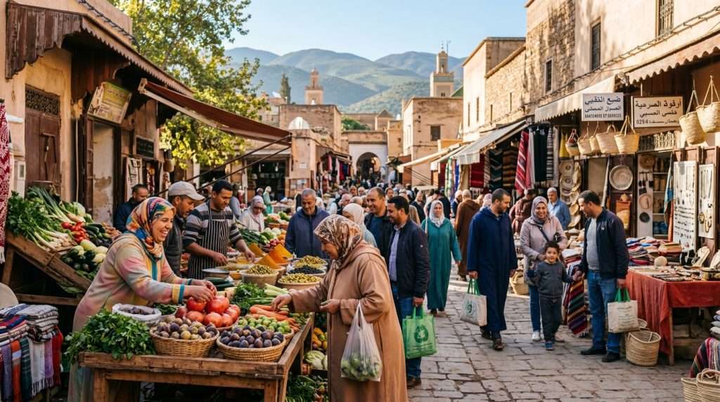
Only about 66,800 people live in the urban city area, which covers 857 sq km. The province holds 463,000 people over 16,875 sq km. A small town serves a very large visitor economy.
Growth at home is slow. Luang Prabang District is expected to reach about 115,000 people by 2035, about 25% above 2015. The provincial population grew only 0.4% a year from 2010 to 2019, against 1.5% nationally.
Income tells a similar story. The 2020 target for income per capita was US$2,319 in the province, versus US$2,978 nationally. This gap shows why socio-economic development plans matter so much here, and why the province lags the country.
Services now make up 71% of the economy, up from 62% in 2015. The provincial poverty headcount fell from 30.0% to 19.4% in the period measured, and sits near 20.4% by another measure. Compare trends, not single numbers, because poverty figures differ by survey year.
Economic development at that level shapes what the city can pay for. It also leads to the simple question of how these residents and visitors move around today.
How people get around today
Roughly two out of three residents commute by motorbike. A 2012 survey found that 63% of residents commute by motorbike, 17% walk and 12% use paratransit such as tuk-tuks. Those mode shares are dated, but the pattern still matches what focus groups described in March 2021.
Those groups had 55 respondents. They named motorbike, bicycle and private car as the most used. Over 60% chose a mode for convenience, 35% for comfort and only 4% for safety.
| Mode | Share of resident commutes (2012) | Who mainly uses it |
|---|---|---|
| Motorbike | 63% | Residents |
| Walking | 17% | Residents and visitors in the core |
| Paratransit | 12% | Tourists and residents |
Motorbikes and tuk-tuks rule the streets
Motorbikes make about 80% of mechanized trips. Commutes average about 10 minutes, and up to 15 in congestion. Each vehicle adds to local emissions, and the tuk-tuk stays popular with tourists.
The city has no signalized junctions, and zebra crossings are not uniform. Users have to read the traffic by eye.
Walking and access for everyone
About 4.2% of the population is disabled. Six junctions have accessibility ramps, but none has tactile paving. Sidewalks break up, and trees and parked vehicles often block the path.
As a visitor, I find walking the core easiest early in the morning, before the vehicles pile up.
Road safety on narrow heritage streets
The province recorded 487 vehicle accidents in 2019. They caused 155 severe injuries and 100 deaths. Narrow streets, mixed traffic and weak management of crossings make those numbers hard to bring down.
The data points to a clear gap, and the green mobility plan tries to close it.
Green mobility plans for the old town
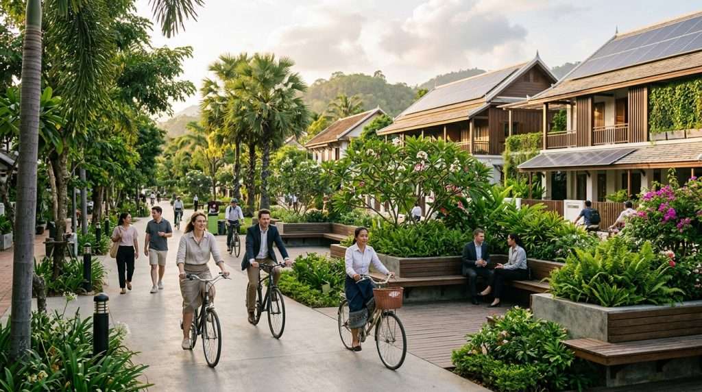
The plan starts with safer walking and cycling corridors, not with new roads. A green mobility study, funded by the Korea Green Growth Trust Fund, covers vision, strategy and financing. It also includes a Green Mobility Index to track progress.
The Ministry of Public Works and Transport and the Department of Luang Prabang World Heritage are partners. The study links to other plans, including the national socio-economic plan, so the work fits one framework. Phase 1 lists costs and funding instruments.
The building blocks are:
- Priority walking and cycling corridors
- Pilot projects to test ideas on the street
- Institutional and capacity building
- Financing options
- Motorbike restriction policies
The study also lists priority studies for planning the next steps. Measures to support walking come first, because they cost less and fit the narrow streets.
A common mistake is to think a ban solves things when no alternative exists. A rule that limits motorbikes only works if people have another way to get to work. An electric tuk-tuk route already exists, and it shows how a cleaner option can run in the old town.
Plans inside the old town are only half the story, because big projects outside it could change everything.
New railway, bridge and economic zone across the Mekong
A visitor now arrives at a station outside the old town and needs a way in. The Lao-China Railway has a station southeast of the center, so every rail traveler faces a last-mile problem. Tuk-tuks and walking are the first options.
Four projects could change land use and visitor flows:
- The Lao-China Railway
- An expressway from Vientiane to China
- A new Mekong bridge linking Luang Prabang and Chompet
- The Luang Prabang Special Economic Zone, 4,850 ha in Chompet
The zone lies across the river and includes areas south and east of the World Heritage Zone on the right bank. This is economic development at a large scale. Easier access may bring more visitors and more development pressure, so land use around the peninsula needs close watching.
A hydropower project of about 1,460 MW on the Mekong has been planned for about 2030. It is a debated item and raises both heritage and environmental questions. The potential gains in power must be weighed against what happens to the river.
Transport links like these also shape business, from hotels to river tours. At the national level they tie the town closer to China and Vientiane, and that is why scientists model a net-zero path for the city.
The net-zero scenario for 2050

The study asks what the city must change to hit zero emissions in 2050, then works backward. The AIM workshop presentation on Luang Prabang describes this net-zero scenario. It sets a base year of 2015 and a target year of 2050.
The scope is narrow: energy-use CO2 only. Climate change goals for agriculture, forestry and waste come as next steps. Good data collection on people, homes and travel sits at the base of the work.
Three scenarios and how they were built
The scenarios are Business as Usual, Countermeasure and Zero Emission. The tool is called ExSS, the Extended Snapshot Tool, and it supports backcasting. Base data covers population and households, transport demand, buildings, and energy demand and supply.
What the 2050 numbers say about growth
The framework assumes steady economic growth. Passenger transport roughly doubles by 2050.
| Measure | 2015 | 2050 | Annual growth |
|---|---|---|---|
| Population | 431,900 | 645,127 | 1.2% |
| Households | 81,000 | 174,359 | 2.2% |
| GDP per capita | US$1,384 | US$3,209 | 2.4% |
| GDP | US$598 million | US$2,070 million | 3.6% |
Why net-zero is a planning tool, not a forecast
I treat the scenario as a planning tool, not a prediction. It shows what must happen for the target to work.
The caveat is the cars. Car travel grows about 12 times, while walking and bicycles grow only 2.3 times. That is the risk to heritage streets, and it is why the next step is the set of actions that deliver the cuts.
Four actions that deliver the 2050 emissions cut
Green power does most of the work. Of the 2,907 ktCO2 saved across all actions, green power delivers 2,391. Cleaner electricity matters far more than a few electric tuk-tuks.
Green power covers renewable energy and lower transmission losses. Each sector adds a smaller share, and the table shows how the totals split.
| Action | What it means | ktCO2 saved |
|---|---|---|
| Green industry | Cleaner production in the industry sector | 237 |
| Green building | Insulation, energy management and fuel shift | 83 |
| Green transport | Efficient vehicles and trips shifted to other modes | 196 |
| Green power | Renewable energy and lower transmission losses | 2,391 |
The numbers show where effort pays off. A building retrofit saves little compared with a cleaner grid. Transport measures save more than buildings, but still much less than power.
These figures cover energy use only, so they leave out farming, forests and waste. Extra support from development partners is key, because the target needs money the province lacks. The cuts also need buildings and temples that stay intact while the city changes.
Protecting Wat Xieng Thong and the old shophouses
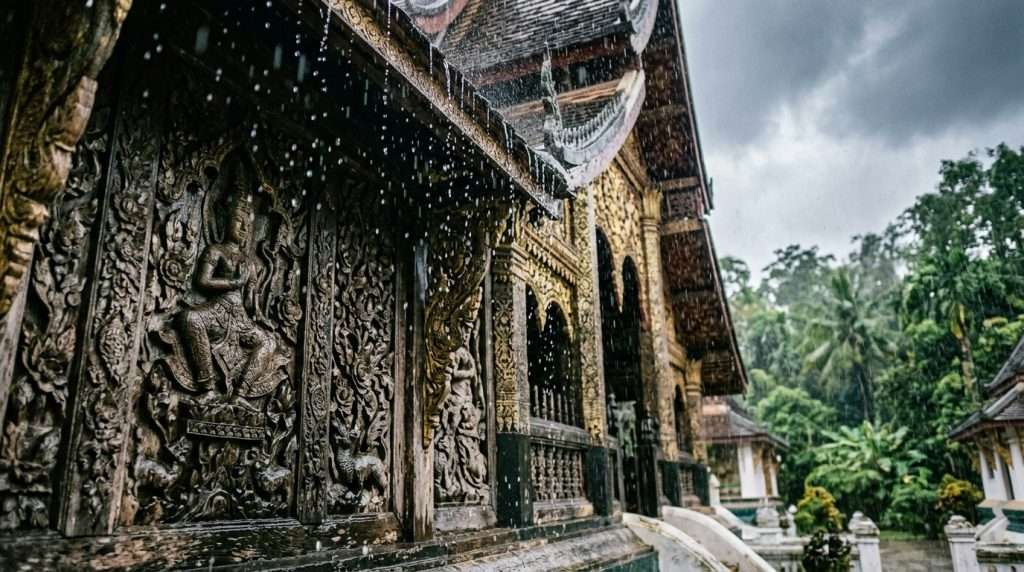
Picture wet-season damp creeping into carved teak. Monsoon moisture rots timber from the inside and makes stucco flake off in sheets. In the 2050 vision, breathable nano-mineral glazes protect Wat Xieng Thong’s sweeping roofs, teak carvings and French-Lao shophouses.
These glazes are a vision, not something in use today. They would arrest timber rot and stucco flaking while keeping the authentic spiritual patina. Breathable coatings matter more than sealing, because a sealed wall traps water inside.
Old walls move water in and out as the weather shifts. A coating that lets vapor escape keeps the building dry without hiding its age. A coating that blocks vapor can push damp deeper into the wood.
Here is a heritage checkpoint: the line between preserving and repainting a temple. Preserving keeps the original surface and slows its decay. Repainting hides it. Any building work would still follow the zone’s management rules and regulations, and measures would be reviewed over the years by heritage planning teams.
A tip for photographers: look for aged texture, not fresh paint. Faded gold leaf and worn wood tell the true story. Protecting the walls is one task, and the water that arrives with the floods themselves is another.
Flood-ready riverfronts along the Mekong and Nam Khan
The old town is surrounded by two rivers and has seen serious flooding, including in 2008. That 2008 flood proved the risk is real. A peninsula is exposed from two sides, so water can rise from the Mekong and the Nam Khan at once.
In the 2050 vision, automated underground retention vaults sit under both riverfronts. They capture 100% of seasonal flood surges. Filtered water then cycles into zero-emission capillary cooling loops for monasteries and museums.
Stored flood water could also cool buildings, so a hazard becomes a resource. Natural resources like river water would get a second use. Careful monitoring of water levels would tell the system when to store and when to release.
One mistake to avoid is treating flood walls as the only answer in a heritage view. A tall wall would block the river views that make the town what it is. The vault idea keeps the riverfronts open to walkers.
Climate change makes heavy rain harder to predict at this level of the city. A flood-ready edge protects the heritage, and the same city streets could also make power from footsteps.
Piezoelectric pavers on Sakkaline Road and Mount Phousi
Picture hundreds of steps up Mount Phousi at sunset. In the 2050 vision, under-floor piezoelectric pavers along Sakkaline Road’s almsgiving corridor and the Mount Phousi stairs turn footsteps into clean microgrid power. Piezoelectric means materials that make a small charge when pressed.
Busy places are the right spots. The almsgiving route and the hill stairs see steady foot traffic from tourists and locals. Every step, by all those users, adds a little to the grid.
This is a vision, and the power from steps would be small. It would support lighting and small services in a car-free corner. The potential lies in showing how walking itself can feed the city.
The dawn almsgiving is a sacred ritual, so any street change must stay invisible and quiet. Nothing should add noise, glare or new objects to the road. Monks and donors come first, and activity around them has to stay calm.
Ideas like these only move forward with national policy behind them.
Climate policy behind the plan
In 2019 Laos passed a decree that makes climate change part of every national development plan. The 2019 Decree on Climate Change sets principles, regulations and measures for managing and monitoring climate matters. It requires climate change to be built into national socio-economic development plans.
The national level sets the direction, and the city study aims to give the local government actions to meet the national target. The conditional path depends on partners, so outside support decides how far it goes.
| Year | Step | What it sets |
|---|---|---|
| 2019 | Decree on Climate Change | Rules for managing and monitoring climate matters |
| 2020 | Updated NDC | Sets the national 2030 goal; 34% already achieved against baseline |
| 2030 | Unconditional target | 60% GHG cuts against baseline |
| 2050 | Conditional scenario | Points toward net-zero |
The 2030 goal is unconditional, which means the country commits to it alone. The 2050 path is conditional, which means it needs outside help. Monitoring keeps both honest, and development plans must show how they meet the target.
All of this shapes what a trip planned now should look like.
Planning a trip to Luang Prabang now
Give the town at least two full days. About 2 to 3 days is typical for the town, and more if you add day trips. A short visit still works on foot.
These are my five tips:
- Walk the core
- Hire a tuk-tuk for day trips
- Book early for peak season
- Respect the dawn almsgiving
- Check your vaccines
How long to stay and when to go
Pak Ou Caves and Kouangxi Waterfall are the main sites beyond the town. Each needs a half day or more, so stay longer if you want both. Book early for peak season, since rooms and services fill up.
Getting around without adding to the problem
Walking is practical in the center, and it adds no emissions. Tuk-tuks are popular and work well for the longer rides. Each shared vehicle takes a few bikes off the road, and many services now offer day-trip packages.
Health, safety and respect on the ground
As a rule of thumb, ask a travel clinic about malaria and other vaccines before going. A doctor can match advice to your route and the season.
A common mistake is treating almsgiving as a photo stop. Keep your distance, stay quiet and never block the monks. Some businesses sell offerings to tourists, so choose carefully. Visitors who respect the ritual help protect the town, which leads to the risks that could slow the vision.
Risks that could slow the 2050 vision
The biggest problem is paying for it. A province with about 20% poverty cannot easily pay for flood vaults and green power alone. Money and capacity are the main limits for the country, and the government needs support.
Development partners are described as the key factor for reaching net-zero. City-to-city collaboration is also sought, and dialogue with local policy is still needed.
The main risks are:
- Financing for large projects
- Visitor growth beyond what heritage rules allow
- Hydropower on the Mekong
- Motorbike growth
- Gaps between models and city policy
Each one can slow the framework down. Better management of visitor flow would ease the second. A model that sits apart from local policy changes nothing on the street.
A vision can still guide choices, even when the money is not yet in place. It tells the city which steps to take first.
That exception matters. A plan without funds still shows where to aim, and it helps the town say no to the wrong projects. So what should a reader take away?
Conclusion
I left the plans more hopeful. Luang Prabang can stay alive and sacred while it cuts emissions, because the vision protects temples and streets as it changes the power supply. Green power matters most, and the development of a clean grid will count more than any single gadget.
My next step is simple. Read a summary of the Lao climate decree, then plan a 2 to 3 day trip in the city on foot.





Leave A Comment