
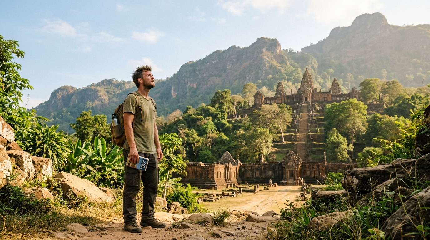
I once stood at the foot of Phou Kao in the heat, with almost nobody around, and listened to the cicadas. The stone steps rose into the haze, and I felt small in the best way. That is why I keep chasing quiet overland places.
This piece walks you through a real, calm UNESCO site in southern Laos. Then it pictures what Champasak Vat Phou future 2050 could look like.
The first half is what I know from the ground. The second half is my hopeful picture of 2050, with captured mountain water, cooling, and power from footsteps. I also share the practical trip info, so you can go and see it yourself.
The place is a planned landscape of temples, roads and water, and it deserves a slow look.
Key Takeaways
- Vat Phou is the heart of a 10 km planned landscape, not just one temple.
- UNESCO listed the site in 2001, and it covers 39,000 hectares.
- Monsoon water and erosion are the biggest threats to the old stone.
- My 2050 vision uses captured water, cooling and footstep power.
- Staying in Champasak town is the easiest way to visit.
- See Vat Phou before Angkor Wat if you plan both.
What Vat Phou Is and Why the Whole Landscape Matters
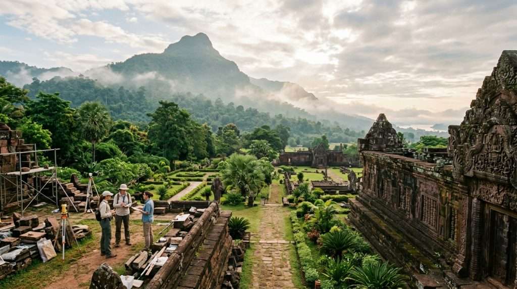
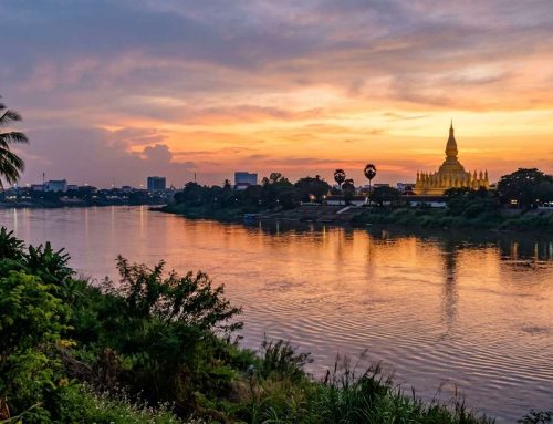
Vat Phou is the heart of a planned landscape that stretches about 10 km from the Mekong River to a mountain. Some people also spell the temple complex Wat Phu. It sits in southern Laos, about 500 km southeast of Vientiane.
The protected area covers 39,000 hectares on the Mekong River, and it joined the World Heritage List in 2001. The Champasak Plain lies between Phou Kao to the west and the river to the east. Phou Kao is also called Lingaparvata.
Vat Phou is not one temple on a hill. It is a 10 km line of temples, shrines and waterworks between river and mountain.
That line runs east to west and holds temples, shrines and waterworks in a neat geometric pattern. It shows the Hindu view of how nature and people relate. Two planned cities and Phou Kao are part of the site too.
UNESCO listed it under three criteria, (iii), (iv) and (vi). In plain words, it is exceptional proof of Khmer culture. It is a symbolic landscape fused with nature. And it expresses Hindu belief.
Many visitors walk away thinking it is only a temple on a hill. I nearly did the same. The real design reaches far beyond the stairs, all the way to the river.
A layout this big took centuries to build, so the next question is who built it and how.
How the Khmer Built It: Mountain, Water and Centuries of Work
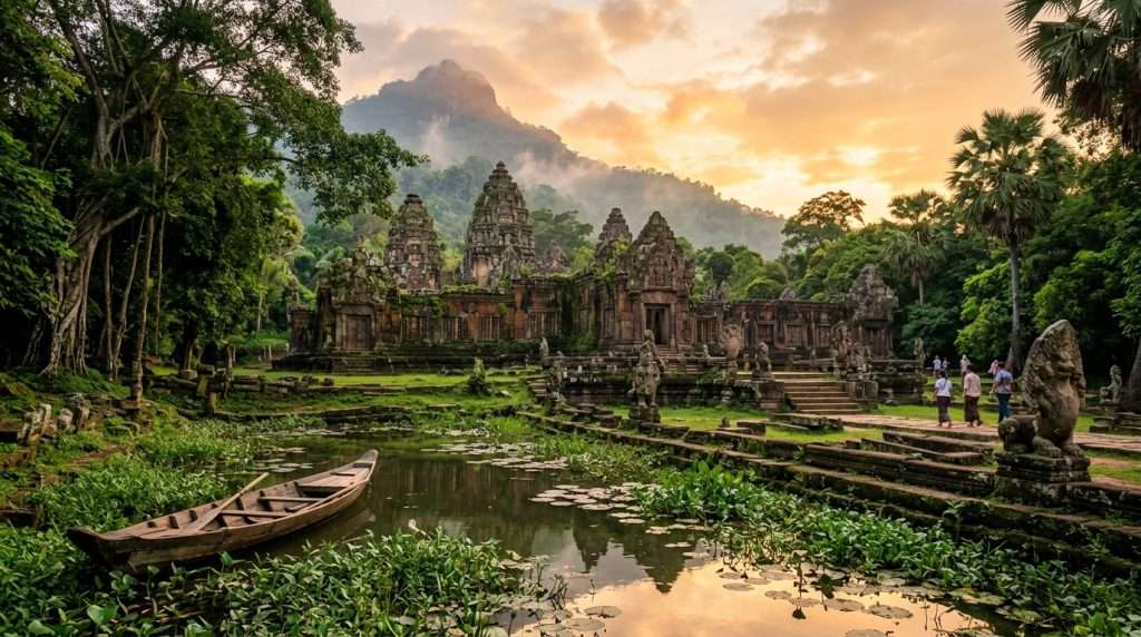
People were shaping this plain from the 5th century, and the work went on for about ten centuries. Most of it happened under the Khmer Empire. The history here is long and layered.
The first city, Shrestrapura, rose on the Mekong in the 5th to 7th century. Its successor, Lingapura, south of the temple, dates from the 9th to 13th century. It is among the earliest known urban settlements in Southeast Asia.
The temple has its own timeline, from the 7th to 12th century. A shrine to Bhadresvara, a form of Shiva, is said to have stood here by the 6th century. The region joined the Khmer Empire in the 9th century.
The most important parts went up in the 12th century under King Suryavarman II, who also built Angkor Wat. An ancient road once led from here to Angkor. A French explorer found the ruins overgrown by jungle near the end of the 19th century.
Water was part of the design. A baray is a large man-made reservoir the Khmer dug to store and spread water. Canals and barays managed water for daily life and for ritual use, and they tied the temple to the plain.
I should be honest here. Much about why the site was abandoned is still unknown, and research continues.
Water is the old builders’ tool and still the biggest worry, but first you should see the place on foot.
Walking Vat Phou Today, From the Causeway to the Sanctuary
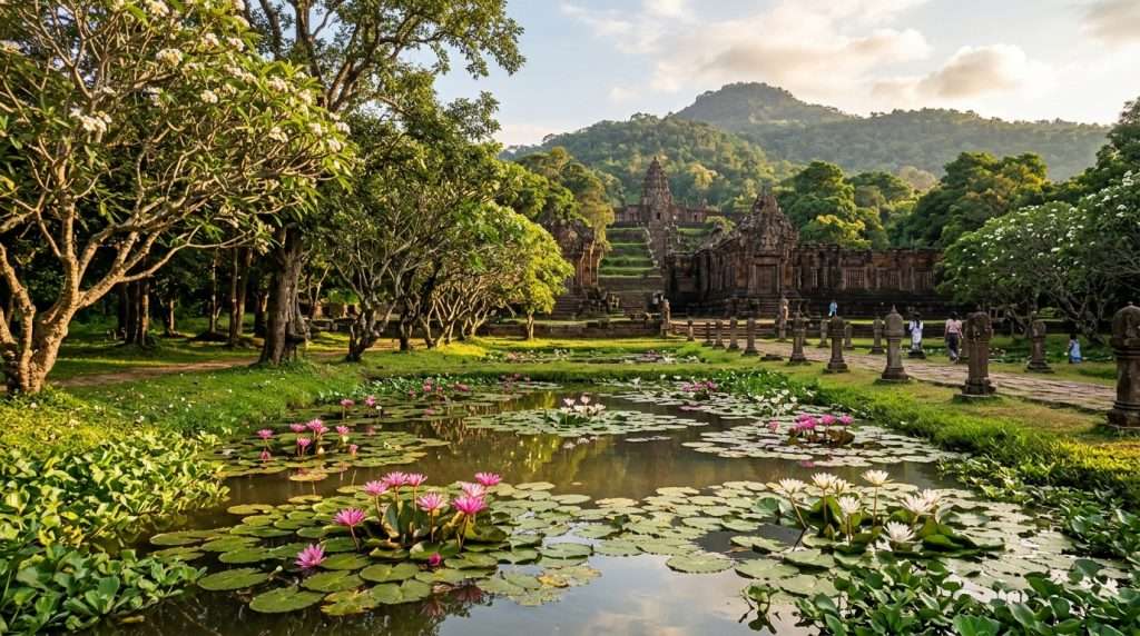
The heat hits first, and then the quiet. I walked Vat Phou with sweat on my neck and only a few other visitors in sight. The structures feel close and a little lonely.
The Approach: Pond, Platform and Pavilions
I stepped off the golf cart that carries visitors from the parking lot to the entrance, and the air smelled sweet. Fragrant white temple trees, much like frangipani, line the area. A big pond full of water lilies lies on the way.
A platform nearby was once the king’s seat at ceremonies. A long causeway then leads to a square with a pavilion on each side, one for men and one for women. Only the outer walls stand, but the windows and beams show Vishnu, Shiva and Parvati.
The Staircase That Tests Your Legs
The staircase is steep, narrow and uneven. It is doable with normal fitness, but go slowly and sip water often. Do not start the climb in the midday sun, which is a mistake I see travelers make.
Halfway up, a plateau shows the foundations of former temples. It also gives you the first view back along the axis. I always stop there and catch my breath.
The Top: Shiva Sanctuary and the View
Above the entrance of the main Shiva temple, the facade shows scenes from the Lao version of the Ramayana. That epic travelled from India to Southeast Asia. The carvings are worn, but you can still follow the story.
I like to sit at the top for a long while. The plain spreads out below, and the ruins feel alive.
These worn stones are exactly what rain and rivers threaten.
What Threatens Vat Phou: Monsoon Water, Erosion and Growth
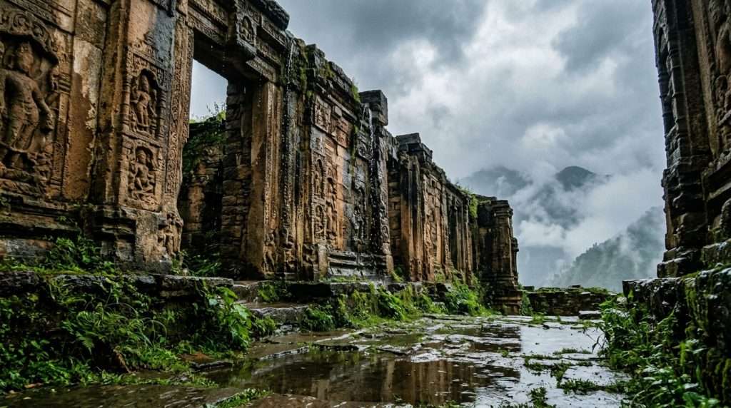
Water is the biggest threat to Vat Phou, and monsoon season erosion is the sharpest risk. Heavy rain, rising rivers and run-off all work on old stone and soil. Several smaller pressures join it for the conservation team.
The buried layers in the urban sites are generally no deeper than 0.5 m. Integrity is high, but the remains are vulnerable, so even small digging or flooding does damage. Most ancient buildings survive only to the tops of their walls.
- Monsoon run-off: rain water carries away soil and wears stone.
- River and stream erosion: a stream and the Mekong have eaten into the second and third walls of the Ancient City.
- Road cuts: modern roads have damaged old ramparts.
- Festival crowds: the annual February festival adds tourism pressure and many feet.
- Town growth: more people, higher expectations and new building in Champasak town.
- Shallow remains: thin layers mean little protection from digging or flooding.
Erosion, some robbing and digging have also touched canals, roads and barays. Most are still in good condition, which gives me hope.
So what would a site this old need to last until 2050?
Champasak Vat Phou Future 2050: A Net-Zero Heritage Sanctuary
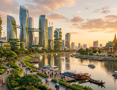
Imagine standing on the causeway in 2050 and sensing power in the stones under my feet. This is my vision, a hopeful picture and not something I have visited. By 2050 I picture the 1,500-year-old mountain-plain axis as a carbon-neutral heritage sanctuary.
I see a self-powered, water-woven system that follows the old axis. Each idea below answers one threat from the last section.
| Idea | Where it sits | What it does | Problem it answers |
|---|---|---|---|
| Nano-mineral glazes | Sandstone sanctuaries and laterite palaces | Stops spalling and lichen pitting | Stone decay |
| Retention vaults and cooling loops | Under Phou Kao’s spring and the barays | Captures flash floods, cools pavilions | Monsoon run-off |
| Piezoelectric pavers | Causeway and mountain terraces | Turns steps into microgrid power | Visitor pressure |
Breathable Glazes That Protect Stone and Patina
Imagine breathable nano-mineral glazes on pre-Angkorian sandstone and laterite. They could stop spalling and lichen pitting while keeping the authentic patina. The stone would look like itself.
Research on stone consolidation in cultural heritage shows why testing and compatibility matter. A new surface on old stone must be reversible and tested first.
Mountain Water Captured and Turned Into Cooling
By 2050 I picture automated underground vaults beneath Phou Kao’s sacred spring and the ancient barays. They could capture 100% of mountain flash floods. The Khmer managed water this way too, just with canals.
That stored water could move by gravity into zero-emission cooling loops for visitor pavilions. Shade would stay cool without a power bill.
Pilgrim Footsteps That Power the Site
Piezoelectric pavers along the 1.4-kilometer ceremonial causeway could turn footsteps into clean microgrid power. Pavers on the stepped terraces could do the same. Every climb on the stairs could add to the grid.
Visions only work if rules and partners carry them.
The Rules and Partners Shaping the Road to 2050
A decree from 1988 already protects far more than the main temple. Provincial Decree No 38/88 set a large Protection Zone with three Preservation Areas around the main archaeological complexes. Today the Department of Vat Phou Champasak World Heritage manages the site.
Its staff are trained in archaeology, architecture and city planning. A National Inter-Ministerial Co-ordinating Committee joins national, provincial and district departments. The plan only works if everyone follows it.
- The 1988 decree and the Protection Zone around the main complexes.
- The Law Concerning National Heritage No 08/NA, adopted in 2005.
- The Champasak Heritage Management Plan, adopted in September 1998, which needs regular updates, plus action plans every five years.
- A landscape-wide approach that treats the 10 km axis and buried early cities as one protected landscape.
- International partners: Lao-French lidar surveys and digital mapping, and Lao-Korean and Lao-Indian teams stabilizing and restoring the palaces.
Lidar is a laser survey from the air that finds hidden structures under the canopy. I find that part thrilling.
Green growth matters as much as stone work. Tourism is tied to the wider Siphandone (4,000 Islands) plan for low-impact development in the region.
I want you to see Vat Phou while it is still quiet.
Planning Your Trip to Champasak Without Overspending
The easiest base is Champasak town itself, because Vat Phou lies close by in southern Laos. Stay in Champasak rather than commuting from far away. The site is easy to visit alone, but a guide adds depth because the place is so quiet.
Fees and guide rates vary, so check them locally. Do not arrive without cash for the entrance and a guide, which is a mistake that stings.
| Hotel | Area | From-price per night |
|---|---|---|
| La Folie Lodge | Done Daeng island | $89 |
| Residence Bassac | Champasak | $65 |
| Champasak Grand Hotel | Pakse | $50 |
| Arawan Riverside Hotel | Pakse | $40 |
The Ban Wat Phu festival happens once a year in February at full moon. It lasts three days and brings music, dance, boxing, boat racing and buffalo offerings. Expect crowds, unlike a normal quiet day.
- Sunscreen
- Sturdy shoes
- Scarf or cap
- Water
- Cash for entrance and a guide
- Rain gear in the rainy season
Comparing the quiet here to Angkor shows why this stop is worth the detour.
Vat Phou or Angkor Wat: How They Compare and Which to See First
Vat Phou is the quieter, smaller cousin of Angkor Wat, and it is worth seeing first. A traveler visiting both countries is best off seeing Vat Phou, then Angkor. Vat Phou is said to have inspired Angkor Wat.
| Aspect | Vat Phou | Angkor Wat |
|---|---|---|
| Crowds | A few fellow visitors | Thousands of other tourists |
| Size | Smaller, less spectacular | Grand and vast |
| Builder | Suryavarman II (12th century) | Suryavarman II |
| Best order | See first | See second |
The quiet is the reason I love Vat Phou. I could hear birds on the steps and sit alone with the stones. That is rare in Southeast Asia.
If you want grand scale, still add Angkor. Vat Phou will not give you that, and it does not try. Seen in order, the two sites tell one story.
Quiet places reward good light.
Photographing Vat Phou: Light, Season and Quiet Hours
The best light comes early or late, when the stones turn warm. The axis runs east to west between river and mountain, so low sun rakes along the whole landscape. Avoid shooting at midday, when the stone looks flat and the heat tires you.
For foreground, use the pond lilies and the temple trees. Their white blooms frame the ruins nicely. The view from the top looks over the surrounding plain.
From the staircase and the halfway plateau, shoot back down the causeway. The long line pulls the eye toward the river. It shows the old design better than any wide lens near the entrance.
The rainy season brings monsoon rain and green rice paddies at the foot of the mountain. Those paddies and Phou Kao make strong wide shots. Protect your gear from the rain.
February’s festival fills the complex, so quiet frames are harder then. Come on an ordinary morning for empty steps.
All those frames made me think about why this place deserves care.
Conclusion
At the top, the quiet settles over everything, and I never want to leave. The old builders already wove water and mountain together. A 2050 sanctuary would simply continue that idea.
The stillness you can feel today is worth seeing before it changes. Visit while the steps are empty and the plain is green.
Pick a February or dry-season date, plan a base in Champasak town and set aside a morning for the climb.








Leave A Comment