
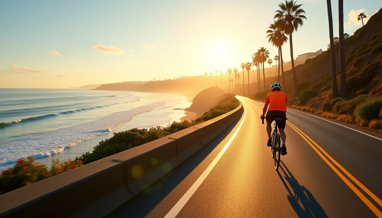
San Diego gives cyclists access to over 1,800 miles of connected bikeways throughout the region. The city ranks among America’s top cycling destinations with perfect weather all year, countless trails and breathtaking views.
The city’s diverse terrain makes it perfect for every type of cyclist. Riders can choose between peaceful car-free paths or tackle challenging hill climbs. More than 50 bike trails wind through the city. These paths give riders amazing coastal views and city landscapes.
Local cyclists love several routes that stand out from the rest. Mission Bay lets riders enjoy 27 miles of smooth, paved paths away from cars. The popular Bayshore Bikeway runs 22-25 miles along San Diego Bay. Cyclists can ride the Pacific Coast Highway route through charming beach towns. The area has even more options for longer rides like the SR56 Bike Trail (10.5 miles), Silver Strand Bike Trail (9.4 miles) and San Luis Rey River Trail (9.0 miles).
This piece explains the 11 best bike rides in San Diego for 2025. From easy coastal rides to tough mountain climbs, each route has local tips to help riders explore this cycling paradise.
Mission Beach Loop
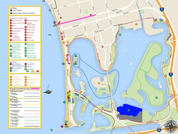
Image Source: Mission Beach Surf Rentals
The Mission Beach Loop creates a scenic heart-shaped circuit that captures San Diego’s coastal charm. This lively cycling route combines beach vibes with bayside calm. Riders of all skill levels will find this route one of San Diego’s most welcoming bike rides.
Mission Beach Loop Overview
This picturesque loop spans 8-10 miles around Mission Bay. The route’s unique shape lets cyclists enjoy different views of San Diego’s coastal areas. You can start your ride from several spots. Many locals suggest starting at Bonita Cove across from Belmont Park, which has plenty of free parking. Crown Point serves as another great starting point with ample parking space. The loop lets you jump in at any point and still enjoy the complete circuit.
Mission Beach Loop Highlights
The Mission Beach boardwalk buzzes with energy as you ride along one of San Diego’s favorite beach spots. Pacific waves crash beside you, creating a rhythm that makes your ride memorable. You’ll pass by Belmont Park’s historic wooden roller coaster from 1925 – a landmark worth checking out. The east side of the loop shows off quiet bayside views where you can spot wildlife. Pelicans and gulls often make appearances. Lucky winter riders might catch glimpses of dolphins playing offshore.
Mission Beach Loop Difficulty Level
The route stays pretty flat with elevation changes under 100 feet. Beginners and older kids can handle this ride easily. You’ll find different surfaces along the way – paved paths, boardwalk sections and some sandy spots that need careful riding. Most of the trail runs on smooth asphalt or concrete paths at least 8 feet wide. The real challenge comes from busy boardwalk areas, especially near popular spots during peak times.
Mission Beach Loop Local Tips
The best time to ride is early morning. You’ll enjoy cooler temperatures, fewer people and beautiful dawn light. Several rental shops near the route offer bikes if you need one. Cruisers and hybrids work great for the mixed terrain. This means visitors can easily hop on the trail without bringing their own bikes. Watch out for the busy spot in front of World Famous Seafood at Pacific Beach Boulevard – you might need to walk your bike briefly. Want to ride more? The route connects north to Pacific Beach or south to Ocean Beach.
Mission Bay Bike Trail

Image Source: San Diego Street Elite
The Mission Bay Bike Trail circles the largest aquatic park in the United States. It gives cyclists one of the best scenic rides in Southern California. The route weaves through San Diego’s premier recreation area and rewards riders with endless water views and plenty of fun stops along the way.
Mission Bay Bike Trail Overview
A distinctive heart-shaped loop makes up the Mission Bay Bike Trail. The trail runs between 11.57 and 17.3 miles, depending on your chosen route. Riders can enjoy natural ocean beauty and inlets under clear blue skies on this flat, paved path that hugs the bay’s interior. The trail uses dedicated bike paths with minimal street exposure, which makes it perfect for anyone looking to avoid traffic. You’ll find several entry points to start your ride. Crown Point has plenty of parking if you’re driving. South Shores Park near SeaWorld gives you both parking and restroom facilities.
Mission Bay Bike Trail Explains
The trail gives you a perfect snapshot of Southern California life. Palm trees line the paths, and you can hop off to visit multiple waterfront beaches right from the trail. Several parks dot the route including Mission Bay Playground, Tecolote Shores, Playa Pacifica and De Anza Cove Park. De Anza Cove Park’s volleyball courts, covered picnic tables and outdoor exercise equipment are great spots to take a break. The Mike Gotch Memorial Bridge over Rose Inlet stands out as an architectural gem with amazing bay views. Nature lovers will enjoy the quiet spots around De Anza Cove. This area turns more peaceful and gives you chances to spot local wildlife.
Mission Bay Bike Trail Difficulty Level
The trail rises just 150 feet throughout the entire course. This makes it one of San Diego’s most available bike rides. Riders of all skill levels can enjoy the smooth asphalt or concrete surface, which stays at least 8 feet wide. Most people finish the loop in 5.5-6 hours at a relaxed pace. Experienced riders often complete it in under 2 hours. The trail’s gentle grade (3% or less) and smooth surface work well for wheelchair users and families with strollers.
Mission Bay Bike Trail Local Tips
The best rides happen in the morning with cooler temperatures and fewer people on the path. Don’t have a bike? Many rental shops around Mission Bay can help you out. Summer brings crowds to the trail, especially on weekends. Plan your ride for weekdays if you want some quiet time. East Mission Bay gives you the best parking options to start your ride. If you want to add Fiesta Island’s extra 4-mile loop, begin near SeaWorld.
La Jolla Coastal Ride
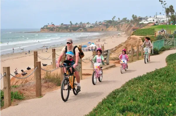
Image Source: Ocean Park Inn
San Diego’s La Jolla Coastal Ride gives cyclists an exceptional blend of dramatic coastal views and luxury experiences. This beautiful route lets riders see stunning ocean views while they explore the charming village. You’ll get an intimate look at San Diego’s upscale coastal community.
La Jolla Coastal Ride Overview
The route covers about 16 miles with roughly 400 feet of elevation gain. Your experience starts at Law Street Beach (technically Palisades Park on the bluffs above the beach). Riders pass through La Jolla Hermosa Boulevard’s unofficial botanical gardens before reaching stunning views at Sun Gold Point. The path follows bike route signs to La Jolla Cove and hugs the coastline on the way back via Crystal Drive to La Jolla Boulevard. De Anza Cove serves as another starting point that connects from Mission Bay if you want a longer ride. The standard 13-mile route can stretch to an impressive 85 miles for riders who continue past North County to Oceanside and Camp Pendleton.
La Jolla Coastal Ride Highlights
Marine mammals steal the show at several spots along the way. The sea lions at La Jolla Cove and harbor seals at Children’s Beach are must-see attractions. Championship surfing spots at Windansea Beach showcase waves that can break for 30 seconds in the right conditions. After you explore the cove area, stop by Bobboi Gelato that serves vegan and dairy-free options. The Lorax Tree in Scripps Park (said to inspire Dr. Seuss) and dramatic wave crashes at Boomers during high tide add to the experience. San Diego’s most expensive and beautiful real estate lines the route.
La Jolla Coastal Ride Difficulty Level
The route works best for moderate riders with simple cycling skills. While rated moderate overall, different sections suit various skill levels. You’ll find flat, easy paths for relaxed riding and challenging hills that reward you with panoramic views. Electric bikes make hills less daunting because assist mode helps when needed. Paved roads, dirt trails and boardwalks create a varied riding experience.
La Jolla Coastal Ride Local Tips
Local riders suggest parking across Mission Boulevard after a couple of laps. Stay away from Garnett, especially south of Ingraham, to avoid traffic headaches. Morning rides offer the best conditions with cooler temperatures and fewer people on the path. Athletic clothes and sturdy sneakers work best for this ride. A light jacket comes in handy as coastal breezes can surprise you. Remember your sunscreen, sunglasses, and water bottle – these are vital for any coastal San Diego bike adventure.
Mt Soledad & Torrey Pines Climbs
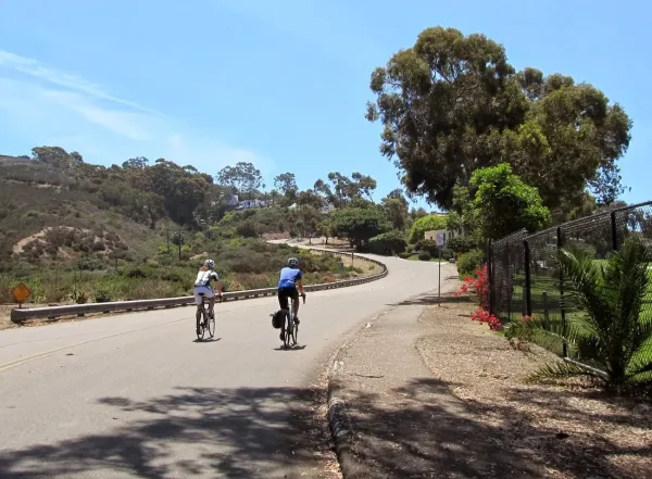
Image Source: Smorgcycle
Mt Soledad and Torrey Pines are two challenging climbs that test cyclists on San Diego’s mostly flat coastal terrain. These famous hills give riders amazing panoramic views after they conquer some of the area’s steepest roads.
Mt Soledad & Torrey Pines Overview
This awesome ride covers 23.3-23.4 miles and climbs between 1,164-1,925 feet. Most riders start near UCSD campus and take the Rose Canyon bike path to Fiesta Island before hitting the climbs. You can tackle both hills in one trip – first going up Torrey Pines, then through Gilman-Rose Canyon to Soledad’s south side. The return lets you zoom down Via Capri and climb back to UCSD on Torrey Pines Road. There are lots of different ways to approach these climbs, so you can mix it up each time.
Mt Soledad & Torrey Pines Highlights
The best part is Mt Soledad’s peak, with its breathtaking 360-degree views from Mexico all the way to Orange County. The Veterans Memorial sits 822 feet up, marked by its white cross that you can spot from miles away. The memorial shows about 2,400 plaques honoring veterans from Revolutionary War times to now. Torrey Pines has its own special views – stunning coastal scenes and a chance to ride through Torrey Pines State Natural Reserve. The routes wind through some of San Diego’s fanciest neighborhoods with incredible houses.
Mt Soledad & Torrey Pines Difficulty Level
The route ranges from moderate to expert based on your chosen path. Via Capri is one of San Diego’s toughest climbs – a mile-long beast that averages 10% grade with some parts hitting over 20%. Other options vary in difficulty. Nautilus Street keeps a steady 6% grade for 1.7 miles, while Soledad Mountain Road gives you a more gradual climb. Torrey Pines has two choices – the “inside” park service road (0.8 miles at 8% grade) or the “outside” route on North Torrey Pines Road (1.5 miles at 5% grade).
Mt Soledad & Torrey Pines Local Tips
Local riders suggest hitting these climbs early to beat the heat and traffic. Make sure your bike has the right gearing before trying Via Capri’s steep sections. Soledad Mountain Road is a good choice if you want something less intense than Via Capri. You can do both climbs in one ride, which takes about 1.5-2 hours. These climbs are so popular that you’ll rarely ride alone – local bike clubs often plan group rides here.
Ocean Beach to Cabrillo National Monument
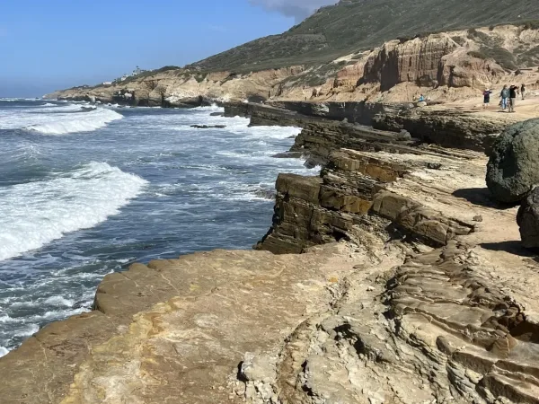
Image Source: Jay’s Essential Bike Rides
A scenic coastal ride connects Ocean Beach to Cabrillo National Monument. Cyclists can enjoy stunning Pacific views and rich history along this route. The path takes you from the ocean’s edge to one of San Diego’s beloved landmarks.
Ocean Beach to Cabrillo Overview
The moderate out-and-back route covers approximately 18 miles with 550ft of elevation gain. Some riders choose longer variations that stretch to 22.2 miles with 1,112ft of climbing. Your ride starts at Ocean Beach Pier or Robb Field. The route heads south on Sunset Cliffs Boulevard and connects to Catalina Boulevard as you climb toward Point Loma. Riders cross the San Diego River on the Sunset Cliffs bridge. You can then ride through Ocean Beach or take the protected bike lane on Nimitz Boulevard.
Ocean Beach to Cabrillo Highlights
The best part of your ride begins at Naval Base Point Loma, with smooth roads and pristine scenery. Fort Rosecrans National Cemetery offers sweeping views of San Diego Bay, Coronado Island and the city skyline. You’ll spot scale radar ships and World War II bunkers as you pedal along. The ride concludes at Cabrillo National Monument where you can explore the Old Point Loma Lighthouse, tidepools and park visitor center.
Ocean Beach to Cabrillo Difficulty Level
The route ranks as moderate but comes with its challenges. A flat start leads to a two-mile climb on Catalina Boulevard toward Naval Base Point Loma. The toughest section is the optional .75-mile spur to the tidepools. You’ll face a steep 350ft climb on your way back. Smooth road surfaces and manageable gradients make this route perfect for intermediate cyclists.
Ocean Beach to Cabrillo Local Tips
Cyclists pay a $10 entrance fee at Cabrillo National Monument or $35 for annual access. The America the Beautiful National Parks annual pass works too. Weekday mornings are best to avoid crowds. Save some time to check out the monument grounds and tidepools, even on a simple out-and-back ride. The tidepool climb is tough – while visiting them is your choice, the steep climb back is part of the deal. Fill your water bottles at the guard shack before heading back.
Mission Trails Hill Climb
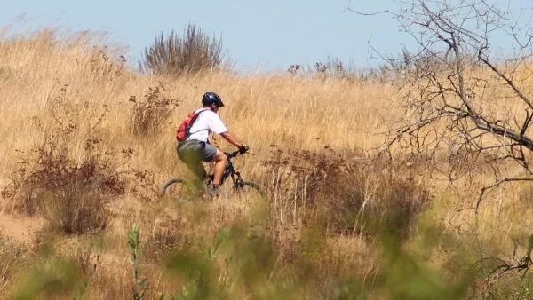
Image Source: San Diego
Mission Trails Regional Park sits in the heart of San Diego County. This cycling challenge offers a stark contrast to the region’s coastal routes. The expansive natural playground lets cyclists test their endurance while experiencing San Diego’s rugged native landscape.
Mission Trails Hill Climb Overview
Mission Trails Regional Park spreads across 5,800 acres just 8 miles northeast of downtown San Diego. The park’s diverse network of trails suits riders of all skill levels. North and South Fortuna Mountains naturally split the park into distinct riding zones. The eastern side welcomes easier routes, while the western side tests more experienced cyclists. The full Mission Trails Hill Climb route stretches 35.2 miles with a challenging 1,804 feet of elevation gain. The park ranks among America’s largest city parks and offers both natural and developed recreational areas.
Mission Trails Hill Climb Highlights
Mission Trails’ dramatic landscape reveals San Diego’s pre-European settlement appearance. Riders will find rugged peaks and arid valleys, with stunning wildflower displays in spring. The route takes you across the San Diego River and past the Old Mission Dam, a nationally registered landmark. The area’s signature trails feature thrilling downhill sections on E-Ticket (Upper and Lower) and S-Curves.
Mission Trails Hill Climb Difficulty Level
The park stands out as a great spot to build climbing endurance. Doubletrack and fire roads make up most of the terrain, though quality singletrack sections add variety. Steep climbs and loose terrain create real challenges in several areas. The park’s intermediate road ride classification requires good fitness. The western section’s topography demands both technical skill and endurance from cyclists.
Mission Trails Hill Climb Local Tips
The trails get busy with hikers and fellow cyclists on weekends, so a bell helps you navigate these shared spaces safely. Class 1 and 2 e-bikes are welcome throughout the park. The park offers a perfect escape from San Diego’s “May Gray” or “June Gloom” as you ride above the marine layer. New visitors should try the “Omission Trails” route – an 8.4-mile ride with 1,401 feet of elevation gain that shows off the park’s varied terrain.
Bayshore Bikeway
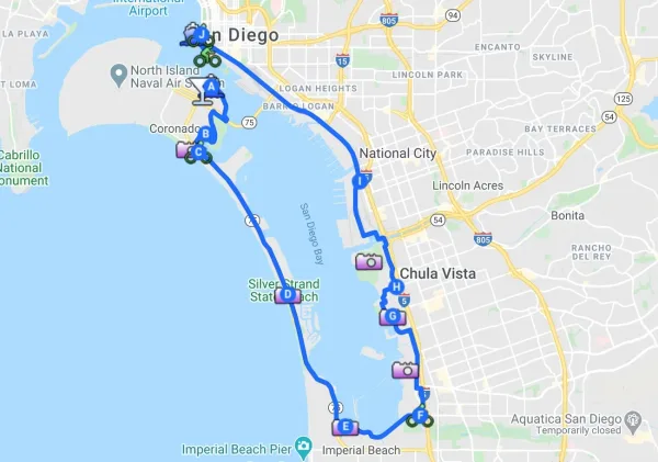
Image Source: Leisure Travel Vans
The Bayshore Bikeway circles San Diego Bay in a 24-mile scenic loop. This remarkable cycling project lets riders enjoy seaside views and urban exploration while discovering San Diego’s coastal environments.
Bayshore Bikeway Overview
The 1970s saw the birth of the Bayshore Bikeway, which now stretches approximately 17.5 miles of completed bike path. The signature route has 13 miles of car-free paths, while the rest uses on-street bicycle lanes or designated bike routes. This path is part of the California Coastal Trail – a bold 1,200-mile network from Oregon to Mexico. The construction came together through collaboration with the U.S. Navy, Port District and Metropolitan Transit System.
Bayshore Bikeway Highlights
Cyclists pass through Coronado and the historic Hotel del Coronado (built 1888) before riding past the U.S. Naval Amphibious Base where Navy SEALs train. The route showcases the natural beauty of Silver Strand State Beach and San Diego Bay National Wildlife Refuge – a 3,900-acre wetland home to endangered and migratory birds. The paved rail-trail section ends at Main Street in Chula Vista, but San Diego’s distinctive skyline remains visible throughout the loop.
Bayshore Bikeway Difficulty Level
Smooth paved asphalt makes up the trail surface, which stays at least 8 feet wide with a gentle grade (3% or less). Most wheelchairs and strollers can navigate the bikeway easily. The east side (San Diego portion) comes with its challenges – poorer road conditions, potholes and disconnected segments appear occasionally. Some riders find industrial sections tricky to navigate their first time around.
Bayshore Bikeway Local Tips
Many experienced cyclists start at Coronado Ferry Landing after taking Flagship’s Coronado Ferry across the bay. Families with young riders might want to loop back at Imperial Beach instead of completing the full circuit to avoid on-street sections. The best rides happen early on weekday mornings when temperatures stay cool and traffic remains light. Several bike rental shops near downtown and Coronado help visitors get on the trail quickly.
Sweetwater Trail to Chula Vista
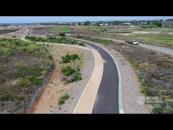
Image Source: YouTube
The Sweetwater Trail connects communities through nature and gives cyclists a peaceful riverside trip that shows off San Diego’s inland beauty. Riders looking for a gentler cycling experience away from coastal crowds will find their perfect escape here.
Sweetwater Trail Overview
This 6.9-mile loop trail near Bonita takes about 2-2.5 hours to complete. The route follows the Sweetwater River and passes through several recreational areas on its way to Chula Vista. The trailhead on Summit Meadow Road has plenty of parking, picnic areas, shelters and water fountains. The trail’s western end links to the larger Bayshore Bikeway network, letting riders explore more of South County.
Sweetwater Trail Highlights
The path weaves through a variety of landscapes—from big fields to shady woodlands. Riders will see sandy shorelines along the creek bed and pass beneath several roads on their way to the bay. Wildflowers add color to the scenery year-round and the trail’s family-friendly vibe makes it special. Rohr Park sits right along the trail with its playgrounds, picnic spots and dog park.
Sweetwater Trail Difficulty Level
The trail rises just 255 feet, making it one of San Diego’s easiest bike rides. Beginners will feel comfortable on the mostly flat terrain, but some challenges exist. Exposed sections lack shade, and the path can get muddy after rain.
Sweetwater Trail Local Tips
Riders should head out early for the best experience and bring enough water. You can hop on the trail at several spots including 2nd Avenue, W. 33rd Street/Hoover Avenue, Plaza Bonita Road and Bonita Road. Hungry cyclists will find restaurants near both ends. Dog owners can bring their leashed pets along for the ride.
Pacific Coast Highway Ride
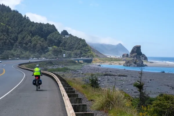
Image Source: Rolling Existence
The Pacific Coast Highway stands as America’s finest coastal cycling route. It runs from Seattle to San Diego as part of the larger 1,852-mile Pacific Coast Bicycle Route. This legendary highway gives San Diego cyclists amazing local rides and links to epic long-distance adventures.
Pacific Coast Highway Overview
San Diego’s typical PCH ride stretches 35.3 miles with 1,229 feet of elevation gain. This segment makes up the southernmost part of the California coastline section, which runs about 1,200 miles of the total Pacific Coast route. Many cyclists take advantage of the train service as a bike shuttle. This lets them do one-way trips without returning to their starting point. Cyclists can start at the Oceanside Transit Center and head south through beach communities toward La Jolla.
Pacific Coast Highway Highlights
The route offers non-stop oceanfront riding where you might spot marine wildlife. Cyclists pass through lively beach towns and ride beneath tall coastal pines. They’ll see dramatic rock formations that jut from the sea. The Big Sur Coast section just north of San Diego County is what many riders call the most spectacular part of the entire Pacific Coast.
Pacific Coast Highway Difficulty Level
Cycling groups suggest riding north to south for the best experience. Southern California’s segment stays mostly flat with a few hills here and there. Traffic can be a concern since the PCH doesn’t have dedicated cycling lanes outside major cities. The good news is that most drivers seem used to sharing the road with cyclists.
Pacific Coast Highway Local Tips
Starting early around 5 AM helps you avoid heavy traffic, and you’ll reach your destination by early afternoon. PCH draws many tourists, so bright gear like neon vests and flasher lights helps keep you safe. The Amtrak Pacific Surfliner welcomes bicycles, which makes longer one-way routes possible.
North County Loop
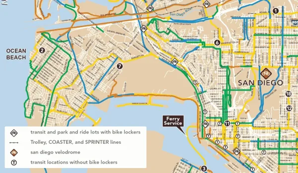
Image Source: Ocean Beach MainStreet Association
The North County Loop takes cyclists away from San Diego’s busy center through riverfront paths and rail trails into a refreshing inland ride. This route shows off San Diego’s northern region’s rich farmland and provides a break from the crowded coastal areas.
North County Loop Overview
The route links Oceanside to San Marco by combining the San Luis Rey River Trail with parts of the Inland Rail Trail and additional bike lanes. Riders will find mixed trail conditions along the way. The River Trail offers smooth riding while the Inland Rail Trail is still a work-in-progress. All the same, these trails create a well-laid-out circuit with gentle terrain that guides riders back to the coastline from San Marco.
North County Loop Highlights
Spring months bring exceptional seasonal attractions:
- The Flower Fields come alive with colors from early March through early May
- Strawberry stands pop up during bloom season with fresh picks
- Riders catch amazing views as they head down to the coast
To cite an instance, cyclists love stopping for fresh strawberry shakes at roadside stands after their ride—they taste even better with berries picked that morning.
North County Loop Difficulty Level
Unlike some tough San Diego climbs, this loop stays relatively flat. Good riding conditions stretch across the entire route without any major climbs. Intermediate riders looking for distance without too much climbing will find this route perfect.
North County Loop Local Tips
The best time to ride this route is early spring. The weather is perfect and matches the flower blooming season in this part of San Diego. Smart riders take a moment at the coastal descent to enjoy The Flower Fields’ display. Remember to plan water stops and leave room for those amazing strawberry treats—they’re a North County cycling tradition you won’t want to miss.
Black Mountain Loop
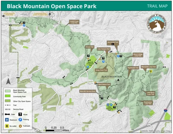
Image Source: San Diego Mountain Biking Association
The Black Mountain Loop in northern San Diego’s Rancho Peñasquitos area gives mountain bikers a challenging and rewarding experience. Local riders love this rugged trail system that combines technical terrain with stunning panoramic views, making it a perfect spot to get an adrenaline rush close to the city.
Black Mountain Loop Overview
Black Mountain Open Space Park spans 2,352 acres of chaparral and sage-covered hills, ridges, and canyons. Black Mountain’s 1,554-foot summit stands as the crown jewel of this natural area. The peak rewards riders with amazing 360-degree views – the ocean to the west, mountains to the north and east and downtown San Diego to the south. You can start your ride from several spots including Laurentian Drive, Hilltop Park, Sundevil Way and parking lots off Carmel Valley Road. The classic loop connects several trails through the park and some routes take you through neighborhood streets to complete the circuit.
Black Mountain Loop Highlights
The climb to Black Mountain’s summit pays off with breathtaking views of the San Diego region. Riders pass through beautiful California chaparral landscapes that showcase untouched Southern California nature. The park’s network of trails each has its own character – Miner’s Ridge Loop, Black Widow and Nighthawk Connector are local favorites. The mix of technical sections makes these trails perfect for enduro riders who want to push their limits.
Black Mountain Loop Difficulty Level
The mountain’s exciting downhill sections come with a price – you’ll have to earn them through some serious climbing. A steady fire road climb leads to the summit area. Most trails range from moderate to difficult, with fast and rocky terrain. You’ll find technical sections with loose rocks that require good bike handling skills. This challenging loop serves as an ideal training ground for enduro and cross-country riders who want to improve their technique.
Black Mountain Loop Local Tips
The best route to the summit starts at Hilltop Community Park (9711 Oviedo Way) via a 2.5-mile dirt road. Locals recommend riding early in the morning to beat the heat and crowds. Many riders start near Laurentian Drive (9606 Laurentian Drive) to access the fire road that leads to Black Widow and Nighthawk Connector trails. The Miner’s Ridge downhill section from Sundevil trailhead makes a quick technical loop. Take your time to explore the side trails off the main loop – they’re worth checking out.
Comparison Table
| Trail Name | Distance (miles) | Elevation Gain (ft) | Difficulty Level | Surface Type | Key Highlights | Best Time to Ride |
| Mission Beach Loop | 8-10 | <100 | Beginner | Paved paths, boardwalk | Scenic Belmont Park, ocean panoramas, native wildlife | Early morning |
| Mission Bay Bike Trail | 11.57-17.3 | 150 | Easy | Smooth asphalt/concrete | Scenic beaches, waterfront parks, Mike Gotch Memorial Bridge | Morning, weekdays |
| La Jolla Coastal Ride | 16 | 400 | Moderate | Mixed (paved roads, dirt trails, boardwalks) | Sea lions at La Jolla Cove, Windansea Beach, Bobboi Gelato stops | Morning |
| Mt Soledad & Torrey Pines Climbs | 23.3-23.4 | 1,164-1,925 | Moderate to Expert | Paved roads | Panoramic vistas, Veterans Memorial, Torrey Pines State Reserve | Early morning |
| Ocean Beach to Cabrillo | 18-22.2 | 550-1,112 | Moderate | Smooth roads | Fort Rosecrans Cemetery, natural tidepools, historic lighthouse | Early morning, weekdays |
| Mission Trails Hill Climb | 35.2 | 1,804 | Intermediate | Doubletrack, fire roads, singletrack | Historic Mission Dam, spring wildflowers, E-Ticket trails | Early morning |
| Bayshore Bikeway | 24 | N/A | Easy-Moderate | Paved asphalt | Iconic Hotel del Coronado, nature preserve, downtown views | Early morning weekdays |
| Sweetwater Trail | 6.9 | 255 | Easy | Mixed | Scenic riverside paths, seasonal wildflowers, Rohr Park | Early morning |
| Pacific Coast Highway Ride | 35.3 | 1,229 | Moderate | Paved roads | Charming beach towns, seaside vistas, marine life | Early morning (5 AM) |
| North County Loop | N/A | N/A | Intermediate | Mixed | Carlsbad Flower Fields, local produce stands, ocean views | Early spring mornings |
| Black Mountain Loop | N/A | N/A | Moderate to Difficult | Technical trails, fire roads | Summit panoramas, challenging descents | Early morning |
Enjoy Bike Rides in San Diego
San Diego is a cyclist’s paradise that offers routes for every skill level, interest, and ambition. Riders can enjoy near-perfect weather conditions year-round while learning about the region’s remarkable diversity—from flat coastal boardwalks to challenging mountain ascents.
These 11 routes show just a glimpse of San Diego’s cycling potential. New visitors can start with the available Mission Beach Loop or Mission Bay Bike Trail. They can then move up to more challenging experiences like Mt Soledad or Black Mountain Loop. Car-free paths along Bayshore Bikeway and Sweetwater Trail work great for families and casual cyclists. Seasoned riders can push their endurance on Pacific Coast Highway’s longer stretches.
These routes are more than physical challenges. Cyclists ride past historic landmarks, through wildlife refuges, next to marine mammals and beneath ancient Torrey Pines. Each experience lets riders connect with San Diego’s natural beauty and find hidden gems that locals cherish.
Riders get the best experience on all routes during early morning—cooler temperatures, fewer crowds and spectacular lighting conditions make every ride better. It helps to think over seasonal factors before planning adventures, especially when you have wildflower displays in spring or coastal marine layers during “May Gray” periods.
Strong bike infrastructure in San Diego County gets better each year, making cycling more available to everyone. Riders looking for relaxing seaside cruises, heart-pounding climbs or family-friendly adventures will find these signature routes exceptional. They showcase why San Diego remains one of America’s premier cycling destinations. Remember to pack sunscreen, bring water, and get ready to see San Diego’s diverse landscapes from the best spot—atop two wheels.
FAQs
Q1. What are some of the best places to go biking in San Diego? San Diego offers diverse cycling options, including coastal routes like Mission Beach and Pacific Coast Highway, inland trails like Mission Trails Regional Park and scenic rides around San Diego Bay and Coronado. Each area provides unique experiences for different skill levels and preferences.
Q2. Which bike path in San Diego is considered the longest? The Bayshore Bikeway is one of the longest bike paths in San Diego, stretching approximately 24 miles around San Diego Bay. It offers a mix of dedicated bike paths and on-street sections, passing through downtown San Diego, Coronado and South Bay.
Q3. Are there any short but scenic bike rides in the La Jolla area? Yes, the La Jolla Coastal Ride offers beautiful ocean views and passes by attractions like La Jolla Cove. While the full route is longer, there are shorter segments like the Fay Avenue Bike Path that provide stunning vistas of the La Jolla hills and Pacific Ocean in just 1.2 miles.
Q4. What’s the best way to navigate bike routes in San Diego? While there are many cycling apps available, using a GPS-enabled app that allows offline map downloads is highly recommended. This ensures you can navigate even in areas with poor cell service. Additionally, consulting local bike maps and joining group rides can help you discover the best routes.
Q5. How challenging are the hill climbs in San Diego for cyclists? San Diego offers a range of climbing challenges for cyclists. Routes like Mt. Soledad and Torrey Pines provide moderate to difficult climbs with rewarding views. The Mission Trails Hill Climb and Black Mountain Loop offer more intense elevation gains for experienced riders. However, there are also plenty of flat coastal routes for those preferring easier rides.


Leave A Comment