

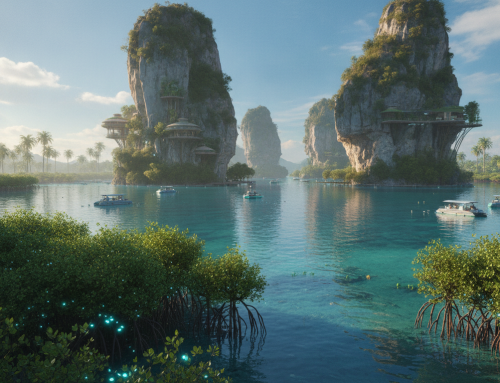
On Nha Trang Bay’s sand in Khánh Hòa Province, I wonder how this coast may look decades from now. I have walked this beach more times than I can count, and each visit raises the same question. My vision for Nha Trang future 2050 begins here.
This piece is my personal daydream, not a technical blueprint. I imagine a net-zero, ocean-cooled coastal city that treats the sea as both partner and power source. It is an opinion piece grounded in real science and genuine affection for this place.
Picture the ancient Po Nagar Cham Towers wrapped in breathable nano-mineral coatings that protect without smothering. Imagine the Cái River estuary with smart surge sluices and Hòn Tre Island anchoring an offshore ocean thermal energy grid. On Trần Phú boulevard, every footstep could help power the streetlights.
Abadie et al. (2020) compared flood risk across 136 coastal cities under different sea-level scenarios. The ADB (2017b) report on climate risk across Asia-Pacific coastal regions tells a similar story. Bay cities everywhere need a plan, and I think Nha Trang deserves a bold, hopeful sketch.
Key Takeaways
- This section imagines a net-zero, ocean-cooled transformation for a Vietnamese bay city by mid-century.
- Four pillars anchor the vision: breathable Cham heritage coatings, offshore ocean thermal energy, smart river sluices, and kinetic sidewalk power.
- Po Nagar Cham Towers, the Cái River estuary, Hòn Tre Island, and Trần Phú boulevard all play starring roles.
- The concept draws on real climate research, including studies on coastal flood risk and Asia-Pacific climate resilience.
- This is framed as an opinion piece and speculative vision, not an official development plan.
1. Reimagining Nha Trang Future 2050: A Sponge Metropolis Rising from Nha Trang Bay
Every city has an origin story. Nha Trang’s begins with water, worship, and a river mouth that resisted control. I return to this coast because its past explains its present so clearly. Three moments shaped the Nha Trang future 2050 planners are building right now.
The 8th-Century Legacy of Po Nagar and the Cái River Estuary
In the 8th century, the Kingdom of Champa chose this spot for a reason. They built the Po Nagar temple complex where the Cái River meets Nha Trang Bay. Fresh water, fertile soil, and easy sea access made the estuary a natural trade and worship hub.
Cham engineers knew what modern planners still respect: rivers and tides shape nearby life. Their temple towers survived monsoons, floods, and centuries of shifting coastlines without losing their footing.
I think these old stones hold the real lesson. Before climate adaptation had a name, this estuary taught people to live with water, not fight it.
French Oceanographic Science and the 1922 Institute of Oceanography
In 1922, French scientists opened the Institute of Oceanography on Nha Trang Bay. It soon became one of the oldest marine research centers in Southeast Asia, which surprised me when I first learned it.
Researchers cataloged fish species, coral reefs, and ocean currents decades before solar grids or sea walls were imagined. That early data still matters. Modern climate models use patterns first recorded by those pioneering marine biologists.
Its legacy is quiet but powerful. That century-old research station helped make Nha Trang a place where science and the sea work side by side.
Khánh Hòa’s Modern Marine-Economic Master Plan
Today, the provincial government continues the work of those early scientists. Khánh Hòa’s marine-economic master plan presents a bold vision based on ocean resources, sustainable tourism, and long-term climate resilience.
Officials call it a blueprint for a sponge metropolis, designed to absorb shocks instead of merely resisting them. That phrase shows a major shift in thinking. Rather than taller sea walls, planners favor porous streets, protected wetlands, and smarter water storage systems.
These three eras show the path toward 2050:
| Era | Key Development | Legacy for 2050 |
|---|---|---|
| 8th century | Po Nagar temple built at the Cái River mouth | Early example of siting cities for water access and resilience |
| 1922 | French Institute of Oceanography founded | Long-term marine data supporting today’s climate models |
| 2020s | Khánh Hòa marine-economic master plan launched | Framework for sponge-city infrastructure and net-zero goals |
Together, these three chapters form the backbone of the Nha Trang future 2050 vision now taking shape across the bay.
2. Preserving Po Nagar: Terracotta Nano-Armor for a Salt-Battered Heritage

I’ve climbed Po Nagar many times, and each visit shows more salt damage in the red brick. These eighth-century towers, built to honor the goddess Yan Po Nagar, have outlasted monsoons, wars, and centuries of curious travelers.
But maritime spray from Nha Trang Bay is a quieter, slower enemy. Serious Po Nagar Cham towers preservation means rethinking how we treat this ancient brick, not just patching breaks.
Breathable Cham Red-Brick Nano-Mineral Consolidation
Older restoration crews often used waterproof sealants, and I understand the logic. Keep water out, keep the brick safe. But Cham brick was never built to be sealed. It’s porous by design, letting moisture pass through rather than pooling inside the walls.
Modern conservation science tests nano-mineral consolidants that soak into the brick’s pores and bond directly with the clay. Unlike a coating, this treatment lets the wall keep breathing. Salt crystals migrate to the surface instead of collecting behind a barrier and cracking it apart.
The goal isn’t to stop weathering completely on a coastline this exposed. It’s to slow the damage without changing how the brick looks or feels.
Non-Invasive Mineral Masonry Glazes Versus Traditional Restoration
For decades, restoration crews patched damaged brick with cement mortar. It looks solid, but it behaves nothing like the original material. Cement traps moisture, and trapped moisture plus salt is exactly what destroys terracotta from the inside out.
Non-invasive mineral masonry glazes work differently. They’re thin, breathable coatings made from minerals that match the brick’s own chemistry instead of fighting it. Preservationists I’ve spoken with are genuinely split.
Some argue any coating alters the monument’s authentic surface. Others see it as the only realistic way to slow salt damage without ripping out original material. I lean toward the gentler option, even if that means visible wear stays part of the towers’ story.
Subsurface Hydrologic Heritage Engineering Beneath Cù Lao Mountain
What happens underground matters just as much as what happens above it. Cù Lao Mountain stands at the Cái River’s mouth. Tidal water and freshwater runoff constantly shift the groundwater table beneath the towers’ foundations.
Subsurface hydrologic heritage engineering aims to manage that flow through buried drainage channels and monitoring wells, keeping saline groundwater from wicking upward into the brick base. Done right, this kind of engineering stays completely invisible. Visitors would never know it’s there, and that’s the point.
Protecting a thousand-year-old temple complex shouldn’t require visible infrastructure competing with the towers themselves. The mountain keeps its silhouette while the science quietly does its work underneath.
3. Powering Nha Trang Bay: The OTEC Grid Anchored by Hòn Tre Island

Water around Hòn Tre Island holds a quiet source of power. Most visitors see the island as a resort backdrop, a green lump with cable cars and beach clubs. Planners see the deep-sea ocean thermal energy grid as an anchor for Nha Trang’s net-zero future.
This Nha Trang Bay OTEC grid could power the entire coastline without burning a single drop of fuel.
It is one of four pillars driving Nha Trang toward energy independence. After learning how it works, I found it the most surprising.
How Deep-Sea Marine Thermal Energy Conversion Works
Ocean thermal energy conversion, or OTEC, runs on a simple idea. Warm surface water in Nha Trang Bay stays around 82°F year-round.
Just a few thousand feet down, deep ocean water drops to near 40°F.
That temperature gap drives the process. Warm water heats a low-boiling-point fluid, usually ammonia, and turns it into vapor. The vapor spins a turbine and generates electricity.
Pumped-up cold water cools the vapor back into liquid, and the cycle starts again.
There is no fuel or emissions, and the system does not wait for wind or sunlight. It uses the ocean doing what it’s always done in a closed loop.
Hòn Tre Island as the Offshore Energy Anchor
Hòn Tre is not just picturesque; it is practical. The nearby waters plunge deep quickly, giving engineers the cold-water access OTEC systems need.
This depth avoids running pipes for miles.
Underwater cables would extend from platforms just offshore and feed power toward the mainland grid. Hòn Tre’s central bay location also shortens transmission distances to Nha Trang City, Cam Ranh, and nearby districts.
From the ferry deck, I struggled to picture turbines humming beneath the calm surface. That invisible infrastructure offers a minimal footprint and maximum output.
Grid Integration and Storage for a Round-the-Clock Net-Zero Supply
OTEC has one major advantage over solar and wind: It runs 24 hours a day. It faces no clouds, calm days, or supply gaps.
Still, the bay’s full power system needs storage to balance demand spikes. Battery arrays and smart grid controllers would store surplus output.
They would release it during peak evening hours, when tourism and residential use both climb.
Here’s a quick comparison of how OTEC stacks up against the region’s other renewable options:
| Energy Source | Availability | Key Advantage | Main Limitation |
|---|---|---|---|
| OTEC (Hòn Tre) | 24/7, all seasons | Constant baseload power | High upfront infrastructure cost |
| Solar | Daylight hours only | Low maintenance, fast install | Zero output at night |
| Wind (offshore) | Variable, weather-dependent | Strong output in monsoon season | Inconsistent during calm spells |
| Tidal | Predictable, twice daily | Highly reliable timing | Limited to narrow coastal zones |
4. Taming the Cái River: Surge Sluices and the Sponge City Model

If Nha Trang wants to become a true sponge metropolis, it must first make peace with the Cái River.
This river flows past the ancient Po Nagar towers into the bay, but typhoon season makes it dangerous. Storm surges then push into low-lying streets.
Three connected systems now manage this water instead of fighting it.
Engineering Estuarine Surge Sluices at the River Mouth
The first system uses movable surge sluices where the Cái River meets Nha Trang Bay.
These movable gates close automatically when storm tides move inland. They block seawater from surging upriver during typhoons. Researchers Abadie and colleagues have studied exactly this danger, showing how low-probability, high-impact coastal flood events can overwhelm unready cities.
Their research on urban coastal flood risk makes one point clear: waiting for the “big one” is too late. Jeddah faced a similar challenge. Al Saud’s 2015 flood-control retrofit offers a useful blueprint for holding back sudden surges without disrupting daily life.
“Climate-proofing infrastructure investment upfront is consistently cheaper than paying for disaster recovery later.”
Closed-Loop Reservoir Stormwater Harvesting
Sluices alone cannot solve everything, so the plan adds closed loop reservoir stormwater harvesting.
Instead of sending rainwater straight into the bay, this system channels it into upstream reservoirs. There, water is filtered and stored for later use.
During dry months, that stored water can irrigate parks, refill wetlands near Po Nagar, or support light industry. Almost nothing gets wasted. It becomes a resource for later use, easing pressure on groundwater supplies and the Cái River itself.
Stadium Porous Asphalt Stormwater Drainage Networks
The final defense is surprisingly simple: pavement that absorbs rain.
Stadium porous asphalt stormwater drainage lets rain soak through parking lots and public plazas, preventing surface pools. I’ve seen similar surfaces work elsewhere, and the difference during a downpour is obvious.
Around Nha Trang’s stadium and nearby public spaces, this porous layer sends water into gravel beds below. The water slowly recharges groundwater or feeds the reservoir network.
With the sluices and reservoirs, ordinary streets become quiet flood fighters. A sponge city works best when every surface plays a part.
5. Trần Phú Boulevard Reborn: Kinetic Streets for a Net-Zero Smart City

Each evening, Trần Phú fills with joggers, vendors, and cyclists beside Nha Trang Bay. They follow its curve, unaware the boulevard could become part of a power grid.
This pillar makes the city’s favorite sunset strip part of the Khánh Hòa net-zero smart city plan. It feels less dramatic than an OTEC platform or surge sluice. Yet people may notice it most directly beneath their sandals.
Beachfront Kinetic Energy Harvesting Along Trần Phú
Picture kinetic tiles set into the boulevard’s pedestrian lanes. Each footstep compresses a small piezoelectric layer, releasing a pulse of electricity.
Thousands of joggers, vendors with carts, and cyclists pass daily, so the numbers rise quickly.
Engineers are also studying wave-action harvesters anchored just offshore, where surf keeps moving. Together, offshore waves and foot traffic turn constant motion into clean power for the wider grid.
Redesigning the Coastal Boulevard for People and Power
Energy harvesting works only when people want to walk here, so the redesign puts pedestrians first.
Plans call for wider bike lanes, shaded walkways, and tree canopies to cool the boulevard. The boulevard bakes under tropical sun most afternoons.
This matters beyond comfort. Akbari and Kolokotsa’s 2016 research on urban heat island mitigation shows shade and reflective surfaces can lower street-level temperatures. That matters on a beachfront strip with almost no natural cover.
Cooler pavement helps kinetic tiles and embedded sensors last longer. Heat degrades sensitive electronics faster than almost anything else.
Linking Kinetic Infrastructure to the Khánh Hòa Net-Zero Smart City
I want to be honest: “smart city” labels get thrown around a lot, and they do not always deliver.
Anthopoulos’s 2017 review of smart city projects found a real gap between promised ideals and completed, maintained projects. Trần Phú’s kinetic tiles will not power all of Nha Trang alone. Nobody should pretend they will.
“The gap between smart city rhetoric and smart city reality remains one of the biggest challenges facing urban planners today.”
Kinetic paving can realistically add a small, steady stream of distributed power. It can join the grid supplied by Hòn Tre’s offshore turbines and the OTEC network. Sensors tracking foot traffic and output show the khanh hoa net zero smart city plan uses real tools, not marketing.
| Technology | Energy Source | Boulevard Location | Primary Benefit |
|---|---|---|---|
| Piezoelectric tiles | Footstep and bike pressure | Pedestrian walkways | Continuous micro-generation from daily foot traffic |
| Wave-action harvesters | Nearshore surf motion | Offshore breakwater edge | Steady coastal power supply, day and night |
| Shade canopy solar panels | Solar exposure plus overhead shading | Walkway canopies | Cooling for pedestrians and added solar generation |
| Smart traffic sensors | Kinetic and solar hybrid input | Bike lane crossings | Real-time grid data and efficiency monitoring |
6. Conclusion
At sunset, I stood on the sand and thought about the many layers this city carries.
Ancient brick towers, a working fishing harbor, glass hotels, and the larger question of what comes next now shape Nha Trang.
Nha Trang future 2050 brings four ideas together: Nano-armored brick at Po Nagar keeps the past breathing.
An OTEC grid anchored off Hòn Tre pulls power from the deep sea itself. The Cái River becomes a partner, not a threat, while Trần Phú turns footsteps and waves into usable energy.
None of this is promised. I’m not an engineer, and I’m not claiming certainty about the future.
Still, the science behind each piece exists somewhere in the world today.
Khánh Hòa’s planning documents include detailed transport and infrastructure data in this regional development report.
These documents show a province actively building toward that kind of ambition.
So my advice is simple: watch this coastline. Come visit while it is still transforming.
Watch how Nha Trang future 2050 unfolds piece by piece, and perhaps see firsthand how much of this vision becomes real.




Leave A Comment