

Ancient Mayan ruins are proof of a remarkable civilization that built 40 cities across Central America. These cities were home to as many as 50,000 people. Massive pyramids and coastal fortresses continue to engage visitors even after centuries.
Latin America houses more than 4,000 ancient Mayan ruins, with Mexico having the largest share. The Mayan empire reached its peak between 250-900 AD. Chichen Itza’s 80-foot pyramid features 365 steps, while Cobá’s Nohoch Mul pyramid stands an impressive 138 feet tall. Tulum stands out as the only Mayan city on the Caribbean coast, perched on 40-foot cliffs that overlook crystal-clear turquoise waters.
Looking for the best preserved Mayan ruins to visit? This local guide-approved list features 15 must-see locations for 2025. These destinations range from vast UNESCO World Heritage sites covering six square miles to hidden treasures still nestled in jungle growth. They offer a window into an ancient civilization whose legacy lives on through seven million descendants in Mexico and Guatemala today.
Chichen Itza
Chichen Itza stands as one of the most extraordinary ancient Mayan ruins in Mexico’s Yucatán Peninsula. This archeological marvel covers approximately six square miles and shows proof of pre-Columbian civilization’s architectural brilliance.
Chichen Itza Historical Significance
The city flourished between the 9th and 12th centuries as a powerful religious, military, political and commercial hub. Its name means “At the mouth of the well of the Itza”, which refers to the natural cenotes that gave vital water access.
Settlers first arrived around 550 CE, drawn by readily available water sources. The city saw massive growth under Toltec influence between 900-1000 AD. The site served as a regional capital that controlled the area from central Yucatán to the north coast until people abandoned it around 1440 AD.
UNESCO recognized the site’s historical value by naming it a World Heritage site in 1988. It earned another distinction in 2007 as one of the New Seven Wonders of the World.
Chichen Itza Unique Features
El Castillo (Temple of Kukulkan) dominates the site with its 79-foot step pyramid design and precise mathematical layout. The pyramid features 91 steps on each of its four sides. Add the temple platform and you get exactly 365 steps—matching the solar year’s days.
The sort of thing I love happens twice each year during spring and autumn equinoxes. Sunlight creates triangular shadows along the northern balustrade that look like a serpent sliding down toward stone serpent heads at the pyramid’s base.
The Great Ball Court showcases another architectural achievement. It stretches 545 feet long by 223 feet wide, making it ancient Mesoamerica’s largest ball court. Players used only their elbows, wrists and hips to hit balls through stone rings mounted 7 meters high.
Chichen Itza Visitor Tips
You’ll enjoy the best weather between November and April, avoiding the rainy season. Early birds who arrive before 10 AM miss both tour busses and peak heat.
The site welcomes visitors daily from 8 AM to 5 PM. Entry costs 614 MXN (about $34 USD). A certified guide can boost your understanding of the site’s historical value.
Note that authorities banned climbing these structures in 2006 when the National Institute of Anthropology and History stopped public access to monuments.
Tulum Ruins
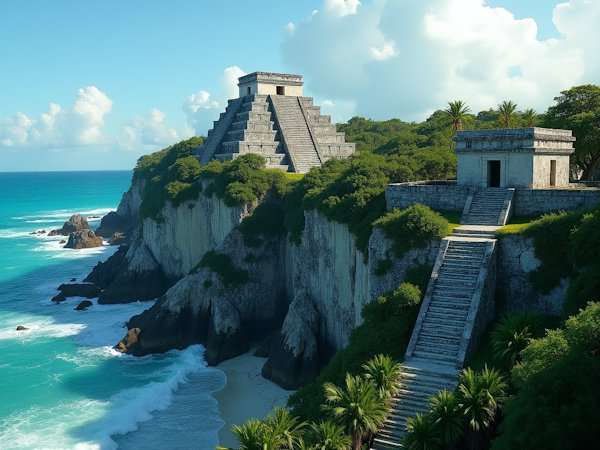
The ancient Mayan city of Tulum sits atop dramatic 12-meter limestone cliffs with stunning views of the Caribbean Sea. This remarkable archeological site stands as the only major Mayan settlement built along the coast and its preserved ruins continue to engage visitors with their seaside splendor and rich history.
Tulum Ruins Historical Significance
Constructed during the post-classic period between the 13th and 15th centuries, Tulum served as a crucial seaport and trading center for Mayan civilization. The settlement’s original name was Zamá, which means “City of Dawn”—a reference to its eastern orientation toward the sunrise. The city controlled valuable trade routes for obsidian, jade and turquoise.
The city stayed active for about 70 years after the Spanish arrived in 1518, making it one of the last active Mayan settlements. The population eventually abandoned the site by the late 16th century after European diseases took their toll.
Tulum Ruins Unique Features
The site’s defensive fortifications stand as its most remarkable feature. Massive limestone walls stretch 400 meters along the sea-facing side, reaching heights of 3-5 meters and spanning 8 meters in thickness. These impressive barriers protected three sides of the city while steep sea cliffs guarded the fourth.
Several notable structures remain preserved inside the walled city. El Castillo, rising 7.5 meters high, doubled as a temple and a beacon for approaching ships. The Temple of the Frescoes showcases fascinating murals that tell stories of Mayan cosmology through three distinct levels—the underworld, living realm and creator gods. The Temple of the Descending God features unique carvings that scholars believe represent a deity linked to bees.
Tulum Ruins Visitor Tips
The site welcomes visitors daily from 8 AM to 5 PM, with final entry at 3:30 PM. Entry costs about 80 MXN (USD). The best time to visit is before 10 AM to beat the crowds and avoid peak heat.
You’ll need 1-2 hours to explore this compact archeological zone. The ruins offer something unique among Mayan sites—direct access to a beautiful beach perfect for swimming.
The site’s preservation requires that visitors avoid climbing on any structures. A hat, sunscreen, and water bottle are essential since shade is limited throughout the ruins.
Coba
The ancient Mayan city of Coba spreads over 80 square kilometers of rich jungle terrain. This archeological marvel has the largest network of stone causeways in the ancient Mayan world. The name Coba means “chopped water” or “ruffled water,” which points to the five lagoons that surround the site.
Coba Historical Significance
The city’s roots date back to 100 BCE – 100 CE. What started as a tiny settlement grew into a powerful regional force. Coba peaked between 500-900 CE. During this time, builders completed most of its major structures and hieroglyphic inscriptions. The city’s population reached about 50,000 people, though some experts believe it might have housed up to 100,000 residents.
Coba’s power came from its control of farmland, trade routes and the vital water from nearby lagoons. The city built strong trade and political ties with major Mayan hubs like Tikal, Calakmul, and Dzibanche. Researchers have found that fourteen rulers led Coba between 500-780 CE, including a female ruler named Yopaat. The city’s influence dropped after 900 CE, but people lived there until at least the 14th century, possibly until Spanish explorers arrived.
Coba Unique Features
The city’s most striking feature is its network of raised stone paths called sakbe’ob (white roads). Archeologists have found about 50 sacbes. The longest one stretches an incredible 100 kilometers to Yaxuna. These limestone roads, 10-30 feet wide, helped control trade and administration.
The Nohoch Mul pyramid towers 42 meters (137 feet) high. It stands as the tallest pyramid in Quintana Roo. The site also features more than twenty stelae that tell the city’s royal history. Stela 1 holds special importance as the only known stela with four Long Count dates. One of these dates refers to the Mayan calendar cycle that ended December 21, 2012.
Coba Visitor Tips
You can visit the site daily from 8 AM to 5 PM, but you must enter before 3:30 PM. Entry costs about 100 MXN (5 USD). Visitors can explore this vast site in three ways:
- Walk the entire complex (takes about 3 hours)
- Rent bikes for 50 MXN per person
- Take a “bicitaxi” tour for 150 MXN per cart
The best time to avoid crowds is before 10 AM. Wear comfortable clothes and good shoes if you plan to climb the structures. Bring plenty of water because the jungle gets very humid. You’ll find facilities and small restaurants near the site.
Palenque
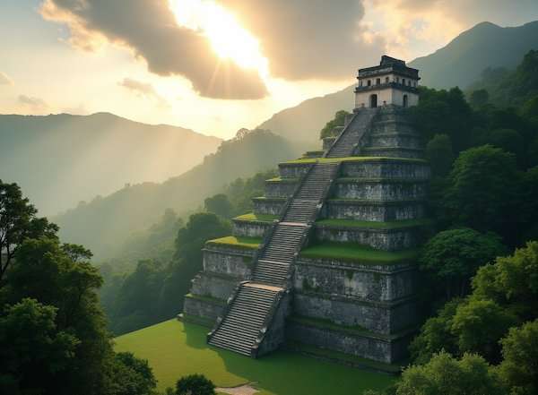
Palenque, one of the most stunning ancient Mayan ruins, lies deep in Mexico’s Chiapas jungles. Its elegant structures and detailed carvings tell us so much about Maya civilization.
Palenque Historical Significance
People first lived here around 226 BC. The city reached its peak during the Late Classic Period (600-900 CE). The Maya named it Lakamha, meaning “big water”. Pakal the Great ruled for 68 years (603-683) and rebuilt the city after rival Calakmul attacked in 599 and 611.
His son K’inich Kan Bahlam (635-702) and grandson K’inich Akul Mo’ Naab (678-736) kept building new structures. These three rulers created most of what we see today. The city started declining after Toniná attacked in 711. Elite building projects stopped after 800. The Maya had left the city completely by the time Spanish explorers arrived in the 16th century.
Palenque Unique Features
The Temple of the Inscriptions stands as Palenque’s masterpiece. This stepped pyramid has the Maya world’s second-longest glyphic text that covers 180 years of the city’s history. Archeologist Alberto Ruz Lhuillier made an amazing find in 1952 – Pakal the Great’s tomb adorned with jade.
The palace complex amazes visitors with its parallel walls and corridors topped by pointed vaults. Palenque’s builders used plaster instead of typical tooled-limestone to create smooth finishes. Scientists found a pressurized aqueduct here in 2010, the oldest known in the New World.
Palenque Visitor Tips
You can visit Palenque from 8 AM to 5 PM daily. Two entrances welcome visitors:
- The main entrance by the museum (85 pesos for ruins plus 31 pesos park fee)
- The upper entrance works best for early arrivals
The best times to avoid crowds are early morning or sunset. Pack light clothes and bug spray since the jungle creates intense humidity. You’ll need comfortable, closed shoes to climb the structures safely.
The on-site museum displays fascinating artifacts from excavations. Only 10% of Palenque’s estimated 1,400 buildings have been uncovered, which adds to this ancient Mayan site’s mystery.
Calakmul
Mexico’s Yucatan jungle hides one of the most important ancient Mayan ruins – Calakmul, which sits near the Guatemalan border. This UNESCO World Heritage Site includes both the archeological zone and the Calakmul Biosphere Reserve, the largest tropical forest in North America.
Calakmul Historical Significance
The powerful Snake (Kaanu’l) Kingdom made Calakmul its capital. The city ruled Mayan politics for centuries and competed fiercely with Tikal. Their power struggle shaped the story of the Maya Lowlands during the Classic period (250-850 CE). King Sky Witness led Calakmul to victory over Tikal in 562 CE. They executed Tikal’s ruler Wak Chan K’awill, which started Tikal’s 130-year decline in power.
This mighty metropolis had between 50,000 and 1.5 million people living in its big empire. Yuknoom Cheen II (Yuknoom the Great) brought the city’s golden age from 636-686 CE. He built Calakmul’s influence through marriage connections and military alliances.
Calakmul Unique Features
The site has some of the Maya world’s tallest pyramids. Structure II reaches about 164 feet (50 meters) high. Calakmul holds the record for most stelae (commemorative stone markers) of any Maya site—120 in total.
Archeologists found amazing murals under a late-period temple. These paintings stand out from typical Maya art. Instead of showing royalty and battles, they show nobles and regular people buying and selling in marketplaces. The city’s water system proves equally remarkable. They built complex canals and reservoirs to store water during dry seasons.
Calakmul Visitor Tips
The site lies about 2.5 hours from the nearest town of Xpujil. Entrance costs between 235-400 pesos per person.
December through February offers the best time to see wildlife. The ideal visiting season runs from November to April when rain is less likely. The site opens at 8 AM – getting there early means fewer people and better views.
Essential items for your visit:
- Water, snacks, and insect repellent since facilities are basic
- Good shoes that work well for climbing structures (still allowed here)
- Time – you need 3-4 hours to see the big site properly
Your reward? The view from these massive pyramids stretches endlessly across the jungle canopy. On clear days, Guatemala appears in the distance.
Visit the beaches in Guatemala.
Ek Balam
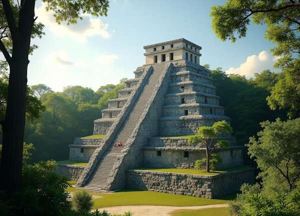
Ek Balam stands tall in the Yucatán jungle, with its well-preserved stucco sculptures that stand out as some of the most remarkable finds among Mexico’s ancient Mayan ruins.
Ek Balam Historical Significance
The city began around 300 BCE. Its name Ek Balam means “Black Jaguar” or “Star Jaguar” in Yucatec Maya and it served as the capital of the powerful Talol kingdom. The city reached its peak under Ukit Kan Le’k Tok’s rule from 770-800 CE as a thriving military and political center. The population grew to 18,000-20,000 inhabitants, and the city built strong trading connections with Chichén Itzá, Cobá and the Puuc region.
The Spanish conquest in the 16th century led to the city’s slow decline and abandonment. French explorer Désiré Charnay found the site in 1886, but actual excavations didn’t start until 1994.
Ek Balam Unique Features
The archeological site has 45 structures within its walls. The Acropolis stands out as one of Mesoamerica’s most impressive structures. This massive building stretches 162 meters long, 68 meters wide and reaches 32 meters high.
The fourth level houses “Sak Xok Naah” (White House of Reading). Its entrance amazes visitors with a monster-mouth design and large fangs that represent the underworld. Ukit Kan Le’k Tok’s spectacular tomb held more than 7,000 artifacts, from pottery and jade to shells and pearls.
The site features the unique “Mural of the 96 Glyphs.” This masterpiece shows beautiful hieroglyphic writing with decorative curls and flourishes.
Ek Balam Visitor Tips
Visitors can explore the site from 8 AM to 5 PM daily, with final entry at 4 PM. Foreign visitors pay 531 pesos (90 pesos INAH fee plus 441 pesos Yucatan government fee).
Ek Balam remains one of the few Mayan ruins where you can still climb the structures. The best time to visit is between 8-10 AM when crowds are small.
The nearby Cenote X’canché offers a beautiful natural sinkhole with clear waters that you can visit for an extra fee. You’ll need about 1.5-2 hours to see the ruins properly.
Uxmal
The Puuc architectural style makes Uxmal stand out as the finest example of late Maya art and architecture in Yucatan, Mexico. This remarkable ceremonial center sits 62 kilometers south of Merida. The site showcases stone craftsmanship and attention to detail that remains unmatched in the Maya world.
Uxmal Historical Significance
The city began around 700 CE and grew into a thriving metropolis with approximately 25,000 inhabitants. Uxmal reached its peak between the 7th and 10th centuries and served as the Talol kingdom’s power center under the Xiu family’s rule. The city’s layout differs from other Mayan cities because astronomical phenomena, not geometry, determined its design. Builders oriented the structures specifically to track Venus and other celestial bodies.
Uxmal’s influence waned as Chichen Itza grew more powerful after the 10th century. The city remained active until about 1450 CE, when it became a pilgrimage site. UNESCO recognized Uxmal’s exceptional cultural value by naming it a World Heritage Site in 1996.
Uxmal Unique Features
The ceremonial center’s crown jewel, the Pyramid of the Magician (or Soothsayer), rises 35 meters with its distinctive oval shape. This remarkable pyramid contains five temples built on top of each other over 400 years. Temple IV features a dramatic earth monster mask that creates its entrance.
Other notable structures include:
- The Nunnery Quadrangle features four detailed buildings with 74 individual rooms
- The Governor’s Palace showcases the best Puuc architecture with over 20,000 precisely cut mosaic stones
- The House of Turtles earned its name from its frieze of sculptured turtles
Classic Puuc architecture defines the site with smooth lower walls and ornate upper facades. Masks of Chaac, the rain god, appear throughout the structures, highlighting the site’s reliance on rainwater collection through chultunes (cisterns).
Uxmal Visitor Tips
Visitors can explore Uxmal from 8 AM to 5 PM daily. Foreign tourists should expect to pay around 494 pesos for entry. Early morning visits help avoid crowds and the intense midday heat.
Travelers can reach Uxmal by driving from Merida on Route 261 or taking ADO busses from major Yucatan cities. The site belongs to the Puuc Route along with Kabah, Sayil, and Labna. This location makes it perfect for exploring multiple ancient Mayan ruins in one area.
Teotihuacan
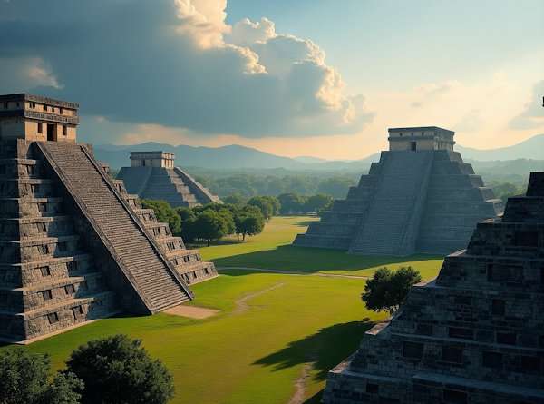
Teotihuacan stands majestically above central Mexico as one of North America’s most magnificent pre-Columbian cities. People often mistake it for Mayan architecture, though it predates their civilization’s golden age. This archeological wonder’s population reached at least 125,000 residents, making it the world’s sixth-largest city during its peak.
Teotihuacan Historical Significance
The city dates back to 100 BCE and grew into a religious center before reaching its peak between 100-650 CE. Most monumental architecture emerged during a dramatic expansion from 150-300 CE. The identity of Teotihuacan’s founders remains elusive despite years of research. Experts suggest they might have been volcanic refugees or Totonac people from eastern Mexico.
The Aztecs named the city “Teotihuacan,” which means “birthplace of the gods”, after they found these abandoned ruins. The city’s original name remains unknown, though Maya texts refer to it as “puh” (Place of Reeds).
Teotihuacan Unique Features
The Pyramid of the Sun dominates the landscape, reaching 216 feet (66 meters) skyward. Its construction required approximately 1,000,000 cubic yards of material. A cave system lies beneath the pyramid. Scientists initially thought it was natural but now believe humans created it, possibly as a royal tomb.
The Pyramid of the Moon stands proudly along the 2.5 km Avenue of the Dead. Built around 150 AD, archeologists found evidence of human and animal sacrifices within its walls. The city’s walls still showcase remarkably preserved murals that depict corn, serpents, jaguars and humans.
Teotihuacan Visitor Tips
Tourists can reach this site, located 30 miles northeast of Mexico City, through:
- Public bus from Terminal Central del Norte (60 minutes, 50 MXN/2.40 USD)
- Organized tours departing throughout the day
The site welcomes visitors daily from 9 AM-5 PM with 80 MXN (4 USD) admission. Early arrival before 10 AM helps visitors avoid crowds and midday heat. Comfortable footwear and sun protection are essential since the expansive complex offers minimal shade.
Monte Alban
Monte Alban sits majestically on a flattened mountaintop 400 meters above Oaxaca Valley. This ancient city stands as one of Mesoamerica’s oldest urban centers and most important pre-Columbian archeological sites. Visitors can enjoy stunning 360° panoramic views of the valley below from this hilltop complex.
Monte Alban Historical Significance
Founded around 500 BCE, Monte Alban grew faster into the dominant Zapotec socio-political and economic hub that retained its power for almost a thousand years. The settlement expanded between 100 BCE-200 CE to become the capital of a large expansionist state that ruled the Oaxacan highlands. The city built strong connections with other Mesoamerican regional powers, especially Teotihuacan in the north.
Monte Alban reached its peak during 100-600 CE and covered 6.5 square kilometers with about 25,000 residents. More than 2,000 terraces lined the hillside below with houses and farm plots. The surrounding valley supported roughly 100,000 people. The site’s prosperity lasted for centuries until its mysterious decline around 800 CE when people started moving away.
Monte Alban Unique Features
The city’s heart features the Main Plaza, stretching 300 meters by 150 meters. Workers leveled the mountaintop to create this impressive space and covered it with white plaster. The plaza could hold the entire city’s population during state-sponsored ceremonies.
The “Danzantes” (dancers) stand out as the site’s most unique feature. These 300-plus carved stone monuments show naked men in twisted positions, some with mutilated genitals. Experts believe these figures represent sacrificial victims and showcase some of Mesoamerica’s earliest writing examples.
Monte Alban Visitor Tips
The site opens daily from 9 AM to 3:30 PM. Entry costs 95 MXN (about $4 USD) per person, and kids under 13 get in free. Early morning visits help avoid crowds and the harsh midday sun.
Construction work affects the access road now. Visitors must park a mile away and walk uphill to reach the site. Bring comfortable shoes, sun protection and plenty of water.
The site stays open year-round. The best time to visit is between December and February when the weather is pleasant. Plan to spend 2-3 hours exploring this remarkable archeological treasure.
Chacchoben

The ancient Maya civilization built Chacchoben, which means “Place of the Red Corn,” deep in Mexico’s Costa Maya region. Its elegant curved pyramids showcase sophisticated architectural style through their ceremonial center.
Chacchoben Historical Significance
Archeological evidence suggests human settlements in the Chacchoben area go back to 1000 BCE. The site reached its peak around 300-360 CE after periods of abandonment and reoccupation. Most important structures went through remarkable modifications during this time. Chacchoben became the largest community in the “Region of the Lakes,” an area named for its many lagoons.
Chacchoben managed to keep its religious importance for centuries after its final abandonment around 1000 CE. Archeologists found incense burners at the Temple of the Ways dating from 950 through 1518 CE. This suggests ritual activities continued until Spanish arrival.
A Maya Yucatec farmer, Serviliano Cohuo, found the temple ruins by accident in 1942. Dr. Peter Harrison, an American archeologist, completed the first professional exploration 30 years later. He created the original maps and informed Mexican authorities about his findings.
Chacchoben Unique Features
The ceremonial center covers about 6 square kilometers. Temple 24 stands as one of its most impressive structures. Ancient workers showed their fine craftsmanship through meticulous concrete application between stone layers in this massive step pyramid.
Chacchoben’s structures have a unique austere look without ornamentation and inscriptions. The pyramids feature graceful curved lines in their Peten architectural style.
Temple 1 stands 42 feet high with a single staircase. The smaller Temple of the Vessels sits nearby, where ritual implements were once stored.
Chacchoben Visitor Tips
The site welcomes visitors daily from 8:00 AM to 5:00 PM. Entry costs approximately USD 4.80 (80 pesos).
To have the best experience:
- Start your visit early to avoid crowds and midday heat
- Use comfortable shoes with good traction on potentially slippery trails
- Pack water, sunscreen and insect repellent
Video camera users need to pay an additional USD 5.00 fee at the entrance.
El Rey
El Rey sits right in Cancun’s bustling Hotel Zone and is a chance to explore ancient Mayan ruins close to modern amenities. The archeological zone features 47 stone structures that help visitors learn about Mayan civilization in a compact area.
El Rey Historical Significance
The story of El Rey goes back to at least 300 BCE, when local fishermen first made it their base. The settlement grew substantially between 1200-1500 CE. This period marked its peak as a pre-Columbian town that focused on maritime trade and fishing.
El Rey played a vital role as a Caribbean port among other locations like Xcaret, Xelha, Tulum and Muyil. The people here worked in fisheries and salt extraction from 200-1200 CE. More people moved here from the Yucatan Peninsula’s interior around 1300-1500 CE, which made El Rey even more important.
The Maya left the settlement after the Spanish arrived in the 16th century. The structures stayed hidden until archeologists found them in 1923.
El Rey Unique Features
Ceremonial buildings and market areas make up the main structures at El Rey. While smaller than other Mayan sites, El Rey has several remarkable features. Archeologists found something special in 1975 – a burial site under a temple floor. The grave belonged to someone important and contained a copper ax, bracelet and decorations made of shell and bone.
Some stone walls still show their original murals. Visitors can see images of rulers and important members of Mayan society. The name “El Rey” (The King) comes from a ceremonial mask and skull found here, which people think were used in sun god worship.
El Rey Visitor Tips
You can visit the ruins from 8:00 AM to 5:00 PM daily. Entry costs about 80 pesos ($3 USD). Video camera users might need to pay an extra 45 pesos.
To make the most of your visit:
- Start early to beat the heat
- Put on comfortable shoes because stone paths are uneven
- Take sun protection since shade is limited here
You’ll find El Rey at KM 17-18 on Boulevard Kukulcan. The site’s location makes it easy to reach for anyone staying in Cancun. This compact archeological zone gives visitors a great introduction to ancient Mayan ruins without taking up an entire day.
Tula
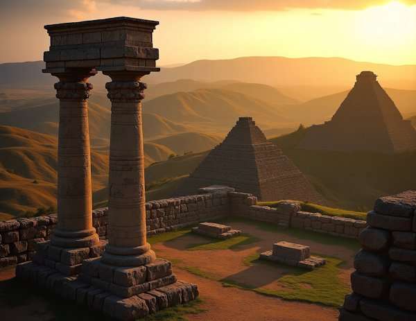
The formidable capital of the Toltec Empire, Tula, stands two hours north of Mexico City. This archeological wonder connected the historical gap between Teotihuacan’s fall and the Aztec’s rise. The city became Central Mexico’s dominant center from 900 to 1100 CE and shaped much of Mesoamerican culture.
Tula Historical Significance
Tula, originally called Tollan-Xicocotitlan, rose to prominence as Teotihuacan declined around 650 CE. The settlement grew into a bustling metropolis under Quetzalcoatl Ce Acatl Toplitzin’s leadership. The city sprawled across 14 km² and housed between 50,000-60,000 residents. The word “Toltec” evolved to mean “artisan” or “skilled worker”, showcasing their cultural refinement.
The Aztecs saw Toltecs as civilization’s pinnacle and viewed their society as almost mythically perfect. Their reverence affected Aztec religious practices, political structures and city designs for centuries. The city’s decline began after 1150 CE, and fire destroyed its ceremonial center around 1179 CE.
Tula Unique Features
Pyramid B, known as the Pyramid of Quetzalcoatl, stands as the site’s masterpiece. Four massive Atlantean warriors crown this five-tiered structure – basalt columns carved as Toltec soldiers reaching nearly 16 feet. Each warrior shows incredible detail with butterfly-shaped chest plates, ceremonial weapons and solar disk back plates.
The Coatepantli (“Wall of Snakes”) matches this grandeur. This 40-meter long, 2.25-meter high wall features carvings of serpents consuming human skeletons. The “Burnt Palace” complex nearby displays detailed relief carvings of nobles in procession. Jaguar, eagle and serpent motifs appear throughout the site, highlighting themes of war and sacrifice.
Tula Visitor Tips
The site welcomes visitors daily from 8 AM to 5 PM, with final entry at 4:30 PM. Entry fees range from 65-100 pesos ($3-5 USD).
For the best visit:
- Start your exploration early to avoid crowds and heat
- Plan 2-3 hours to see the site fully
- Bring comfortable shoes and sun protection as shade is scarce
You can reach Tula by car from Mexico City in about 2 hours or take direct busses from Mexico City’s Norte bus station. The Jorge R. Acosta Museum houses fascinating artifacts from the site and deserves a visit.
Templo Mayor
Mexico City’s bustling streets hide Templo Mayor, which served as the sacred heart of Tenochtitlan, the ancient Aztec capital. This archeological treasure provides valuable context about Mesoamerican civilizations that existed alongside the Maya, though it’s not technically a Mayan ruin.
Templo Mayor Historical Significance
The temple’s construction began around 1325 and saw seven major expansions. Each Aztec ruler built over previous versions to show their power. The temple’s most spectacular improvements came under Motecuhzoma I in 1454, who added impressive artworks and architectural elements. The structure remained Tenochtitlan’s most important religious center until Hernán Cortés and his Spanish conquistadors destroyed it in 1521.
Electrical workers stumbled upon a monolithic stone disk showing the moon goddess Coyolxauhqui in 1978, which led archeologists to start systematic excavations. The Proyecto Templo Mayor continues today, yielding remarkable finds. A recent discovery called offering 186 revealed a stone chest with 15 anthropomorphic sculptures and various marine elements.
Templo Mayor Unique Features
Twin pyramids rose side by side on a massive platform to form the temple’s structure. The dual design represented two sacred mountains – the left side honored Tlaloc (rain god) while the right celebrated Huitzilopochtli (war god). Serpent heads flanked the staircases leading to shrines at each pyramid’s top.
Archeologists have found thousands of ritual objects including wooden masks, scepters, figurines and ceremonial offerings. These sacrifices often included human victims whose hearts were cut out before their bodies were thrown down the temple steps.
Templo Mayor Visitor Tips
The site welcomes visitors Tuesday through Sunday from 9:00 to 17:00. Entry costs about 80 pesos (USD 4.00) and includes access to both the archeological zone and museum. Students, teachers, seniors with valid ID and children under 13 can enter free.
Early morning visits help avoid crowds. The museum’s design mirrors the temple’s layout with eight exhibition halls showcasing artifacts from the excavations.
Yaxchilan
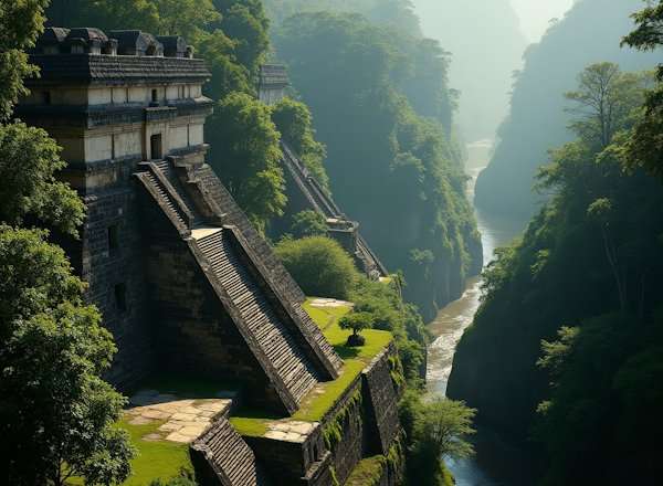
The dense jungle of Chiapas hides Yaxchilan, one of Mexico’s most atmospheric ancient Mayan ruins. Visitors can reach this site only by boat on the winding Usumacinta River. This powerful city once controlled trade along this vital waterway and dominated smaller sites like Bonampak during the Late Classic Period.
Yaxchilan Historical Significance
The city, originally named Pa’ Chan (“Divided Sky”), started its dynasty around 320 CE and thrived for more than four centuries. King Itzamnaaj Balam II brought true expansion to the city during his remarkable 60-year reign (681-742 CE). His ambitious building projects reshaped the settlement. His son, Bird Jaguar IV, later took the city to its peak by commissioning more than half of the known monuments.
Yaxchilan’s history tells stories of intense rivalry with nearby Piedras Negras over the profitable Usumacinta trade route. Historical records show fascinating power shifts – Yaxchilan defeated Tikal in 562 CE, and later fought with Palenque in 654.
Yaxchilan Unique Features
The site’s strategic defensive position within a tight river loop makes it exceptional, along with its remarkable sculptured stone lintels. These detailed carvings sit above doorways throughout the site and tell rich dynastic histories. Many show nobility performing bloodletting rituals.
The site’s grandest monument, Structure 33, sits atop the Grand Staircase. Its hieroglyphic stairway shows Bird Jaguar IV as he takes part in ceremonial ball games. A headless statue rests inside this structure. A Lacandon legend says celestial jaguars will destroy the world once the head returns to its body.
Yaxchilan Visitor Tips
You need to:
- Take a one-hour boat trip along the Usumacinta River from Frontera Corozal
- Get there before 10 AM to avoid crowds and see jungle wildlife
The site welcomes visitors daily from 8 AM to 5 PM. Entry costs about 70 MXN. Visitors should pack insect repellent, water and comfortable hiking shoes for extensive walking. The remote location makes it smart to hire a guide from Frontera Corozal or arrange transportation from Palenque.
Bonampak
Bonampak’s beautifully preserved murals showcase Maya life through vibrant paintings that changed how scholars understand this ancient civilization. The archeological site’s name means “painted walls” in Maya, and it houses some of Mesoamerica’s most important artistic treasures.
Bonampak Historical Significance
The site sits on a tributary of the Usumacinta River in eastern Chiapas, Mexico. Bonampak reached its peak during the mid-8th century as a satellite of the larger Yaxchilán. The city managed to keep political ties with Yaxchilán from at least the 5th century, and we operated under its influence. Under Chan Muán’s reign (776-c.795), the population grew to about 6,000 inhabitants.
The settlement, originally called Ak’e, features a large terraced acropolis built on a natural hill. The Lacandon Maya continued their religious rituals among the ruins until experts found the site in the 20th century, even after its abandonment around 900 CE.
Bonampak Unique Features
Without doubt, the site’s fame comes from its exceptional floor-to-ceiling murals that cover the interior walls of a small three-room building on the acropolis. Artists created these paintings around 790-792 CE during Chan Muán’s reign, and they document specific events with incredible detail.
Each room’s colorful frescoes tell different stories:
- First room – Chan Muán designating his son as heir amidst white-robed nobility
- Second room – A raid on a neighboring community featuring jaguar-pelted warriors
- Third room – Graphic depictions of bloodletting, torture, and sacrifice of captives
Yes, it is these murals that revolutionized our understanding by disproving the romantic notion of Maya as peaceful people. The paintings also reveal Maya’s musical culture, showing percussion instruments like log drums and turtle-shell idiophones.
Bonampak Visitor Tips
Visitors should note that as of January 2024, security concerns might close the site. The site usually opens daily from 8 AM to 4:30 PM, charging around USD 5.70/95 Pesos for entry.
Each mural room allows only four people at once because human breath affects the paintings. You can take regular photos but not with flash. Winter, spring and summer offer the best visiting conditions. Remember to wear light clothes and bring mosquito protection.
Comparison Table
| Site Name | Location | Peak Period | Notable Features | Peak Population | Entrance Fee (2024) | Key Structures |
|---|---|---|---|---|---|---|
| Chichen Itza | Yucatán Peninsula | 900-1000 CE | Mathematical precision with equinox displays | – | 614 MXN ($34 USD) | El Castillo (79ft pyramid), Great Ball Court |
| Tulum | Caribbean Coast | 13th-15th century | Defensive walls protect this coastal Mayan city | – | 80 MXN | El Castillo (7.5m), Temple of Frescoes |
| Coba | Quintana Roo | 500-900 CE | Most extensive stone causeway network | 50,000-100,000 | 100 MXN ($5 USD) | Nohoch Mul (42m pyramid) |
| Palenque | Chiapas | 600-900 CE | First discovered pressurized aqueduct | – | 85 MXN + 31 MXN park fee | Temple of Inscriptions, Palace Complex |
| Calakmul | Yucatan jungle | 250-850 CE | Houses 120 stelae, the most discovered | 50,000-1.5M | 235-400 MXN | Structure II (50m pyramid) |
| Ek Balam | Yucatán | 770-800 CE | Rich stucco sculptures remain intact | 18,000-20,000 | 531 MXN | Acropolis (32m high) |
| Uxmal | Yucatan | 700-1000 CE | Distinctive Puuc architecture | 25,000 | 494 MXN | Pyramid of the Magician (35m) |
| Teotihuacan | Central Mexico | 100-650 CE | Ancient world’s sixth largest urban center | 125,000+ | 80 MXN ($4 USD) | Pyramid of the Sun (216ft) |
| Monte Alban | Oaxaca Valley | 100-600 CE | Mountain complex with Danzantes art | 25,000 | 95 MXN ($4 USD) | Main Plaza (300m x 150m) |
| Chacchoben | Costa Maya | 300-360 CE | Distinct curved pyramid design | – | 80 MXN ($4.80 USD) | Temple 24, Temple of the Vessels |
| El Rey | Cancun Hotel Zone | 1200-1500 CE | Original wall paintings | – | 80 MXN ($3 USD) | 47 stone structures |
| Tula | Central Mexico | 900-1100 CE | Famous warrior statues | 50,000-60,000 | 65-100 MXN | Pyramid of Quetzalcoatl |
| Templo Mayor | Mexico City | 1325-1521 CE | Twin pyramids honor two deities | – | 80 MXN ($4 USD) | Twin pyramids to Tlaloc and Huitzilopochtli |
| Yaxchilan | Chiapas | 681-742 CE | Stone lintels with intricate carvings | – | 70 MXN | Structure 33, Grand Staircase |
| Bonampak | Chiapas | 776-795 CE | Vibrant ancient murals | 6,000 | 95 MXN ($5.70 USD) | Three-room mural building |
Appreciate Ancient Mayan Ruins
These fifteen ancient Mayan ruins are proof of one of history’s most advanced civilizations. Chichen Itza’s precisely calculated 365 steps and Bonampak’s vivid murals continue to showcase their creators’ mathematical brilliance, knowledge of astronomy and artistic skill. Each archeological site gives visitors a unique point of view into Mayan life. You’ll find coastal trading hubs like Tulum sitting above turquoise waters and the mysterious Calakmul hidden in dense jungle with its 50-meter pyramids.
Some sites need extra work to reach them, especially when you have remote spots like Yaxchilan that’s only accessible by river. But the experience is nowhere near as challenging as it might seem. The building feats at these sites show incredibly complex societies that built massive structures without metal tools, wheels or animals to help. People who walk among these stone monuments connect with civilizations that mapped the stars, created advanced writing systems and built huge cities for tens of thousands of residents.
Protecting these cultural treasures is crucial as more visitors arrive each year. Tourism that respects these sites helps fund conservation and brings money to the builders’ descendants’ communities. Modern travelers join an ancient tradition of wonder when they climb Coba’s Nohoch Mul pyramid or watch Chichen Itza’s serpent shadow during equinox. This honors cultures whose seven million descendants still have thriving communities across Mexico and Guatemala.
FAQs
Q1. Which Mayan ruin is considered the most impressive to visit?
Chichen Itza is often regarded as the most impressive Mayan ruin to visit. Its iconic El Castillo pyramid, intricate stone carvings and the fascinating equinox phenomenon make it a must-see destination. However, other sites like Palenque, Uxmal and Calakmul also offer unique and awe-inspiring experiences.
Q2. Are there any lesser-known Mayan ruins worth exploring?
Yes, sites like Ek Balam, Calakmul, and Bonampak are less crowded but equally fascinating. Ek Balam features well-preserved stucco sculptures, Calakmul boasts the largest number of stelae and Bonampak is renowned for its vivid murals. These sites offer a more intimate experience with Mayan history and architecture.
Q3. What’s the best time of year to visit Mayan ruins?
The best time to visit most Mayan ruins is during the dry season, typically from November to April. This period offers more comfortable temperatures and less rainfall. However, specific sites may have different optimal visiting times. For example, visiting Chichen Itza during the spring or autumn equinox allows you to witness the unique serpent shadow effect on El Castillo.
Q4. Are visitors allowed to climb the pyramids at Mayan sites?
Climbing restrictions vary by site. Many major sites, including Chichen Itza, no longer allow visitors to climb the structures to preserve them. However, some sites like Coba still permit climbing on certain structures. It’s always best to check the current regulations before visiting, as rules can change.
Q5. What should I bring when visiting Mayan ruins?
When visiting Mayan ruins, it’s essential to bring comfortable walking shoes, sun protection (hat, sunscreen, sunglasses), insect repellent and plenty of water. Light, breathable clothing is recommended due to the often hot and humid climate. A camera is also a must to capture the impressive architecture and intricate details. Some sites have limited facilities, so it’s wise to bring snacks and additional water.








Leave A Comment