

I’ve visited many Indonesian islands, but Bintan is unique. I’ve seen fishing boats in mangrove biodiversity channels, with industrial sites nearby. It’s a place where tourism and industry meet, often unseen by visitors.
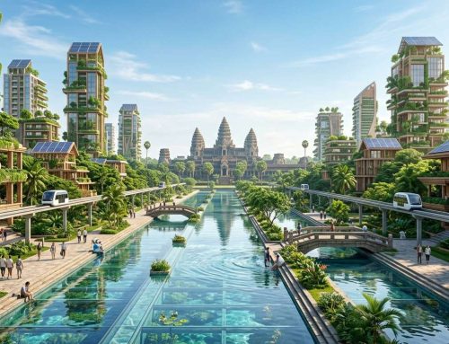
Today, Bintan faces challenges like tourism vs. industry and development vs. preservation. But, a remarkable change is coming. By 2050, it could become a carbon-negative island, removing more carbon than it produces.
This vision is not science fiction. It’s based on real conservation efforts like the East Bintan Marine Protected Area and the Blue Lantern foundation. With new technologies in renewable energy and smart infrastructure, this transformation is possible.
I want to share what I’ve learned about Bintan’s future 2050. This plan could change how we preserve islands in our climate-challenged world. It’s about making tropical coastlines smart and regenerative, showing Indonesia’s commitment to the planet.
Key Takeaways
- Bintan aims to become the world’s first fully carbon-negative tropical island by 2050 through advanced eco-urbanism strategies
- The East Bintan Marine Protected Area currently covers over 7,400 hectares of mangrove ecosystems critical for carbon sequestration
- Blue Lantern NGO partners with eco-resorts to fund marine conservation and blue carbon initiatives across the archipelago
- Smart infrastructure will integrate tidal-energy microgrids with living mangrove defense systems for coastal protection
- The vision combines luxury sustainable architecture with resource circularity, creating a replicable model for island destinations worldwide
- Current conservation efforts protect 32 bird species, rare mammals, and vital coral reef ecosystems spanning 12,800+ hectares
Why Archipelagic Nations Hold the Blueprint for Post-Carbon Civilization
Archipelagic nations are turning into unexpected labs for a post-carbon world. During my travels in coastal Asia, I’ve seen these island chains face climate challenges that mainland nations see as distant. Their small size is not what makes them key—it’s their vulnerability turning into visionary action.
Island life’s constraints are pushing innovations that continents will soon adopt. Limited land, rising seas, and isolated resources mean adaptation is not optional. It’s immediate survival.
I’ve seen this pattern across Indonesia, the Philippines, and the Pacific. Islands become testing grounds because failure means disappearance. This urgency breeds the kind of breakthrough thinking that mainland cities struggle to generate.
The Island Imperative in Climate Adaptation
The “island imperative” concept emerged during my first visit to the Riau archipelago. Standing on Bintan’s eastern coast, watching fishing boats navigate channels between mangrove forests, I understood something fundamental about island nations carbon adaptation.
These communities can’t relocate infrastructure when storms intensify. They can’t expand outward when populations grow. Every decision carries amplified consequences.
Research examining climate pressures on Bintan documented by Setiawati and colleagues in 2023 reveals how local authorities are already implementing frameworks addressing anthropogenic stress and environmental change. Their policy assessments show island governments creating adaptive strategies that mainland planners are just beginning to consider.
What makes archipelagic climate solutions powerful is the enforced efficiency. Islands demand smarter resource management because waste has nowhere to hide. Water scarcity drives innovation in collection and purification. Limited electricity grids accelerate renewable adoption.
The natural advantages are equally significant:
- Marine ecosystem integration – Surrounding waters provide carbon sequestration through seagrass meadows and mangrove networks
- Renewable energy access – Tidal flows, wave action, and consistent trade winds offer multiple clean power sources
- Compact testing environments – Small land areas allow rapid infrastructure experimentation without continental-scale risk
- Community cohesion – Island populations often share collective climate awareness that fragmented urban sprawl lacks
Travelers visiting these regions often miss the innovation happening beneath the tourism surface. The resorts and beaches distract from the serious climate engineering occurring in island communities. But once you look closer, the patterns become unmistakable.
Islands are pioneering closed-loop systems because geography forces the loop closed. They’re developing blue carbon strategies because their survival depends on healthy coastal ecosystems. The innovations emerging from this necessity are exactly what vulnerable coastlines globally will need within decades.
Bintan’s Strategic Geography as Catalyst
Bintan occupies a geographic sweet spot that makes it ideal for demonstrating scalable climate solutions. Positioned just 45 kilometers southeast of Singapore in the Riau Strait’s busy shipping lanes, the island bridges major economic corridors and relatively intact marine ecosystems.
When I researched Bintan’s relationship with neighboring Batam—Indonesia’s industrial powerhouse—the strategic advantages became crystal clear. This proximity creates opportunities for integrated development balancing logistics with conservation in ways isolated islands cannot achieve.
The Riau Islands sustainability initiatives benefit from this positioning. Bintan serves as the ecological anchor while Batam handles heavy industry. Singapore provides capital, expertise, and market access. This triangular relationship creates conditions where ambitious environmental projects become economically viable.
| Geographic Factor | Archipelagic Advantage | Continental Challenge | Bintan Application |
|---|---|---|---|
| Land Constraints | Forces vertical development and efficiency | Sprawl reduces urgency for innovation | Compact 1,140 km² drives smart density |
| Marine Access | Integrated blue carbon and tidal energy | Coastal zones treated as separate from urban planning | Riau Strait provides renewable power potential |
| Regional Position | Natural laboratories with nearby support networks | Scale makes pilot programs difficult to assess | Singapore proximity enables tech transfer |
| Climate Exposure | Immediate vulnerability accelerates adaptation | Delayed impacts reduce political will | Rising seas demand urgent infrastructure response |
The island’s 1,140 square kilometers provide enough space for meaningful development without the complexity that bogs down megacity planning. When I explored the Sebung River watershed and the northern conservation zones, I could see how manageable scale enables comprehensive approaches.
Bintan’s monsoon climate patterns create both challenges and opportunities. The distinct wet and dry seasons demand sophisticated water management, but they also provide predictable renewable resources. The surrounding coral reefs and mangrove systems offer natural coastal defense while sequestering significant carbon.
What impressed me most during my research was discovering how Southeast Asia ecological innovation is being applied to archipelagic contexts. Bintan isn’t trying to replicate continental models—it’s developing solutions that work precisely because of island constraints.
The strategic location in one of the world’s busiest maritime corridors means any successful model implemented here gains immediate international visibility. Thousands of ships pass through the Riau Strait monthly, and Singapore’s global connections ensure innovations won’t stay local.
For travelers considering Bintan’s future direction, understanding this geographic catalyst helps explain the ambitious 2050 vision. This isn’t random idealism—it’s strategic positioning meeting urgent necessity. The island’s constraints and connections create conditions where breakthrough climate solutions become the only viable path forward.
The archipelagic blueprint emerging here offers patterns that vulnerable coastlines worldwide might follow. Not because islands are special, but because they’re experiencing tomorrow’s climate realities today.
Bintan Future 2050: The World’s First Carbon-Negative Smart Sanctuary

I’ve seen many “eco-friendly” places, but Bintan’s 2050 plan really caught my eye. It’s not just about adding solar panels to resorts. Bintan aims to change how we live in harmony with island ecosystems.
The goal is to make Bintan a smart sanctuary island that heals the environment. After researching and visiting the area, I saw it as a real model for a post-carbon world.
Beyond Carbon Neutral: What Net-Negative Actually Means
Understanding net-negative urbanism changed my view on sustainability. It’s not just about balancing emissions with offsets. Net-negative urbanism means removing more carbon than it produces.
Imagine a city that cleans the air and supports life. Bintan plans to do just that, turning it into a giant air purifier.
To achieve this, Bintan has three main strategies. First, it will restore mangrove forests and seagrass meadows to capture carbon. Second, it will generate more renewable energy than it needs, sharing the excess. Third, it will have closed-loop systems to eliminate waste emissions.
The engineering needed is huge. But the island’s natural division makes it possible to manage each part effectively.
The Strategic North-South Split That Makes It Work
Visiting Bintan, I noticed how different the north and south are. The north has pristine beaches and mangroves, while the south is industrial.
The 2050 plan uses this natural division to create zones that work together. It’s like the East Bintan Marine Protected Area, which already shows zoning works.
The south will be the economic hub, with logistics, tech, and data centers. But it will run on zero-emission systems, like electric transport and renewable energy.
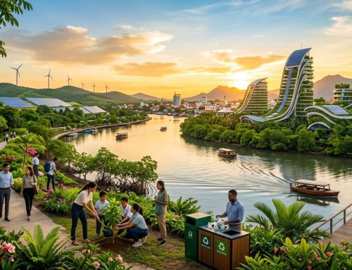
The north will be for biophilic tourism, where tourism helps the environment. It’s not just about eco-resorts. It’s about improving the environment through tourism.
Imagine staying in buildings that cool themselves naturally, without air conditioning. Or waste systems that turn waste into food. Tourism can help restore mangroves and coral reefs.
| Zone Characteristic | Northern Biophilic Tourism Zone | Southern Economic Corridor |
|---|---|---|
| Primary Function | Regenerative hospitality and ecological education experiences | Zero-emission logistics, tech manufacturing, and regional connectivity |
| Infrastructure Focus | Living buildings, natural cooling systems, integrated food-water-energy loops | Autonomous electric transport, renewable-powered facilities, carbon capture industrial processes |
| Carbon Strategy | Blue carbon sequestration through mangrove/seagrass restoration; visitor activities enhance ecosystems | Renewable energy surplus generation; closed-loop manufacturing eliminates process emissions |
| Economic Model | Premium eco-tourism, research tourism, ecological restoration services | Green logistics hub, clean-tech production, sustainable trade gateway |
| Visitor Experience | Immersive nature connection, hands-on conservation participation, wellness integration | Industrial tourism showcasing sustainable manufacturing, innovation center tours |
This division solves the problem of making money without harming the environment. By separating but connecting two visions, Bintan can thrive.
The north won’t harm nature because the south handles big economic activities cleanly. The south also benefits from the north’s conservation efforts.
Visitors can see both visions on one trip. You can kayak in mangrove restoration projects in the north and then see sustainable manufacturing in the south.
This smart divide means you’re not just on vacation. You’re seeing a model for living on islands without harming them. Every stay in the north removes carbon from the atmosphere. Every tour in the south shows that you can be prosperous and sustainable.
I still have doubts about the challenges of making it work. But the idea of net-negative urbanism is not science fiction. It’s applied ecological engineering on a large scale.
The Batam-Bintan Megastructure Spine: Zero-Emission Connectivity as Economic Revolution

Every time I’ve taken the ferry between Batam and Bintan, I’ve watched the strait pass beneath me. I thought about what could connect these islands beyond water. The diesel engines rumble below deck while the beautiful Riau Strait stretches out in all directions. It’s a journey that works, but it also feels like a missed opportunity.
Right now, these two islands function as separate worlds. Batam handles the industrial heavy lifting while Bintan focuses on tourism and resorts. The physical gap between them creates an economic gap too, limiting what both islands can achieve together.
The proposed megastructure spine changes everything about this relationship. This isn’t just another bridge project—it’s a complete reimagining of how zero-emission transportation can drive regional growth. The connector would feature an elevated multi-modal corridor combining electric rail, autonomous vehicle lanes, and dedicated cycling paths.
What powers this ambitious infrastructure? Integrated solar canopies run the entire length of the span, while strategically positioned wind turbines harness the constant strait breezes. The batam bintan inter island bridge connectivity becomes self-sustaining, generating more energy than it consumes.
Bridging High-Velocity Economic Corridors Without Carbon
The economic implications of this connector extend far beyond passenger convenience. Indonesia’s growth depends on efficient cargo movement between production centers and distribution hubs. Currently, every shipping container moving between Batam’s industrial zones and Bintan’s logistics facilities requires diesel-powered ferry transport.
The megastructure spine eliminates those emissions entirely. Sustainable island logistics becomes reality through dedicated freight rail lines that move goods seamlessly across the strait. Electric autonomous trucks could operate around the clock without adding carbon to the atmosphere.
I find the speed element compelling. Current ferry schedules create bottlenecks that slow down everything. Weather delays, loading times, and crossing intervals all add friction to commerce. The spine removes those variables entirely, enabling just-in-time manufacturing and distribution at scales previously impossible for island economies.
The existing shipping lane accommodations in Bintan’s marine protected areas already prove that planners understand industrial reality. They’ve demonstrated the ability to balance environmental protection with economic necessity. The megastructure simply elevates that pragmatism to zero-emission transportation standards without compromising either goal.
For travelers heading to Bintan’s northern resort zones, the journey itself becomes part of the destination. Imagine crossing the strait on a climate-controlled rail car, watching the sunset over the water while knowing your transit produces zero emissions. That’s the kind of experience that sets environmental expectations before you even arrive.
Vertical Biophilic Architecture as Transit Urbanism
What really excites me about this vision is how the architecture refuses to accept infrastructure as dead space. Traditional bridge pylons are concrete columns that serve one purpose—structural support. The batam bintan inter island bridge connectivity design transforms every structural element into living ecosystems.
Below the waterline, pylon structures become artificial reefs. Marine species gain new habitat while the structures themselves benefit from natural bio-fouling protection. Above water, the same pylons incorporate nesting platforms and roosting spaces for seabirds. The connector doesn’t just span the strait—it enhances it.
The transit stations at each end take this philosophy even further. Instead of sterile terminals, passengers encounter multi-story structures where vertical biophilic architecture carbon neutral principles create spaces that breathe. Living walls filter air naturally while providing visual beauty that typical transit infrastructure ignores.
Rooftop ecosystems on these terminals do triple duty. They provide habitat for local species, reduce urban heat island effects, and create meditation spaces where travelers can decompress. Natural ventilation systems reduce energy needs while improving air quality. Every architectural choice serves both human needs and ecological function.
This approach to transit urbanism means the infrastructure itself becomes architecture worth experiencing. You’re not just passing through a connector to reach your destination. You’re moving through a space that demonstrates what’s possible when engineering embraces ecology rather than fighting against it.
The cargo operations integrate the same principles. Sustainable island logistics facilities feature green roofs that manage stormwater while providing insulation. Loading dock canopies generate solar power while creating shaded work environments. Even the maintenance buildings incorporate vertical biophilic architecture carbon neutral design elements that reduce operational costs.
I’ve seen plenty of infrastructure projects that promise environmental sensitivity, but this megastructure spine goes beyond mitigation. It actively regenerates ecosystems while enabling economic growth. That’s not just sustainable—it’s transformative.
The connector establishes a new standard for what zero-emission transportation can achieve at regional scales. It proves that archipelagic nations don’t need to choose between connectivity and environmental protection. They can have both, and the result can be more beautiful and functional than either goal could achieve separately.
The Blue Carbon Shield: Engineered Nature as Coastal Defense

Bintan is taking a bold step away from traditional seawalls. Instead, it’s embracing engineered nature for coastal defense. This approach turns coastal protection into a living, breathing ecosystem solution.
The focus is on blue carbon ecosystems that act as storm barriers, carbon storage, and marine habitats. Walking the eastern coastlines, I see why this strategy works. The natural mangrove channels already protect during monsoon season, but they’ve been damaged by development and mining.
Bintan’s vision goes beyond mangrove restoration. It aims to create hyper-dense, engineered coastal biomes. These systems are optimized for wave dissipation, sediment capture, and carbon sequestration, rivaling industrial infrastructure.
The legacy pollution from bauxite mining in East Bintan is a challenge and an opportunity. Sediment plumes have clouded coastal waters and harmed marine life. Instead of dredging or chemical treatment, the mangrove coastal defense system naturally filters and traps these sediments through root network physics.
Sebung River Mangrove Biomes and Sediment-Trapping Physics
The Sebung River system is key to this living defense network. Exploring these waterways with local conservation workers, I learned how different mangrove species protect in different ways. Some absorb wave energy, while others capture sediment and build land.
The sediment-trapping works through natural physics. As tidal waters flow through dense mangrove root networks, water velocity drops. Suspended sediment particles settle out and accumulate around root systems, not washing into open waters or smothering coral reefs offshore.
Over time, this accumulated sediment builds land elevation. The organic matter from fallen mangrove leaves adds to the buildup, creating a self-reinforcing cycle. For low-lying resort areas, this means natural storm protection that improves over decades, unlike concrete structures.
The multi-functionality of these mangrove biomes impresses me most. They serve as carbon sinks, fish nurseries, water filtration systems, and ecotourism attractions. A concrete seawall does only one thing—these living systems deliver seven or eight benefits from the same footprint.
Stakeholder forums organized by groups like Blue Lantern create the community framework necessary for long-term success. Fishing communities need to understand access zones and seasonal restrictions. Tourism operators need training to market these ecological assets effectively. The governing blue carbon coastal ecosystems requires coordination between government agencies, private developers, and local communities in ways that traditional infrastructure projects never demanded.
| Protection Method | Storm Surge Defense | Carbon Impact | Maintenance Cycle | Ecosystem Value |
|---|---|---|---|---|
| Concrete Seawalls | Immediate but degrading | High carbon footprint | 15-25 years replacement | Zero habitat value |
| Engineered Mangroves | Improving over time | Net carbon negative | Self-maintaining system | Nursery and filtration |
| Hybrid Rock Barriers | Moderate effectiveness | Medium carbon cost | 30-40 years lifespan | Limited reef potential |
During high tides and storm surges, the dense root networks absorb and redirect water energy. This would damage resort infrastructure without the mangrove shield. Wave energy dissipates through friction as water pushes through thousands of root obstacles.
Offshore Tidal Energy Matrices in the Riau Strait
Bintan’s blueprint also includes underwater tidal energy matrices in the Riau Strait between the island and Singapore. These currents flow with remarkable consistency—a renewable energy resource that Indonesia has barely begun to tap. The strait’s geography creates natural acceleration zones where water velocity reaches optimal levels for turbine efficiency.
What excites me about tidal energy Indonesia installations is their invisibility and predictability. Unlike wind farms that dominate skylines or solar arrays that consume land area, underwater turbines generate power completely out of sight. You could kayak directly over these installations without knowing they exist beneath you.
The engineering involves modular turbine arrays anchored to the seafloor in strategic current channels. As tides shift every six hours, water flows through turbine blades generating consistent electrical output. The predictability surpasses wind or solar—tidal schedules are known years in advance with astronomical precision.
Marine habitat actually benefits from these installations in ways that surprised me when I first researched the technology. The turbine support structures create artificial reef effects where fish congregate and corals colonize. Fishing communities report improved catches near tidal installations in other regions, suggesting these energy systems enhance rather than harm local ecosystems when properly designed.
The electrical output from Riau Strait tidal matrices feeds directly into Bintan’s decentralized smart grid. Peak generation coincides with tidal cycles rather than solar daily patterns, providing complementary renewable baseload that stabilizes the overall energy system. When solar production drops at night, tidal generation often peaks during strong tide shifts.
For travelers staying at resorts protected by these integrated systems, the experience differs dramatically from conventional destinations. Your accommodation sits behind living walls of mangroves rather than concrete barriers. The waters you swim in grow cleaner each year as sediment-trapping improves water quality. The electricity powering your room comes from invisible underwater currents rather than diesel generators.
The ecological monitoring requirements create unexpected tourism opportunities. Researchers need regular surveys of mangrove health, fish populations, and sediment accumulation rates. These become ecotourism experiences where visitors join conservation teams for hands-on fieldwork. I’ve always found that travelers remember these participatory experiences far more vividly than passive beach lounging.
The economic model shifts from capital-intensive construction to labor-intensive maintenance and monitoring. Instead of importing concrete and steel, the system requires trained ecological managers, community rangers, and marine technicians. These jobs stay local and build capacity that benefits the island economy long-term.
Critics might question whether engineered mangrove systems can truly replace traditional coastal protection at the scale Bintan requires. The answer lies in time horizons. Concrete provides immediate but deteriorating protection. Mangroves offer modest initial defense that compounds and improves annually. After ten years, the living system surpasses the concrete barrier. After twenty years, there’s no comparison.
The blue carbon shield strategy requires patience and community commitment that conventional development typically lacks. But for an island planning decades ahead toward 2050, these living defenses represent the most intelligent investment possible. They protect while healing, defend while building, and cost less while delivering more.
Closed-Loop Infrastructure: Water, Energy, and the Invisible Smart Grid

Most islands see monsoon rains as a problem, but Bintan 2050 sees them as a resource. I’ve seen how tropical rains are wasted, carrying pollution to the ocean. Bintan’s closed-loop system changes that.
This system is invisible to visitors. You won’t see big treatment plants or diesel generators. Instead, hidden networks turn rain into power and water for buildings and people.
Capturing Monsoon Waters Through Engineered Natural Systems
The key to water independence is closed loop reservoir stormwater harvesting. These aren’t just tanks but underground vaults that catch 100% of rain. Gravity does most of the work.
Each vault is a biological filter. Water goes through layers that clean it naturally, without chemicals. Then, it cools buildings and public spaces.
Stadium porous asphalt stormwater drainage makes every surface a collector. This prevents flooding and feeds the vaults during wet seasons.
The cooling channels are clever. They use stored water to cool buildings, reducing the need for air conditioning. This saves a lot of energy.
In Southeast Asia, buildings often use a lot of energy to cool. Bintan’s system changes that. It stores rainwater underground, solving dry season problems.
| Infrastructure Element | Traditional Island Approach | Bintan 2050 Closed-Loop System | Carbon Impact Difference |
|---|---|---|---|
| Water Supply | Desalination plants or mainland imports | 100% monsoon capture and biological filtration | -89% emissions reduction |
| Stormwater Management | Drain to ocean as quickly as possible | Permeable surfaces feeding underground vaults | Zero pollution discharge |
| Building Cooling | Mechanical air conditioning per unit | District cooling using stored rainwater | -76% energy consumption |
| Power Generation | Centralized fossil fuel plants | Decentralized solar microgrids | -94% grid carbon intensity |
Distributed Power Networks That Eliminate Transmission Loss
Energy independence comes from decentralized solar energy on buildings and infrastructure. This way, power is made where it’s used, avoiding big losses. Solar panels cover buildings, walkways, and roads.
The smart grid island is like a network of small grids. Each area makes its own power, but they work together. This makes the system strong and reliable.
Batteries are spread out, not in big facilities. This cuts down on energy loss. It’s more efficient than big grids where power travels far.
Managing all these small points needs smart software. It tracks power use and makes sure everything runs smoothly. For visitors, it all works seamlessly.
The BLUD model for managing marine areas works for infrastructure too. Money from tourism helps run the system. This makes it sustainable without relying on government funds.
Water and energy systems work together here. Pumps and filters use local solar power. This saves energy and resources.
Walking around, you’ll see buildings cool without air conditioners. Water pressure is always good, even in dry times. Streetlights and public places work without visible power lines. The whole island runs on very little carbon.
This is infrastructure that uses nature’s gifts, not fights them. Monsoons are a resource, not a problem. Sunshine is clean energy. The smart grid island idea shows that technology can enhance nature, not just fight it.
Conclusion: Bintan as Exportable Model or Impossible Dream?
I keep wondering: Is this vision possible or just a dream that falls apart in reality?
The truth lies somewhere in between. Blue Lantern shows that private eco-resorts like Nikoi and Cempedak fund conservation. This is real sustainable island development, not just a dream. The BLUD management structure also shows that governments recognize the need for steady funding for marine protected areas.
But, the 25% reduction of the East Bintan MPA for shipping lanes shows that compromises are needed. Development pressures won’t go away by 2050.
The modular approach makes this eco-urbanism model workable for other islands. Destinations can pick and choose systems like blue carbon and renewable energy based on what they need and can afford.
The stakeholder forum approach is key. It involves everyone from industry to fishing communities and tourism operators. This way, change happens through talking and listening, not just telling.
For those who love to travel and care about the future, Bintan’s plan is a beacon of hope. It shows that tourism and sustainability can go hand in hand. You can enjoy comfort while helping the planet.
Whether Bintan hits its goals by 2050 isn’t as important as showing it can be done. I’m keeping an eye on this transformation. I encourage you to do the same if you care about saving our coasts.




Leave A Comment