
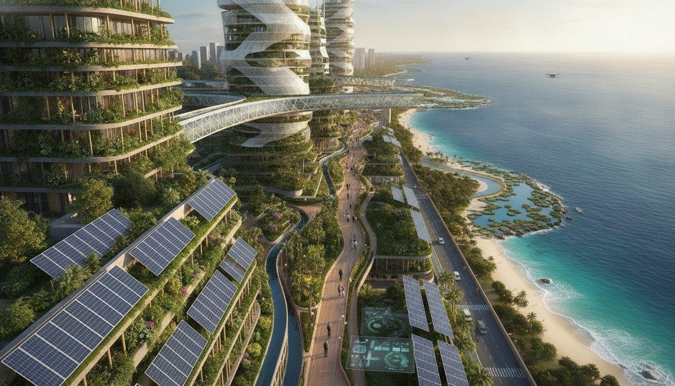
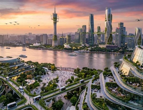
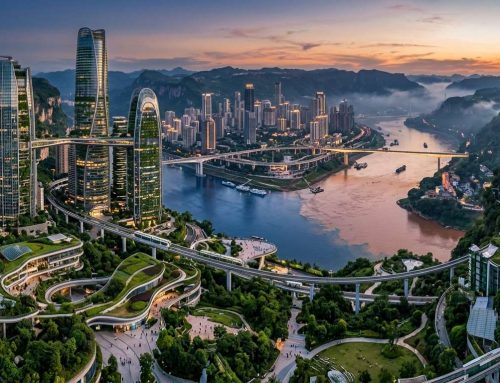
I step off a small boat into the Ombai Strait, and the skyline ahead stops me cold. This isn’t the sleepy, colonial-era port town I remember from old photos and travel journals. It’s something else entirely — a coastal capital rebuilt from the seabed up, humming quietly with clean power and bold engineering choices.
I know what you’re thinking. This sounds speculative, maybe even a little far-fetched. And honestly, it is, partly.
But the momentum behind it isn’t fantasy. Across Southeast Asia, governments are pouring serious money into decarbonization plans. Indonesia alone, backed by the International Energy Agency, is targeting net zero by 2060, with an estimated $8 billion needed every single year to make that happen.
If a nation that size can chase a goal like that, a smaller, more nimble country could pull off something just as ambitious on a tighter, sharper scale. That’s the possibility that keeps pulling me back to this idea.
This is the story I want to walk through with you: how one former colonial waterfront might become a genuine blueprint for climate-adapted city life, zone by zone, system by system.
Key Takeaways
- A small nation could realistically model large-scale climate adaptation by learning from regional giants like Indonesia.
- Southeast Asia’s push toward net-zero targets creates real financial and technical momentum for smaller coastal capitals.
- A four-zone urban master plan offers a practical framework for balancing growth, energy, and flood resilience.
- Ocean-based energy systems, like thermal conversion technology, could power an entire coastal capital sustainably.
- Rebuilding a colonial-era waterfront doesn’t mean erasing history — it means adapting it for a changing climate.
- Billions in annual investment, seen elsewhere in the region, suggest this kind of transformation isn’t just imaginative thinking.
Dili Future 2050: A Capital Rewritten by Climate and Ambition
Most travelers passing through Dili today are on their way somewhere else. They might be off to dive sites, hike trails, or relax on quieter beaches. Dili has never been a top destination.
But, its 2050 transformation is striking. This city is rewriting its story, becoming a climate blueprint for the region.
Indonesia’s Just Energy Transition Partnership is a nearby example. It aims for 34% renewable energy by 2030, with international backing. This ambition is likely to inspire Dili’s own bold plans.
By 2050, Dili will be a global example of adapting to a new era. It will be divided into four dedicated zones, each focused on a different aspect of sustainability. Let’s explore how Dili got to this point and the key document guiding its transformation.
From Colonial Port Town to Climate-Adapted ASEAN Gateway
Dili’s history as a colonial port town is deep. Portuguese traders and administrators shaped its waterfront long ago. Today, you can still see narrow streets and old facades.
Rising seas and monsoon flooding changed Dili’s future. The country’s leaders had to plan for a coastal capital that would last for centuries, not just decades.
This urgency, combined with ASEAN’s focus on sustainable infrastructure, gave Dili a chance for total reinvention.
The Dili Urban Master Plan as the City’s Governing Blueprint
The Dili Urban Master Plan is the blueprint for Dili’s transformation. It outlines the city’s four-zone structure, turning climate goals into action plans.
Think of it as a route map for a long journey. It shows where each zone starts, its purpose, and how they all connect.
The plan goes beyond buildings. It coordinates energy, water, and heritage preservation, ensuring everything works together.
The Four-Zone Framework Redefining Urban Function
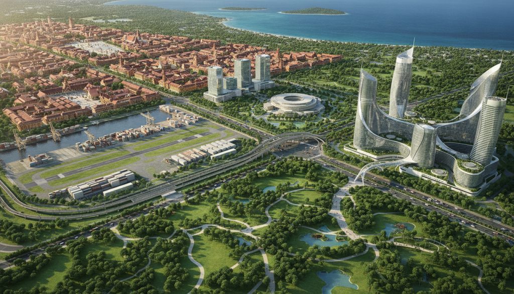
Every great city guide breaks a place into neighborhoods. Dili’s 2050 master plan does the same with four zones. Instead of one district trying to be everything, the capital splits its identity across Dili Center, Metinaro, Tibar, and Hera. Each zone has its own job, architecture, and economic engine.
I like this approach because it mirrors how I map out any city I photograph. You don’t try to shoot the whole place in one afternoon. You break it into pockets, learn what makes each one tick, then piece the full story together later.
Pulling this off financially is its own challenge. Reports tied to the Net-Zero Asset Owner Alliance submission point to blended-finance tools — de-risking mechanisms, catalytic capital, and MDB-backed project pipelines — as the funding architecture needed to stitch four very different zones into one coherent capital.
“Blended finance isn’t just a funding mechanism — it’s the connective tissue that turns isolated pilot projects into citywide transformation.”
Without that connective tissue, Dili risks four disconnected experiments instead of one working city.
Dili Center: Anchoring Heritage Preservation
Dili Center keeps the city’s original heartbeat alive. Picture the same colonial-era streets and coral-stone churches I’d wander today, camera in hand, chasing golden-hour light on weathered facades.
Under the 2050 plan, this zone becomes a protected historic core. New construction stays low, materials stay traditional, and public squares remain open for markets and festivals. Planners restore old buildings rather than replace them, using updated engineering to keep centuries-old walls standing through stronger storms.
It’s the zone built for memory. Locals and travelers get a living museum instead of a demolished past.
Metinaro: The New Seat of Administration
Metinaro takes on the job Dili Center never wanted: running the government. This zone becomes the administrative brain of the country, housing ministries, courts, and civic offices inside low-carbon buildings designed for efficiency.
Moving government functions here frees the historic core from heavy traffic and oversized office towers. Metinaro’s layout favors walkable civic plazas over sprawling parking lots, with public transit links tying it back to the rest of the capital.
Think of it as Dili’s new City Hall district, built from scratch with resilience baked into every foundation.
Tibar: Green Maritime Logistics Hub
Tibar turns into the working port, handling trade that flows through the Ombai Strait. Shipping container yards, warehouses, and cargo terminals cluster here instead of crowding the historic waterfront.
The twist is the “green” part. Electrified cranes, solar-powered terminal operations, and cleaner fuel standards for docking vessels cut the emissions typically tied to maritime logistics. Tibar becomes the economic engine room, moving goods without choking the air locals breathe.
For a small island nation, controlling trade infrastructure this way means growth doesn’t have to come at the coastline’s expense.
Hera: Innovation and Knowledge Economy
Hera rounds things out as the idea zone. Universities, research labs, and startup incubators cluster here, giving Timor-Leste a dedicated space to grow homegrown talent instead of exporting it.
I think of Hera as the district where Dili’s future gets tested before it scales citywide — renewable tech pilots, digital infrastructure trials, and university partnerships all find a home here.
It has a smaller footprint than the other three zones, but arguably the one shaping how the rest of the capital solves tomorrow’s problems.
Four zones, four jobs, one city. That’s the postcard version of Dili’s 2050 blueprint — and it’s the kind of layout that makes a place worth exploring one neighborhood at a time.
Cape Fatucama and Cristo Rei: Engineering Coastal Resilience
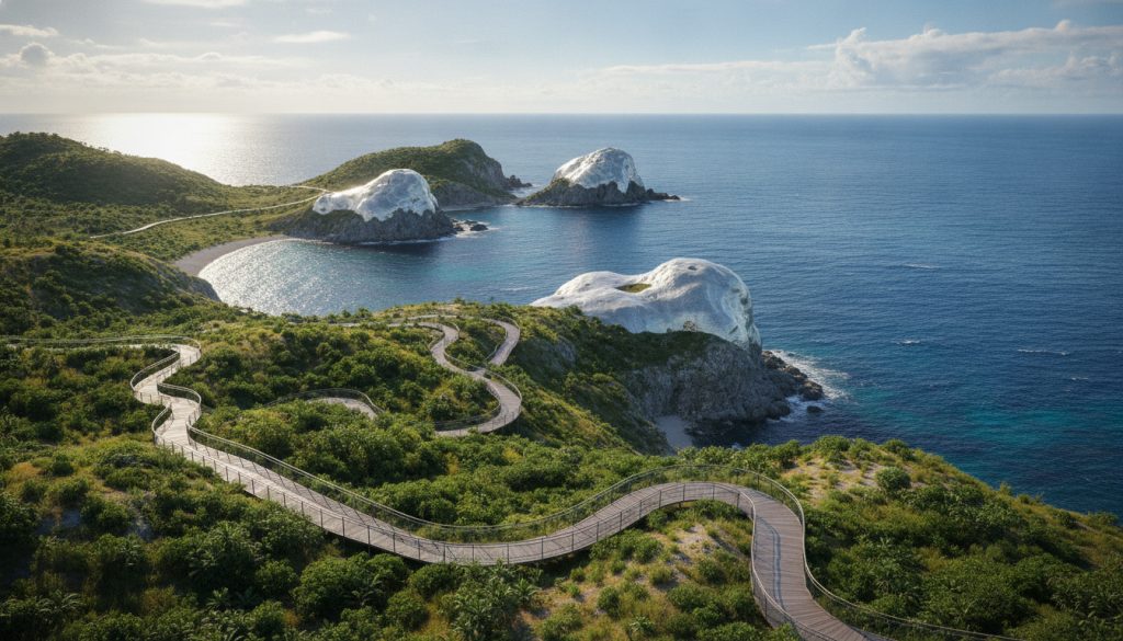
I’ve seen many coastal spots wear down from salt and humidity. But Cape Fatucama stands strong. It’s a spot I’d love to capture with my camera as soon as I arrive in Dili. By 2050, it will tell a story of survival, not just beauty.
Monsoon winds bring heavy salt spray all year. Traditional concrete barriers can’t handle it. Dili’s planners chose something better for the statue and cliffs.
Nano-Mineral Glazes and the Science of Breathable Coastal Armor
Regular concrete sealant is like plastic wrap. It blocks moisture, causing salt crystals to expand and crack the surface over time.
Breathable coastal armor is different. It has nano-mineral glaze that lets moisture and salt pass through. This keeps the rock dry inside while shedding salt on the surface, like skin breathing.
This isn’t just a clever material trick. It’s a response to a bigger financial reality facing coastal cities everywhere.
“Climate adaptation finance needs could reach hundreds of billions of dollars annually by mid-century, and existing funding falls dramatically short of that figure.”
That gap explains why low-maintenance coastal technology matters so much. Cities can’t keep re-pouring concrete every few years when the money simply isn’t there. A glaze that lasts decades without reapplication solves a budget problem as much as an engineering one.
Cape Fatucama Coastal Preservation in Practice
Today, you’d barely notice the coating at the viewpoint. That’s the point. The glaze is nearly invisible, doing its job without needing constant attention.
Cape Fatucama’s efforts focus on protecting the statue, stabilizing the cliff, and keeping costs low. Engineers reapply the glaze every 15 years, unlike traditional seawalls that need constant patchwork.
Here’s how the two approaches stack up over a typical coastal maintenance cycle:
| Feature | Traditional Concrete Barrier | Nano-Mineral Glaze |
|---|---|---|
| Reapplication Frequency | Every 3-5 years | Every 12-15 years |
| 20-Year Maintenance Cost | High, repeated labor and materials | Significantly lower, minimal reapplication |
| Salt Weathering Resistance | Moderate, prone to cracking | High, self-shedding surface |
| Moisture Breathability | Poor, traps internal moisture | Excellent, releases moisture naturally |
Being there feels ordinary. You don’t see any obvious tech. It’s just a headland that looks the same, holding up against a harsher coastline.
That’s Cape Fatucama coastal preservation done right: protection so seamless it disappears into the view. Cristo Rei can keep watching over Dili Bay the way it has for generations.
Subsurface Hydrologic Heritage Engineering Beneath the Comoro River Delta
I’ve seen a lot of hidden infrastructure, but nothing like under the Comoro River delta. The ground felt hollow in some spots, like a drum. Later, I found out why.
There’s a network of vaults under the delta, designed to catch monsoon floodwater. This is subsurface hydrologic heritage engineering at its best. It combines old Timorese wisdom with modern design, working silently beneath your feet.
Capturing 100% of Monsoon Flash-Flood Runoff
Monsoon season used to flood East Timor’s streets. Flash floods turned streets into rivers in hours.
Dili’s vault system changed that. It captures 100% of monsoon flash-flood runoff, directing it to underground chambers instead of the streets.
The vaults follow the old riverbed’s contours, spreading out in a grid. It’s one of the most elegant flood solutions I’ve seen.
From Floodwater to Zero-Emission District Cooling
The system gets even smarter. Floodwater doesn’t just wait for the dry season.
It goes through filters and powers a zero-emission cooling network. This cooled water cools government buildings without using fossil fuels.
This planning mirrors the NZAOA roadmap on adaptation finance. It focuses on long-term, strategic investment, not just quick fixes. The vault system is built for generations, not just one storm season.
Closed-Loop Reservoir Stormwater Harvesting Along the Civic Axis
Along Dili’s civic axis, there’s a chain of reservoirs. They practice closed loop reservoir stormwater harvesting, reusing water over and over.
Here’s how it works:
- Storm runoff enters subsurface vaults during flash-flood events
- Water passes through layered mineral and biological filters
- Filtered water cools district buildings along the civic axis
- Used cooling water returns to reservoirs for reuse or gradual release
Compared to most coastal cities, Dili’s approach is clear.
| Approach | Water Reuse Rate | Flood Risk Reduction |
|---|---|---|
| Traditional storm drains | Near 0% | Moderate |
| Detention basins | 10-20% | Moderate to High |
| Dili’s closed-loop vaults | Up to 100% | Very High |
Walking above this system now, I see Dili differently. It’s not just managing water. It’s treating every drop as a resource, engineered into the city’s bones.
Powering Dili: The Ombai Strait OTEC Microgrid and Solar Integration
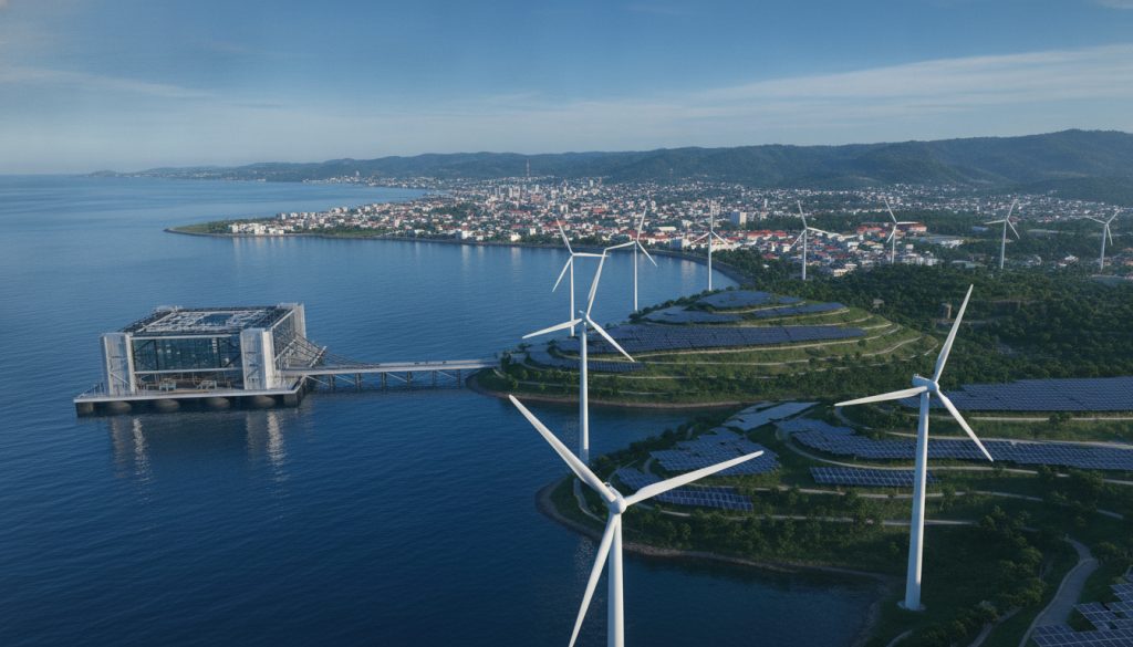
When I first heard about OTEC, I thought it was a joke. Ocean thermal energy conversion sounded like science fiction, not a real power source for a city.
But, Dili’s 2050 energy plan showed it’s real. It’s based on proven technology from places like Hawaii and Japan, just scaled up for Dili’s deep waters.
Deep-Water Ocean Thermal Energy Conversion Explained
Let me explain OTEC in simple terms, like over coffee.
The Ombai Strait is off Timor-Leste’s coast, with deep water. The surface water is warm, often over 82°F. But a few thousand feet down, it’s near 40°F.
This temperature difference is key. OTEC plants use warm surface water to vaporize a fluid, like ammonia. This vapor turns a turbine. Cold water from below condenses it back into liquid, starting the cycle again.
This process works all the time, day and night. It makes the Ombai Strait OTEC microgrid a reliable power source for Dili.
Solar Microgrids as the Distributed Backbone
OTEC is the main power source, but solar does the daily work. Solar panels on rooftops across Dili, public buildings, and warehouses are part of local microgrids.
This isn’t just for Dili. Indonesia aims for 42% renewables by 2030, with solar leading the way. The International Energy Agency tracks clean-energy investments, showing the region’s commitment to mixed renewable energy.
Dili’s plan mirrors national trends nearby. Distributed solar means power is generated close to where it’s used. This way, a problem in one area doesn’t affect the whole grid.
Grid Resilience Across a Four-Zone City
Dili’s four zones each have their own energy needs. The design makes sure each zone is resilient.
| Zone | Primary Role | Energy Priority | Backup Strategy |
|---|---|---|---|
| Dili Center | Heritage preservation, dense population | Rooftop solar microgrids | Battery storage plus OTEC baseline |
| Metinaro | Government administration | OTEC baseline power | Independent islanding capability |
| Tibar | Maritime logistics hub | Solar-fed port operations | Diesel-free backup via microgrid switching |
| Hera | Innovation and research campus | Mixed solar and OTEC | Grid-tied redundancy across zones |
If a storm hits one zone, OTEC keeps the power on everywhere. If OTEC needs maintenance, solar and local batteries in each zone help out. There’s no single point of failure.
It’s like having multiple power sources on a long trip. Dili just applied this logic to run its entire city.
Vertical Biophilic Architecture and Everyday Net-Zero Living
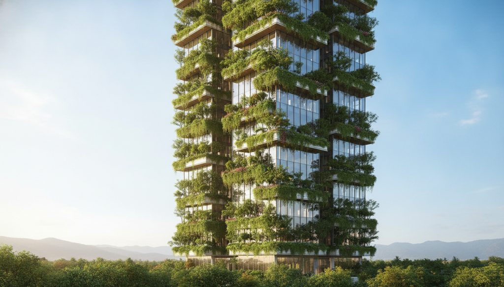
Every great city plan asks one question: what’s it like to live there? OTEC cables and stormwater reservoirs mean nothing if daily life is still hard. In Dili, that struggle is mostly gone.
Carbon-Neutral High-Rises Reimagining Tropical Density
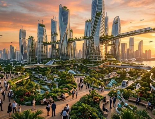
Walking through Dili’s skyline, I noticed how green everything was, even at 40 stories up. This is vertical biophilic architecture carbon neutral design. It includes living walls, shaded terraces, and rooftop gardens on every tower.
Tropical cities often trade trees for concrete. Dili did the opposite. Each high-rise uses greenery for cooling, cutting air conditioning needs and filtering humid air.
On a shaded balcony, I felt the building cool itself like a fan or AC. That’s the quiet magic of designing with the climate, not against it.
Stadium Porous Asphalt Stormwater Drainage in Public Spaces
Tropical downpours flood sidewalks and ruin shoes. Dili’s plazas and stadium grounds use stadium porous asphalt stormwater drainage systems. They pull water through the surface, avoiding puddles.
During a monsoon, the main stadium plaza dried quickly. Water moved underground, keeping the Comoro Delta cool and dry.
This small detail makes a big difference in rainy season. No soggy shoes, no closed streets, no waiting under an awning.
Fusing Timorese Heritage with Space-Age Environmental Physics
The technology in Dili didn’t overshadow its culture. Building facades echo traditional tais textiles, and plazas mimic the roofs of sacred houses.
Climate change has displaced communities worldwide, including in Timor-Leste. Dili’s approach is a direct answer, choosing resilience over retreat. See more at climate displacement case studies from Timor-Leste.
In a plaza that blends ancient architecture with modern physics, I felt warmth. It’s not tropical warmth, but a sense that heritage and innovation go hand in hand.
This is how Dili redefines tropical capital longevity. It doesn’t choose between the past and future. Instead, it builds both into its skyline.
Conclusion
I started thinking Dili was just a small spot on a map. Now, I see it as a place to watch closely for the next decades.
Let’s look back at what we’ve seen. Dili is planning to have four zones instead of one crowded center. They’re building coastal defenses that work with the sea, not against it.
Under the Comoro delta, they’re using hidden water systems to control floods. They’re also setting up an offshore energy grid. And their towers will get greener as they grow, not hotter.
But, nothing is set in stone. Plans can change, budgets can shrink, and politics can get in the way. Yet, every part of this vision for Dili’s future already exists somewhere.
Indonesia is working on a net-zero plan, just like Dili. Groups like the NZAOA are putting real money into projects like this. This shows that people and places are moving toward a greener future.
This is what gets me excited. The next big adventure might not be a hidden valley or a secret trail. It could be a city we’re still building, one green district at a time. Timor-Leste has given me many reasons to return. This is just one more.






Leave A Comment